A Tale of Two Mountains: Hiram Peak VS Ellis Peak [Guest Post by Nate Rische]

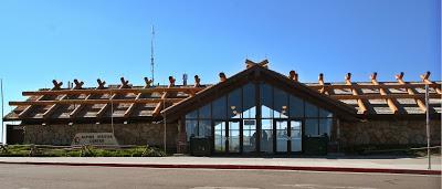
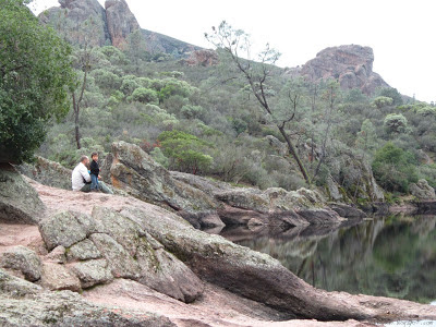
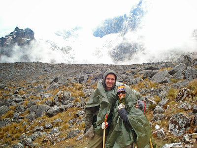
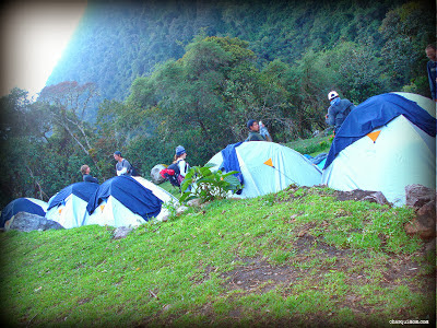
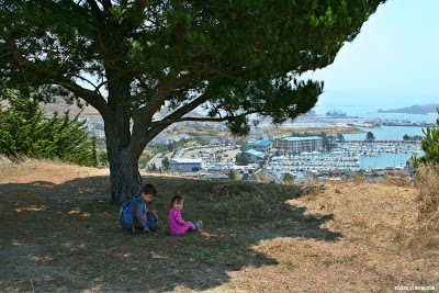
On our last attempted backpacking trip for this year, our good friend and fellow blogger Nate Rische of In The Absence of Something Substantial accompanied us to the Lake Tahoe.  Unfortunately, I became a victim of altitude sickness and we were not able to backpack on the Tahoe Rim Trail.  On the other hand, Nate was able to hike up to Ellis Peak, enjoy the beautiful views of Lake Tahoe and mark off another peak he bagged!

I’m not Chasqui Mom. I’m not even a mom. And thankfully, because that would be awkward; I’m a guy. But while the chasqui were running up and down the Incan Empire, my ancestors were fierce warriors in Bohemia (the region, not the artists) known as the Chod. So you can call me Chodové Warrior. You might also remember me as cheese-tester-guy.

So much of Chasqui Mom is about hiking as a family, and it may seem odd for a single guy to guest post. You’re thinking about it all wrong; I may be single, but I love to spend time outdoors with my family.  Unfortunately my blood relations all live far away, so I don’t get as many opportunities to get out with them. That just means I have to get out with my other family. Wonderful people like the Chasqui Family.

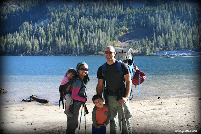
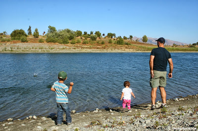
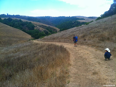
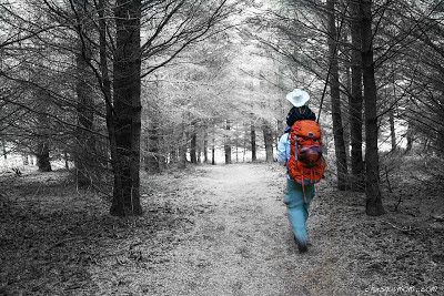
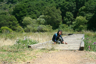
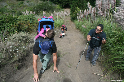
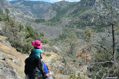
Nate carrying my daughter on a backpacking trip - Chasqui Mom
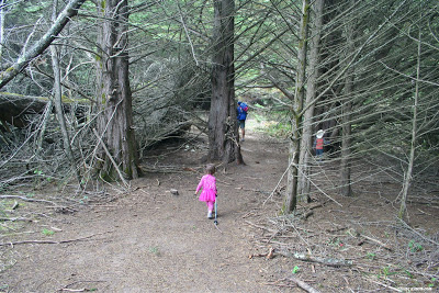
Don’t laugh; try to take a couple of toddler’s backpacking, and you’ll appreciate the need to invite along a guy like me, a pack mule willing to weigh down his pack with your extra gear and throw kids on his shoulder when necessary.

I’m not a mountain climber. I mean, I’d sure like to be at some point, at least a little bit. It’s on my to-do list, and you know how that goes. Unless you already climb mountains, in which case you don’t because you’re a little bit better about those to-do lists than I am.

So when I get the opportunity, I like to get what I can.

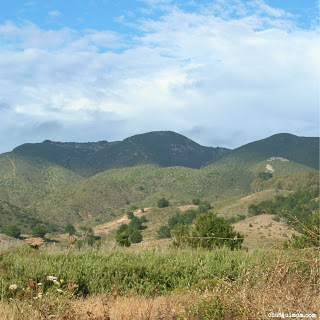
A bit back, I went camping at Highland Lakes, way up in the Sierra Mountains in the Stanislaus National Forrest. In fact, I think my quote about the location was, “Wow, this is remote. When the Chinese invasion comes, this is where I’m coming.” While driving out there, we watched the thunderheads roil on the horizon. We arrived at the campsite with enough time to set up my tent before it started to hail. Good golly, it hailed. Then rained on and off through the afternoon, evening, night, and even into the next morning.


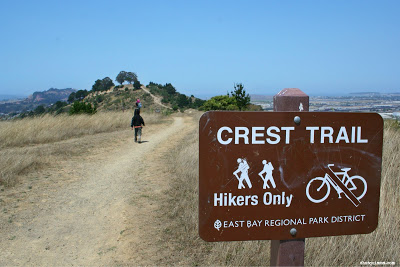
Those of us camping had desired to hike along the Pacific Crest trail, but illness from one of our campers had cancelled that plan. We had the day and nothing planned. When the rain cleared up in early afternoon, I looked up at 
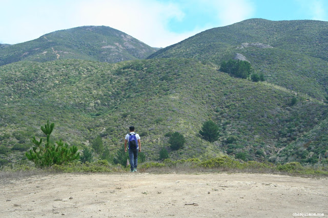
Hiram Peak towering over us, and knew what I had to do.

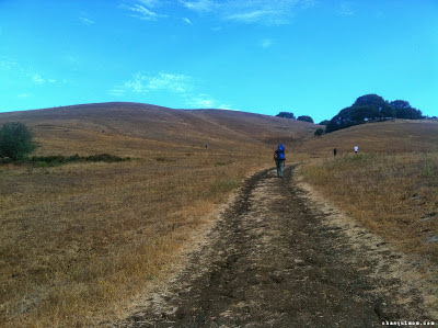
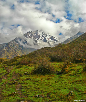
Hiram Peak - August 2012

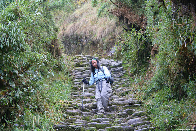
There was no trail, so I surveyed the mountain and made my initial ascent along the west side, approaching from the smaller of the two Highland Lakes. I had a choice to go around the south or north side for the second half of the climb. The south side looked easier, but the north side remained in view of the lakes and campground. I erred on the side of caution, and took the north route. I circled around a plateau along the north side, and started my ascent towards the peak on the east side of the mountain.

Once I hit circled around on the east, there were gorgeous views of groves and valleys stretching on the southeast side of the mountain, scenery that we couldn’t see from our camp ground. I circled around on the east/south-east, and as I climbed the shrubby undergrowth gave way to a very loose rocky terrain. The summit itself was all rocks, boulders, stones, and rubble, everything in between. There was no clear path, and as I zig-zagged up towards the summit it got steeper and steeper.

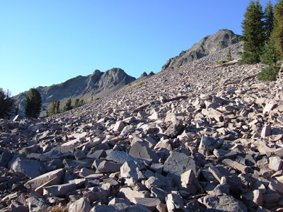
Heading up to Hiram Peak
About 150 vertical feet from the summit, I took stock of where I was and what I had left. The terrain ahead was rough, and I’d seen great views already. I still had to climb all the way back down, and I made a decision. I’d done enough, I was satisfied to turn around. Or so I thought. I went back down. I thought I was happy. It was good enough.

I was wrong. I had been so close. I could have made it, I should have finished. I didn’t. I’d taken the easy way out.

Regret.

Fast forward a bit. We were set to go backpacking on the Tahoe Rim Trail, when one of our group succumbed to altitude sickness. I’m very grateful that altitude sickness is not something with which I’ve had much trouble. Cancelling our plans to backpack, we instead decided to setup camp nearby, but 
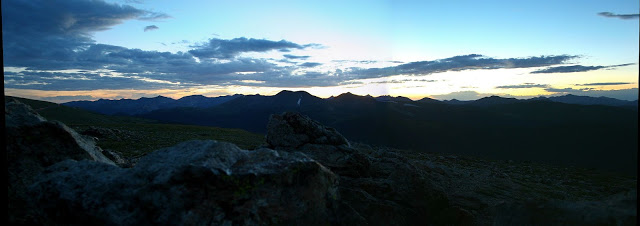
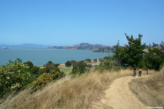
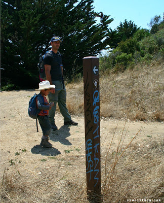
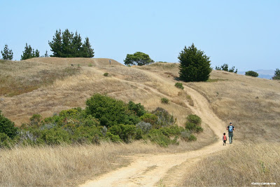
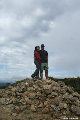
the afternoon was still open, and the trailhead to Ellis Peak beckoned.

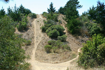
I made the initial climb up to the first ridge, and an outcropping of rocks stood away from the trail. I climbed to the top, and looked out over the Lake Tahoe valley. To my right, Ellis Peak loomed.

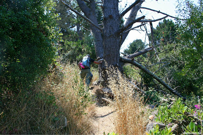
I followed the trail as it led up the ridgeline, turning into furious wind, threatening to blow us over. Seriously, gale-force winds blowing up from the lake along the north side of the peak. Thankfully, we crossed over to the south side for the final ascent, and the mountain shielded us from the wind thereafter.

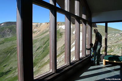
On the north face, in the wind, it was frozen cold. In the wind shadow, it was comfortable, and the sun streamed through the pine forest.

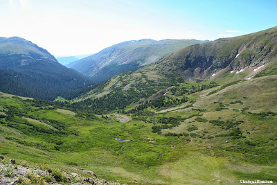
The trail led first to Ellis Lake, which is sort of a misnomer, because a lake there is no more. Simply a very large, grassy divot tucked in a valley before the real ascent started.

According to the trail map, the peak was only ½ mile away, and several hundred vertical feet above.
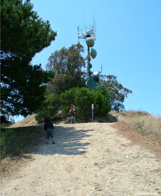
I wasn't going to quit this time. Following the trail, it turned up. And up. After a good climb, we reached the “peak” of the trail. I looked over, the actual peak rose above us another 150 feet, but the trail went no higher.

I wasn't going to regret again.

I climbed those final 150 feet and looked over the peak. It was astounding; climbing up the south side of the peak it was perfectly still. But peaking over the edge and looking down the north side, the wind threatened to knock me over.
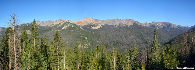
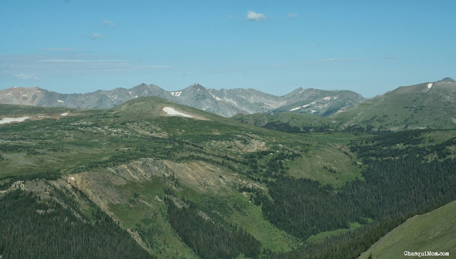
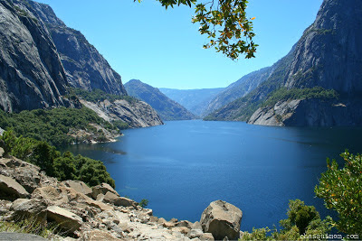
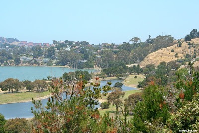
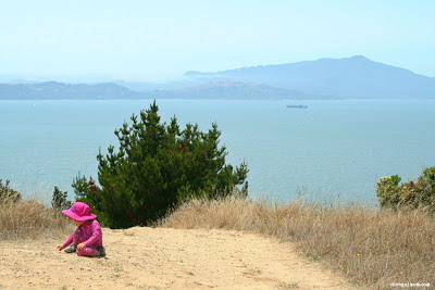
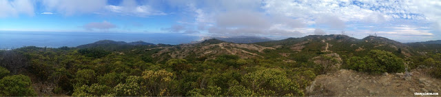
Ellis Peak View

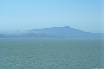
The view was spectacular. As beautiful as any I’d ever seen before, with all of Lake Tahoe stretching out before me. I’d say it took my breath away, but that was probably just the wind.

Sometimes you think you’ve seen all you need to see, and that little bit of effort at the end isn’t worth it. You’re good enough. Maybe you’re thinking of the climb back down, or what you’re going to cook for dinner or whatever.

You’ll never regret staring out over the top of that mountain, even if it costs you a little more. Good enough isn’t, and you’ll always have unfinished business with that mountain.

At least until you do something about it. And maybe the view at the top isn’t any better than you’ve already seen. That isn’t the point; the whole idea isn’t about what you saw, but what you did. Or did not do.

My lasting memory of Hiram Peak is staring up at the top from below.  But from Ellis Peak, the whole world was at my feet.


Hiram Peak, I will see you again.
_________________________________________________________________________________

Have you ever had a "trail regret"? What did you do to overcome it?

Join in on the conversation by leaving a comment here! You can also join in on the conversations on Chasqui Mom's Facebook and Twitter that is updated daily with outdoor activities and other wonderful posts and links from #OutdoorFamilies!


This Hiking Mama is Thankful For...

Thanksgiving is the season of reflecting on what we are thankful for and I'm endlessly thankful for ALL the aspects of my life but here's a little list of what this hiking mama is thankful for!

An Outdoor Loving Family


My crazy energetic son and my dirt loving daughter, truly push me to go enjoy the outdoors with them on a daily basis.  You might think many of our crazy adventures are my ideas but in reality the majority of the ideas are from the great guy I married!  I might be "Chasqui Mom" but he's truly a mountain man that loves the outdoors!

Local Parks: East Bay Regional Park District


The East Bay Regional Park District (EBRPD) is this family's hiking ground!  With 65 parks, 98,000+ Acres, 1,150 park trail miles, 3,789 picnic tables, 13 water features, and 277 camping sites, who says you can't enjoy the outdoors in the urban area of the East Bay-San Francisco Bay Area!!

Hard Adventures


Every outdoor adventure with toddlers is hard but this year has brought a ridiculous level of "Hard" on our outdoor adventures.  From extreme heat, below freezing temperatures, howling winds AND coyotes, sickness and wildlife encounters, you would think I would want to give up. I'm not going to lie there have been moments when I cried and lost it on the trail but all those moments have passed and I have been left with a stronger love and motivation to continue going to the outdoors.

Nature


Nature can be found everywhere, you just have to learn to find it all around you.  I love open fields surrounded by mountains but Nature is all around us from a little lady bug flying around in your backyard to the mountainous Rocky Mountain National Park.  We just have to learn to see it and I thank God for creating such a magnificent place for my family and I to enjoy forever!


Want to see what other Outdoor Families are thankful for.....


What are you thankful for this season?

Join in on the conversation by leaving a comment here! You can also join in on the conversations on Chasqui Mom's Facebook and Twitter that is updated daily with outdoor activities and other wonderful posts and links from #OutdoorFamilies!

Book Review: Wild by Cheryl Strayed - A Transformative Journey from Broken to Better by Jennifer Fontaine

by Cheryl Strayed
315 p, Alfred A. Knopf, $25.95
"Wild" by Cheryl Strayed is a #1 New York Times Bestseller and in Oprahs Book Club of 2012.  I have not had a chance to read this great book and since it's being produced into a movie, I will definitely read "Wild" before it hits the screens. As much as I love being outdoors, I love reading about it as well.  Jennifer Fontaine, author of MommyHiker.com shares the same love of the outdoors and provides a great book review of "Wild".

Cheryl Strayed's calamitous memoir of her 1,180 mile journey along the spectacular and harrowing Pacific Crest Trail can only be described as life-changing. Shifting between her tumultuous past and agonizing present, I found myself shifting as well from astonished to uplifted and back again, riveted by her monumental naiveté and an unforgettable drive to go somewhere. Somewhere different. Anywhere. Just not where she had already been, Hell.

Haunted by the death of her mother, full of guilt for the destruction of her marriage and then her subsequent spiral into drugs, Cheryl realized that she had to get out of the daily traps keeping her from moving forward in to a life of purpose and meaning. At 26, she stepped on to the Pacific Crest Trail in a dusty Mojave Desert town in Southern California, in search of answers. Then, the realization hit her, like an avalanche; she had absolutely no idea what she had gotten herself into. Not an avid hiker by any sense of the word, she quickly learned the PCT was serious business and being ill-prepared would not just cost her a few toenails, but could potentially be the death of her. Luckily, it wasn't a death as much as it was her rebirth.


Through her vibrant and spirited words, I could hear the crunch of the leaves under her ill-fitting boots. I could smell the musky pine trees, see the creek as it meandered through the forest, feel her agony and fully grasp the depth of her grief. Her ability to describe stillness, quiet and seemingly inane moments, allowed me to sit with her in meditation, to ponder along with her my own deepest innermost thoughts. "I gazed out over the darkening land. There were so many amazing things in this world. They opened up inside me like a river. I laughed with the joy of it, and the next minute I was crying my first tears on the PCT. I cried and I cried and I cried. I wasn't crying because I was happy. I wasn't crying because I was sad. I wasn't crying because of my mother or my father or Paul. I was crying because I was full."

The unnecessarily heavy load she carried with her on her journey was a brilliant metaphor for the needless, deafening load of criticism, self doubt and misery she had been carrying for years. As if the physical load wasn't enough, the behemoth backpack began wearing through her clothes, cutting into her skin, causing gaping open wounds that poetically lead straight to her soul. Bound by bloody bandages, she continued, begrudgingly forced to care for her self-inflicted wounds, finally conceding that they must heal and in turn, so must she. 

It was under the weight of her Monster pack that she began to get stronger, not only physically, but mentally. Each step reveled more of her truth, no matter how difficult to admit, and with each ridge and summit she conquered, she began to accept who she was and started setting a vision for who she wanted to be. "I gazed at my battered feet, with their smattering of remaining toenails... I looked North... I looked South, where I'd been, to the wild land that had schooled me and scorched me, and considered my options. There was only one. I knew. There was always only one. To keep walking."

I connected to Cheryl's story largely due to her straightforwardness. She has a unique ability to convey her mistakes, her delusion and even at times, her total (admitted) lack of judgement with such honesty that I forgave her most of the time. She took responsibility for her mistakes and eventually she took the extraordinary step to seek a new path guided by an understanding of what it meant to be motherless, divorced, a writer and that her desire for true love was not only acceptable, but well-deserved. By the end I, too had clarity and a deep desire to hike the PCT!
_______________________________________________________________________


About the Author

Hi, I'm Jennifer Fontaine! In addition to my newest title, Blogger, I am also a wife, a daughter, a sister, a cat lady, a chef, an actor, a film producer and a screenwriter!

I started The Mommy Hiker Blog in the hopes of inspiring other parents to get outdoors with their kids to explore and discover the wonder and beauty of Mother Nature and in doing so, I have inspired myself


Join in on the conversation by leaving a comment here! You can also join in on the conversations on Chasqui Mom's Facebook and Twitter that is updated daily with outdoor activities and other wonderful posts and links from #OutdoorFamilies!

#OutdoorFamilies Photo Contest on Instagram

UPDATED!! 11/21/2013 ~ See Below for the additional GIVEAWAY by Strider Bikes!

Enter to win the #OutdoorFamilies Giveaways! Simply share a picture of you and your family doing an outdoor activity on Instagram and use the hashtags:

#OutdoorFamilies and #ThankfulForFamilies

Contest runs from November 19-26.  You can share a photo daily (up to 7 total photos) and winners will be chosen at random and announced on Instagram by each participating blogger on their blogs.


Giveaway Entry Rules:
What You Can Win:


**All prizes with the exception of one (noted) will be open to both US and Canadian residents**

Participating Bloggers:

Who worked hard to round up these great prizes! ~  Make sure you check out all of these great blogs!
  1. Adventure Tykes ~ adventuretykes.com
  2. Adventurous Moms ~ adventurousmoms.com
  3. The Adventures in Parenthood Project ~ adventurousparents.com
  4. Chasqui Mom ~ chasquimom.com
  5. Go Adventure Mom ~ goadventuremom.com
  6. Mommy Hiker ~ mommyhiker.com
  7. The Kid Project ~ kidproject.org
  8. Tales of a Mountain Mama ~ talesofamountainmama.com
  9. Velo Mom ~ velomom.com
  10. Wild Tales Of ~ wildtalesof.com


Remember this contest will be on Instagram only.  Feel free to share on other social media but the only photos that count will be on Instagram.

THIS CONTEST IS NOW CLOSED

Winners are as follows:
  • @cdnrockiesgirl - Hi-Tec USA: On pair of Shoes
  • @rurris - Travel Chair & Easy Rider Chair
  • @mountainmomyc - DucKsday USA  Rain suit
  • @myhikingadventures - A Children's Outdoors Book: "Watershed Adventures of a Water Bottle" by Jennifer Chambers
  • @sheilaras - Honey Stinger - 2 boxes (choc and van) of the new kid's waffle
  • @alocalwander - Education Outdoors board game
  • @twokidsandamap - In Hero Kit - First Aid or bike repair kit
  • @anngagnier - HABA sand toys
  • @mountainmatron - Bani Bands $50 prize pack
  • @claireem13 - Grasshaven Outdoor - donating an Outdoor Wine Glass Set and pair of snack trays
  • @mommylovestree - Kowalli -  winner's choice of color
  • @singlebestidea - ActiveJunky.com - $150 Gift Certificate to spend at any retailer on their site.
  • @outdoorkidsplay - Mountain Baby - donating pair of Bob Skates
  • @expectadventure - Spyder Mini Cubby Long Ski Mitten
  • @suzismartphoto - Oakiwear (Waders)
  • @lscheutz - Ambler Hats
  • @garagegrown - Nixwax Sandal Wash, Freshbase and Polar Proof
  • @victoria_obseussed - Snowstoppers
  • @alittlenaturalist - Strider Bike
  • @hipmeesha - Outdoor Alphabet


Join in on the conversation by leaving a comment here! You can also join in on the conversations on Chasqui Mom's Facebook and Twitter that is updated daily with outdoor activities and other wonderful posts and links from #OutdoorFamilies!

Family Fun at Keller Beach - Point Richmond

Keller Beach is a small beach within the boundaries of Miller Knox Regional Shoreline in Point Richmond.  Over the summer, we headed over to Keller Beach so our kids could splash around in the Bay, after we finished hiking in the hills of Miller Knox as part of one of our 2013 Trails Challenge hikes.


I wasn't expecting TOO much from a a San Francisco Bay beach but I was pleasantly surprised with Keller Beach.  It was a small beach which reminded me a "White Sands" beach that we visited on the Big Island, Hawaii so immediately it brought back memories of our family trip to Hawaii.

I read some reviews on Keller Beach prior to going and visited the East Bay Regional Park District (EBRPD) website to read about swimming in this section of the San Francisco Bay.  Certain sections of the SF Bay are not safe to swim in because of the high levels of bacteria.  Keller Beach is close to the ocean inlet so its more "ocean" water than "bay" water like in the south bay but the EBRPD regularly tests water at Keller Beach.


During our visit the water was safe to swim and when we arrived  people were splashing and swimming in the calm cold bay.  Our children are not really "water babies" but the love the idea of  "swimming" near the water.  They just really like to play in the mud, wet sand, sand dunes etc.  So they spent the rest of the afternoon running away from the waves, getting their feet wet and through mud into the air!


We arrived on a gorgeous, perfect Bay Area weather day....not too hot, not too cold but I can imagine how chilly it would get there when the infamous San Francisco Bay fog rolls in.  The beach must get also very stormy when we get a bad weather storm comes in.

Mount Tamalpais and the San Rafael Bridge

Keller Beach has restrooms, showers and picnic tables, no-fee beach and has FANTASTIC views of Mount Tamalpais, San Rafael Bridge and the rest of the Bay.  Some reviews I read had complaints of "too much" seaweed and how the neighboring residents should clean up the seaweed....apparently these people have never gone to a beach.


Keller Beach is a great place to dip you toes or swim (if you want) on the Bay, especially after a hiking at Miller Knox Regional Park.  Once again an urban EBRPD park has changed my point of view of the urban outdoors.

Do you know of any urban outdoor areas that have surprised you?

Join in on the conversation by leaving a comment here! You can also join in on the conversations on Chasqui Mom's Facebook and Twitter that is updated daily with outdoor activities and other wonderful posts and links from #OutdoorFamilies!

Related Posts and Links:

  1. Family Urban Hiking at Miller Knox Regional Shoreline
  2. Keller Beach | Miller Knox Regional Shoreline - East Bay Regional Park District

Family Road Biking Added to the Mix

I'm a hiker and I will always be a hiker at heart, but my husband has been road biking for a few years now and has really wanted to add biking to to our family outdoor activities so this summer we decided to take the plunge!  It's been almost four months of family cycling and I'm having a great time and have rekindled the joy of riding a bike.

Family Ride to Coyote Hills Regional Park

Family Road Gear:

Since my husband was all set with his bicycle gear, we needed to get the rest of us outfitted! First of all, we needed to purchase two major items a bike trailer and a road bicycle for myself:
  1. Burley Bee Double Bike Trailer (2013)

    My son is in the process of learning to ride a bike and my daughter is still too short to even ride a balance bike, so in order to get some distance when my son isn't riding his bike, we needed a double bike trailer and decided on the Burley Bee Double Bike Trailer.  Review will be coming soon...


  2. Giant Avail 5 Women's Road Bike (2012)
    I haven't been riding consistently since I road around the training base camp in Georgia on a "Cruiser" type bike in 2004.  Even back then I was very spastic and clumsy (which I still am), so I had some hesitations to start road biking.  After a few visits to local bicycle stores I decided on the Giant Avail 5 Women's Road Bike.  I tested out a few fancier road bikes but as a beginner road biker I really couldn't tell the difference so I decided on the Avail 5.  Review will be coming soon...


Our three year old son absolutely refused to learn to ride a bike with a balance bike because it didn't have pedals like "Daddy's Bike", so we ended up buying him, 
Giant Jr. Animator.  If you can't tell we kind of like Giant bikes! Our son still does not understand the mechanics of riding a bike yet so when he rides his bike we are usually walking or running along side him.


Riding So Far....

Family riding so far has been a learning experience, as any new activity normally is!  My kids are slowly building up their "Time Limit" in the double trailer.  I'm learning what activities, snacks and toys to bring along so they can keep entertained in the trailer.  Our daughter has a terrible time with wearing a helmet, she absolutely hates it so of course she has a somewhat dislike to the trailer BUT every time she is having a better and longer experience with the helmet so OVERALL it's getting better!

I'm trying to keep the same principles as
Chasqui Mom's Toddler Hiking Cycle when we are riding and taking breaks when needed, stopping and letting the kids burn their energy, etc.  A few other things we are learning are:
  • The kids love riding FAST and going over bumps.
  • I'm re-learning how to ride a bike! Not that I forgot how but just its different now as an adult!
  • Bike paths that are family and beginner friendly in the East Bay.
  • Learning that I'm a "Freddy" (a novice rider)! A mountain biker explained that to me recently....
  • How to dress when riding, what not to bring and what to bring...
  • My husband and I are learning to ride while towing our kids in a trailer! It's heavy!


Our routes so far have been close to home due to fact that we don't have a way to transport our bikes...yet! Looking into bike racks so we can start exploring other routes in the San Francisco Bay Area.  I'm really glad my husband convinced me to start riding again because I had forgotten how much fun it is to ride and it is another great way to get the family exercising!

A big "Shout Out" to +CentriPEDAL Bikes LLC, our local East Bay bicycle store, where we purchased our Giant Bicycles.  We are now loyal customers of CentriPEDAL Bikes.  You can also follow them on Facebook.

Related Posts and Links:

  1. The Inspirational Ride to Defeat ALS, Napa Valley
  2. Training for a Cause - Ride to Defeat ALS
  3. Chasqui Mom's Toddler Hiking Cycle
  4. Burley Bee Bike Trailer (2013)
  5. Giant Avail 5 Women's Road Bike (2012)
  6. Giant Jr. Animator
Join in on the conversation on Chasqui Mom's Facebook and Twitter that is updated daily with outdoor activities and other wonderful posts and links from #OutdoorFamilies!

The Alpine Tundra at Rocky Mountain National Park

Never Summer Mountains - View from Fairview Curve
Do you know how it is to go somewhere so beautiful that each corner you turn just takes your breath away? Driving from the West to East on Trail Ridge Road through the Alpine Tundra in Rocky Mountain National Park (RMNP) did this for me, it was one of the most beautiful things I have seen.

Fairview Curve: Never Summer Mountains

Our first stop on Trail Ridge Road was at Fairview Curve (10,120 ft) that had phenomenal views of the Never Summer Mountains, the only volcanic range in RMNP.  I thought "Never Summer Mountains" was a funny name for a mountain range but Summer probably never reaches that mountain range.  The day before we hiked at the Colorado River Trailhead in the valley bellow called, "Kawuneeche Valley".

Continental Divide: Milner Pass

What is the Continental Divide? It is the line that divides the flow of water and snow melt.  On the East Side of the Continental Divide all the water flows to the Gulf of Mexico, part of the Atlantic Ocean and on the West side of the Continental Divde flows to the Pacific Ocean.  To be able to stand at Continental Divide - Milner Pass (10,759 ft), a section of natural occurrence was pretty exciting!


Podre Lake flows to the Missouri then to the Mississippi and ends up in the Gulf of Mexico!


Beaver Creek which is down Ute Trail flows into the Colorado River all the way down to the Gulf of California.


The Alpine Tundra and Visitor Center

The RMNP Alpine Tundra will always hold a special place in my heart.  I felt like I was in another country, I felt like I was back in the place I long to return to, the Peruvian Andes.  The cold, thin air brought me right back to my memories of hiking the Inca Trail.  I instantly fell in love with the Alpine Tundra.


We stopped at the Alpine Visitor Center at 11,796 ft., so we could get our "Passport To Your National Parks" book stamped and let the kids run around.  Amazingly my kids had no issues with adjusting to the elevation change, we live at sea level!  This was also a very memorable moment for me as a mother when my son saw "snow" near the Visitor Center.  He turned to me and with a giant smile and eyes as wide open and says, "Mommy!! That is SNOW!! Let's go get our our snowboards and go down the mountain!".  Soon little buddy...


As we left the Visitor Center, I saw a stairway on Alpine Ridge Trail to Huffer Hill.  I wanted to go to the top but we were headed to hike at Glacier Gorge Trailhead. We had already made too many pit stops so we jumped back into the car and headed down to Glacier Gorge Trailhead.  The beauty of the Alpine Tundra didn't stop with the mountains, we also saw many wildlife in particular the North American Elk all over the tundra.


Many elk roamed the tundra in the far distance when we were going to Glacier Gorge, but on the return trip to Grand Lake after our hike, the Elk were so close to the road that we actually had to stop so the cars would let them pass.  The kids were ecstatic to see them from the safety of the car, we had a very close encounter on the trail, story to come!

Chasqui Run: Alpine Tundra Huffer Hill

After a full day of hiking near Glacier Gorge, on our drive back on Trail Ridge Road to our cabin we stopped at the Alpine Visitor Center.  I wanted to go up Huffer Hill but not walk ...RUN up the hill.  My husband told me I was crazy but I wanted to do it so of course he indulged me,he stopped and waited in the car with our sleeping kids.

I took off running the second I closed the car door, I hit the stairs and ran as much as I could and walked until I caught my breath and ran again until I reached the top.  It was mostly dark, terribly cold, the air was thin but I had such a HUGE adrenaline rush.  I made it to what I thought was the top then end of the stairs and I may have done a "Rocky" victory dance....

The end stairs was not the actual top but there was still another 20-30 feet of paved trail to reach the very top so I finished running it.  I'm not going to lie, I was dizzy, my chest was rattling, coughing but it was the most beautiful thing in the world.

I WAS ALL ALONE.


On top of a gorgeous mountain, with the sun barely peaking from behind the mountains. 360 degrees of me and pure mountains.  It was a moment that I will never forget.  I felt so connected to God, so alive, I was on top of the world at 11,938 ft in the sky.  I enjoyed my alone time for a few more minutes and started running down Alpine Ridge Trail.

I was still on my adrenaline high and ran all the way down back to the car.  I got back to the car and my husband turned to me and said, "I saw you running and thought you were going to tumble down!".  I told him, I have now had a "Chasqui Run" in the Alpine Tundra in the Colorado Rocky Mountains an ode to my ancestors.

To my surprise once back in cell phone service territory, I checked my Strava stats on my "Chasqui Run" and I had earned my first Current Record - Queen of the Mountain (QOM) on Old Fall River Road Climb. 


The Alpine Tundra took my breath away....Have you ever experience a place so beautiful that it took your breath away?


Related Post and Links:
  1. The Colorful Colorado River Trailhead, Rocky Mountain National Park
  2. Dinosaur National Monument, Oh My!!
  3. Summer Road Trip 2013
  4. Rocky Mountain National Park - National Park Service

Gear Review: Teton Sports Escape 4300 Ultralight Backpack

Any parent knows that when you leave the house to go anywhere with kids you have to take a multitude of things to keep the kiddos happy.  Recently when hiking alone with my two toddlers I noticed that my regular day pack was starting to show its age, as well as busting at the seams with our "gear" for our little mid-day hike.

A Mom's Daypack!
Teton Sports Escape 4300 Ultralight Backpack is normally used for backpacking trips or if you have lots of gear, like a mom hiking alone with two toddlers.

The Pluses!

Size - The size (4300 cubic inches/70 liters) is great for carrying everything a mother carries in a diaper bag, plus gear for hiking:

  • Diapers, Wipes, Toiletries
  • Change of Clothes and Sweaters
  • Snacks, Lunch and Toys
  • Hydration Pack and Water Bottle
  • First Aid Kit
  • Picnic Blanket
  • Baby Carrier (i.e. ERGO, Boba, etc.)
Pockets - I love all the top pockets but my favorite pocket is the front right pocket on the adjustable belt.  It's large enough to comfortably hold ANY phone size, plus a car keys as well as having small candies easily accessible.

Unisex - I'm very particular about having products fit to a women's body but "unisex" gear usually fit men better than women.  I loved 99% of the Escape's fit on my small framed body (5 feet tall), in particular the shoulder straps.  

Lightweight - 4.75 lbs! 

Rain Fly - Bright yellow rain cover is attached in the bottom compartment! I consider a great plus because most companies sell the rain fly separately.

Cost - MSRP $159.99

The Minuses

Adjustable Waist Strap - As I mentioned before, I am a really small framed, petite woman and even though the waist strap is for 28"-45" waist, this strap fits my waist just a tiny bit too big.  That is why a said I only love the fit 99%.

Escape 4300 Ultralight Backpack in action at Sunol Regional Wilderness

Chasqui Mom Last Thoughts...

I really like the Escape 4300 backpack, it's a really great spacious, lightweight backpack for day hiking with two toddlers and even though the waist strap fits me a little too big, the winter months are coming when my waist might get a little bigger! I never thought I would have to use a backpacking backpack as a day pack but I'm glad +TETON Sports was gracious enough to send me this backpack at no cost with no review required.  Thank you +TETON Sports for providing me a great new day back and as always, this review is my honest opinion.

+TETON Sports has a great video about getting to know you Escape 4300 Ultralight Backpack, check it out!


Related Posts and Links:

  1. Teton Sports: Escape 4300 Ultralight Internal Frame Backpack
  2. Will My Next Hiking Boots Live Up To My First?
  3. Gear Review: Vasque Breeze Ultradry Hiking Boots

The Inspirational Ride to Defeat ALS, Napa Valley

A few weeks ago, my husband Jesse and good friend Nate road in the Ride to Defeat ALS in Napa Valley with Team Mazzetti.  Even though I did not participate I was very glad I went for many reasons.  It was a great experience for our family, as well as seeing my husband's co-workers/friends ride together as a team.


My children and I slept in while my husband woke up early in the wee hours of the morning to meet up with his team at the starting line.  We had spent the night in the Napa Valley region so there was no risk being late!  In the late morning my kids and I headed over to the Calistoga Area to wait at one of the rest stops.  I had been following my husband on a new iPhone app called "Find Friends" but I don't know if I misread the map or GPS but I couldn't figure out where Team Mazzetti was.


I eventually figured out I came out to the race too early so I headed out to find a park and found a playground at Pioneer Park in downtown Calistoga.  The kids happily played for about an hour until I realized Team Mazzetti was near by, so we hopped in the car and headed to find the team taking a break in Napa Valley's beautiful vineyards! (picture above)


The kids had been away from daddy all day and they were having "daddy withdrawals", so we made sure the kids got lots of hugs from Jesse.  One of the team members could no longer ride, so after we said our goodbyes we shuttled him back to the finish line at the Yountville Veterans Home.

Inspirations...
I had been to two rest stops and later at the finish line...the one thing that amazed and inspired me was a particular family who had a sign that said, "You are doing this for my daddy!!" and it literally broke my heart.  At the same time it brought the significance of the ride, that this was not a race but truly a ride to defeat ALS.  Not only were the families present but people with minor ALS were participating in the ride as well as being present at the finish line.

Over the past couple of months, it has come to our attention that family members of our friends have passed away from ALS.  Jason Fried, a fellow outdoor family blogger (1 Quest 2 The Next), was open enough to share with me that his father passed away NINE WEEKS after he was diagnosed with ALS, nine weeks.... Another friend of ours, Kevin shared with my husband that at the age of 12, his mother passed away from the "horrible condition" after six years of battling with ALS.  This whole process has changed my significance of races with running, riding, etc., to truly finding the meaning behind these activities.

60 Miles - Family Rider!!
My second inspiration was this riding family!!  I'm assuming the woman I saw riding near by was the wife/mother, she's not pictured but she was right behind them.  I saw them at the 60 mile course and my husband briefly spoke to them at one of the rest stops.  I thought to myself to ride 60 miles as a family....that takes dedication! We've recently taken up biking as a family and my kids can barely take 20 miles in the bike trailer so I can appreciate the time and effort that this family did to train

If anyone knows the family pictured above, please forward the link to them and pass on my email to them: melissa@chasquimom.com.

The Finish Line
I think I had tears in my eyes the entire time we waited for Team Mazzetti.  With every rider came cheers, hugs and riders almost passing out! Teenagers, women, men, elderly riders crossed the finish line all with smiles on their faces, some riders saying the ride's motto "NEVER GIVE UP".  My kids played in the leaves, climbed trees for and hour and a half while we waited for Team Mazzetti to finish.  At last, one by one Team Mazzetti came in and all of their FIRST Century Ride was over.


My kids were happy to have their daddy back, Team Mazzetti was happy to have finished, and I was happy to have seen this great ride.  This has left me with the desired to ride next years Ride to Defeat ALS with my kids! My goal is to ride the 27 mile ride towing my two kids, while my husband does the Century Ride and not only for the fun of it but because it is truly a great way to support this cause.

Thank you to all who supported us by donating financially, both Jesse and Nate met their fundraising goals as well as Team Mazzetti raised over $2,000 combined!  Thank you all who supported us with giving us a place to stay, prayers and sending good vibes!  I truly pray and hope someday there is a way to Defeat ALS as well as other health issues that plague our communities like cancer, mental illness and many others.

Looking forward to next year's Ride to Defeat ALS!

To read about an actual riders point of view, please visit Nate Rische's post "Road Race Report: It's Supposed to Hurt Like Hell!" on The Absence of Something Substantial.  

Related Posts and Links:
  1. Training for a Cause - Ride to Defeat ALS
  2. Road Race Report: "It's Supposed to Hurt Like Hell!" by Nathan Rische
  3. 1 Quest 2 The Next

Hiking Along Quarry Lakes Regional Recreation Area


Quarry Lakes Regional Recreation Area is a local East Bay Park located in Fremont, California.  In all my years of living near by we have never visited this park!  I've seen it hundreds of times, driving by it and seeing it from above on BART (the train) but once again the 2013 Trails Challenge brought us to a nice little park.  If you would like to read about our other 2013 Trails Challenge hikes please click here!

Quarry Lakes is a very family friend recreation area, activities including hiking, biking, swimming, fishing, picnicking, boating, dog walking as well as hosting many organized walks and running events!  Quarry Lakes is located near the Niles District near the border of Fremont and Union City surrounded by a residential area, there is a $5 parking fee.


Our 2.5 mile hike started on Old Creek Trail (about 1 mile) near the Boat Launch parking lot, the trail is just a gravel path wide enough for bikes, walkers and hikers.  There are lots of benches around the lakes to take breaks!  As parents we've recently decided that our son will no longer be carry on our hikes since he's weighing 40 lbs or more and our backs can't take it anymore, so our hikes have significantly been shorten and have very little elevation.  Long story short Quarry Lakes is a great place to for my son to hike!

Along Old Creek Trail we saw Canadian Geese!


We skipped rocks!


And most importantly played in the dirt! My Dirt Angel Girl!


We made it to the Western Pacific Trail which follows the BART Tracks....my son got excited and screamed with glee every time a train passed by!  We saw a little lizards and lots of vultures flying above.  It was a great easy hike to stretch our legs, complete another 2013 Trails Challenge hike and get outdoors!!


Related Posts and Links:
  1. Chasqui Mom's 2013 Trails Challenge Hikes
  2. Quarry Lakes Regional Recreation Area - East Bay Regional Park District
  3. Regional Parks Foundation - 2013 Trails Challenge

Implosion Hike...What's Not to Like?!

Saturday, August 17, 2013 was the last day Warren Hall stood at California State University East Bay (CSUEB) in the Hayward Hills.  As a 2004 CSUEB graduate (formerly known as Cal State Hayward), I wanted to see where I had many computer, accounting, french classes and the building where I paid thousands of dollars go down into the ground.

Photo Courtesy of +Paul McWilliams of Not a Moment to Lose
We decided to hike out to the hills south of Warren Hall at Garin Dry Creek Regional Park, a short 1.5 mile hike to where we wanted to set up.  The implosion was schedule for 9:00 a.m. so we woke up early, got the kids ready and headed out to Garin Dry Creek at 20 minute drive.  Garin Dry Creek is a very family friendly park for hikers, so far in the past year we have visited this park five times with our toddlers!


Our toddlers were terribly cranky that morning and everything was a struggle...getting out the door to hiking this very easy hike.  My three year old son has done more difficult hikes than this 1.5 mile hike but he was just not a happy hiker that morning.  My daughter also wanted in and out privileges from her carrier and she was not happy that we did not grant her those privileges.  I was a little worried that we were going to miss the implosion because we only had one hour to make this 1.5 mile hike.  I know that sounds ridiculously slow but if you have ever hiked with toddlers one mile an hour is usually a normal pace.

All the hikers, mountain bikers and photographers that we encountered on the trail had the same idea to go up on the hills behind Warren Hall so there was a steady flow of people around us.  We started our hike on Old Homestead Trail (0.25 miles) to Peak Loop Trail (0.8 mile).  As we arrived to the intersection of Peak Loop and Vista Peak, we saw all the spectators on the hills ready with their camera and I saw top floors of Warren Hall.  As we turned up a slight hill we heard the implosions go off and down came Warren Hall...I was a little irritated that we weren't situated to take pictures but I did see the building go down with my own eyes.


Thankfully, I had a Google+ friend +Paul McWilliams who was stationed down at a parking lot on Mission Blvd and he was able to take the moving picture above.  My kids were a little scared when they heard the implosion but they soon calmed down and made it up the hill so we could see the smoke disappear.  We talked to other bystanders, saw a rancher and his daughter ride by us on a horse and once everyone had left we decided to get closer to see the wreckage.


We continued back on Peak Loop Trail for another 0.44 miles when we realized that the hill in the distance were we saw a lot of spectators was actually not in Garin Dry Creek but on CSUEB property.  It seemed like it was an impromptu trail and we thought about crossing the little valley to get to it but decided against it.  We weren't planning on doing an actual hike but we ended up hiking in a new section of Garin Dry Creek that we've never been too, Ziele Creek Trail!

Beautifully Red Poison Oak ~ Ziele Creek Trail
I don't know how many times I can say this, but Garin Dry Creek is a very family/toddler friendly park difficulty wise, except for all the poison oak around the shaded Ziele Creek area.  If your child understands what poison oak is then great, but my son does not under completely understand what it is.  He's starting to understand not to touch it because it can hurt him.  He actually grabbed a whole branch but didn't get a rash. On the other hand, my husband who barely brushed some poison oak had to deal with rashes for almost two weeks.


We actually got a little turned around as well as some other hikers across the creek due to the fallen leaves on the trail which made it disappear...technically we weren't lost but I can see how easily you can lose the trail.  I guided the hikers across the creek to the trail and then we found the actual trail which was a little bit above us on the hill.  Back on the trail we continued trucking along Ziele Creek Trail and eventually found a dead deer carcass in the semi dried up creek.


In our first hike at Garin Dry Creek, we saw a large buck in the distance and I've heard of mountain lion sightings at Garin Dry Creek, so I know there is lots of animal activity in this park surrounded by urbanization.  All along Ziele Creek we found animal bones (well I hope it was animal bones) so it was quite surprising to find a whole small deer carcass that looked almost like it recently was alive, that nature for you.
.

We eventually emerged from the shady Ziele Creek Trail (1.13 miles) and headed on a familiar trails, Peak Loop and Old Homestead Trail for another mile or so.  My son hiked the entire 4.4 mile trek and my daughter was carried so we actually hiked much faster than we normally do.  My son can hike about five miles when there's hardly any elevation change but my daughter is not so much a hiker yet.  She's a lover of dirt, the first step of becoming a hiker!

Trip Report: Garin Dry Creek Regional Park

Who: Family - Two Adults and two toddlers
Mileage: 4.4 miles
Elevation Change: 1,031 ft
Family Friendly: Moderate


An implosion hike was a great way to see Warren Hall go down and spend our Saturday morning with our kids.  Just for fun here's a close up NBC's video of Warren Hall's last stand!  Thanks for the memories Warren Hall and for giving us one more family memory to add to our list!

Related Posts and Links:
  1. Not a Moment to Lose - Paul McWilliams
  2. Garin Dry Creek Regional Park
  3. A Chilly Hike at Garin Regional Park
  4. New Year's Day Hike: Garin Dry Creek
  5. WATCH: Cal State East Bay's Warren Hall Imploded
  6. California State University East Bay, Hayward
  7. East Bay Regional Park District - Garin Dry Creek Pioneer Regional Park

The Grand Hiking Views at Grand View Park San Francisco - Guest Post for Mommy Hiker

Living in the suburbs of the San Francisco Bay Area, I always try to find an excuse to go into the city of San Francisco.  Whether to visit family, friends or just a to visit my husband on his lunch break, I'm always willing to visit the "City by the Bay."  A part of me desires to live in "The City", another part of me loves the suburb life, and another part loves the solitude of "The Outdoors".  I've been able to find a happy medium with our "Urban Hikes" in and out of San Francisco area.


My family and I decided to start our Labor Day weekend with a hike up to Grand View Park, which is in the Sunset District of San Francisco, the west side of the city and south of Golden Gate Park.  It's a 1-acre park that has fantastic 360 degree views of San Francisco and beyond, if there's no fog!  We lucked out on arrived on a perfect clear afternoon.

Click here to read the entire article on Mommy Hiker's awesome blog!

My Beautiful National Parks and Forests are Closed

I am very sad that my National Parks and Forests are closed due to the Government Shutdown.  No politics here just memories of my beloved parks with my family.

Highland Lakes, Stanislaus National Forest - California


Don Edwards San Francisco Bay Wildlife Refuge - California

Baker Beach to Fort Point GGNRA - San Franisco, California 


Pinnacles National Park - California

Pinnacles National Park - California

Pinnacles National Park - California

Point Reyes National Seashore - California

Point Reyes National Seashore - California

Point Reyes National Seashore - California

Pinnacles National Park - California

Pinnacles National Park - California

Yosemite National Park/Hetch Hetchy - California

Yosemite National Park/Hetch Hetchy - California

Rocky Mountain National Park - Colorado

Arches National Park - California

Pacific Crest Trail - National Scenic Trail - California

Dinosaur National Monument - Utah

Rocky Mountain National Park - Colorado

Rocky Mountain National Park - Colorado

Yosemite National Park - California

Rancho Corral de Tierra Golden Gate National Recreation Area - California

Please visit the National Parks Conservation Association to see how to get our parks open again.

Three Days in One: Salkantay to Andenes Camp

Back in 2007, my husband and I took our first real adventure to Peru where we visited the Amazon Jungle and hiked to Machu Picchu. This is a series of post I've been writing about since I started this blog.  The first post on this particular day can be found at: The Savage Mountain, Nevado Salkantay.

Getting ready to come down Salkantay!
Tuesday, October 17, 2007
We started heading down Nevado Salkantay and it was cold, rainy, windy and muddy but it was much better than hiking up the mountain!  I was very glad to have some energy back and could hike again.  I learned a very good lesson on my way down the mountain to never buy cheap gear! Half way down the mountain my cheap poncho broke....I tried  to fix it but I just got wet.  Never again will I buy cheap gear.  I also wished I had a Balaclava because I had to hold up my scarf around my face to protect my face against the freezing cold wind the entire trek down.


This was the longest portion of the trek in my memory, my zombie trek.  I was cold, wet, hungry and I felt super disconnected I was just walking because I had no choice.  Sit down and rest in the pouring rain or just keep hiking, I chose the latter.  The energy that I felt early was gone, probably because I had barely eaten anything and I started singing to motivate myself to keep walking.  Once we got off the actual mountain and were hiking on flat ground I just wanted to be in our lunch tent!  I don't remember who else was walking with us except Jesse (my husband) and Edwin (one of our guides) but it was foggy, raining so we couldn't see too far ahead of us.  I kept asking Edwin, "How much longer?" and he would say 15 minutes, an hour or so later we finally saw the red tent in the distances and we made it.

We ate our delicious lunch in the pouring rain in a slowly forming swamp, we all sat there talked, recovered from the mountain we just came down.  The guides told me I looked like the women from Puno because my cheeks and nose were so red but after a few days had gone by we realized my nose was burned from the freezing wind.

Rosy Nose and Cheeks!

Jesse made me a make shift poncho out of a garbage bag which of course I wore for about two hours and it never rained....fail.  A group member later remembered she had an extra poncho that she let me borrow for the rest of the trek.  The rest of the afternoon we walked through a beautiful green valley as the rain slowly let up as the sun came out.

Garbage Girl....
Everyone felt good and was in good spirits when we made camp, except the Australian who became sick at the top of Salkantay, he ended up riding the horse all the way to camp.  I felt really bad for him because he really wanted to hike but he couldn't stop throwing up and just looked awful.  I was in his situation the day before so I knew what he was feeling.

Beautiful valleys

Goodbye Salkantay....

Andenes Camp
This day felt like it was three days in one! First getting to the pass at Salakantay, making it down the mountain to our lunch tent, and then walking through the green valley to our second camp at Andenes.  Even though it was a very tiring day, this was one of my favorite days because of the changing scenery from the rocky pass to the green lush valleys.

Related Posts and Links:

  1. Chasqui Mom: Peru Posts
  2. The Savage Mountain, Nevado Salkantay.

Climbing For My Son's Sake!

I've been blessed with a never-ending energetic spirited son.  I knew there was something different about my son since birth.  He never stops moving, I mean NEVER and if he does it is because he is really sick.  I think I've only met a handful of kids like him in his three years of life.  Not only does my son have the "fountain of never-ending energy" but he is also very intense in everything he does. Whether he's playing a game, hiking, putting on his shoes, he does everything with every shred of energy and emotion in his little body.


The Reason
Over this past summer, I was becoming a little frustrated and running out of ideas of how to drain his energy other than hiking.  He's starting to learn to ride his bike, but the learning curve is so steep right now that it just leads to a frustrated toddler still full of energy.  I considered swimming classes but it would be only once a week and I needed something to drain his energy now, something he could do right now without having to learn a new skill.  Playgrounds usually ended up with both of my kids crying because they would not want to leave, not being able to play with other kids toys or just "playground politics" (mother's scared of their kids getting dirty, kids not behaving, etc...).  I rather take my kids to Nature's real playground than a regular kid playgrounds.


The Revelation
One Sunday after church, in my frustration and embarrassment of finding him almost to the top of the 10-foot speaker (the service was over thankfully) it finally hit me, he loves to climb!  After I pulled him down from the speaker, I started entertaining the idea of joining our local climbing gym.


It's like those moments in a movie where the main character has flashbacks to all the situations that led them to a giant revelation ala "Sixth Sense", and I remembered every time I found my son climbing something.  In particular, on a trip to Pinnacles National Park my son saw some people climbing for the first time and he asked me what they were doing and I told him that they were rock climbing.  His eyes opened up like it was Christmas morning and he said, "Mommy I want to rock climb!!!" and took running off down the path towards the climbers.

I did some online research as any mom does nowadays and started suggesting the idea to my husband to join City Beach Rock Gym.  It took a little convincing my husband but after a very frustrating day with our son, we headed off to City Beach and my son and I became members!

Results So Far
It's only been three months that we have started climbing and I could see immediate results in my son's behavior.  On our second visit my son was able to make it all the way to the top to ring "The Bell".  That is when something clicked in his brain and that was all the motivation he needed to use every ounce of energy he had to climb.  Some of the few ways his behavior has changed are the following:

Sleeping better at night
Relief of pent of energy
Less sibling fighting
Wanting to eat
Learning to focus his determination

There are other lessons he is learning like learning to fail, waiting and his physical limitations. I too am learning to climb for my son's sake!  Just until last week did my husband and I learned to belay, which opens up much more of the gym to us and I'm pretty sure to say that my husband and I are hooked.  Personally, climbing is something I'm learning for my son but I'm finding real enjoyment in it's physicality and the puzzle-like nature that my "accounting" brain likes.

Future Climbing Family
We do everything as a family, that is part of being a Latino family (well half)....the way we roll! Currently we are beginning climbers, we do not have any of our own climbing gear.  We use the rental gear from City Beach which is fine during this juncture in our climbing life.  We eventually want to do outdoor climbing but not anytime soon because of our inexperience and mostly lack of gear.  Once we feel comfortable with indoor climbing then we will venture in the world of outdoor climbing, which could add a WHOLE new aspect our day hiking and backpacking trips.  Climbing in the outdoors is a new family dream that we will make come true for our little boy one day.


I'm very glad to have a great circle of family-oriented outdoor community that I can go to with all my climbing questions and in general outdoor activities!  You can visit all my recommended outdoor resource page HERE. It's going to be a great ride to learn how to climb but I'm glad our son pushed us into the world of climbing.  Cheers my to little boy!

Related Posts and Links:

  1. Pinnacles National Park
  2. Chasqui Mom's Outdoor Resource Page
  3. City Beach Rock Gym

Family Urban Hiking at Miller Knox Regional Shoreline

I love exploring the not-known and underdog parks of the Bay Area.  A couple weeks after we had recovered from our last backpacking trip in early July we decided to go on an local hike.  I had already completed the five required trails the East Bay Regional Park District (EBRPD) lists in the 2013 Trails Challenge but my husband needed one more to complete the challenge, so we headed out to Miller Knox Regional Shoreline in Richmond.

Old Country Road to West Ridge Trail
When I think of Richmond lots of negativity pops up in my mind, gangs, shootings, high murder rates so when the EBRPD listed this hike of course I was very interested because I didn't even know there was a shoreline park in Richmond and second of all after reviewing Miller/Knox's website I saw that it had a beach! Just because a place has a bad reputation don't be scared to go exploring and in this case urban hiking!

Urban hiking might mean different things to people but to me it means exploring parks in the immediate urban area, such as the San Francisco Bay Area as well as "hiking" in large cities like San Francisco!  You can definitely get some good hikes and elevation change with the hills in San Francisco!!

Driving to Miller/Knox was a little different because as soon as we got off the freeway it was very industrial, followed by million dollar homes, boats on the Marina and then a pond/playground park at Miller/Knox.


The hike began at Old Country Road Trail with an immediate somewhat steep climb (20%).  We had decided after our last backpacking trip that my son's time of being carried in a carrier had ended, so we were going to choose easier hikes, but somehow we keep ending up picking "steep" hikes. Oh well, my little three year old boy is a crazy good hiker for his age.  This section was very tiny and my daughter was also very determined to hike so we let her slowly climb the "mountain".


The views going up Old Country Road were fantastic.  It was still a little foggy around the coast but we could see the tops of Golden Gate Bridge, city views of San Francisco, Angel Island, Mount Tamalpais, San Rafael Bridge and the actual Bay was looking great that day.  Hiking by the Bay is a little tricky because the weather is so finicky, when the wind is blocked it gets rather warm, then it's very cold and breezy, then the fog could roll back in at any moment.  So even if it's a sunny day I always dress in layers, bring sweaters and jackets when hiking along the Bay.

The Pond at Miller Knox
Mount Tamalapais

Can you see the tops of Golden Gate Bridge?
We made it to the top of the first hill and took a little break and enjoyed views of the marina below us.  My son climbed the only tree at the top of the hill while my daughter played in the dirt and my husband decided to Zillow the houses in the marina, quite expensive I might say.  There were apartments, townhouses and single family homes in this tiny marina.


We had seen the hill we were going to come down when we first started the hike and I had wished we had brought our hiking poles but we hadn't.  At the steepest point it was a 42% grade (down hill) hike and our kids were determined to hike it themselves, so while my husband and son made it down pretty quick I spent my time trying to help my daughter to not slide down hill.  I am notorious with falling down on the trail, even when I'm just standing still, I know it's ridiculous.

West Ridge Trail (left) Old Country Road (right)

At this point, I know why the EBRPD categorized this hike as moderate due to all of its hills.  I read a little later that this used to the a Richmond Rambler Motorcycles trails, which makes sense with all the hills.  Now it's open to hikers (w/dogs), equestrian riders and mountain bicycles on specific trails.  We huffed it up to the second hill, called False Gun with even more great views of the Bay but didn't stay too long because the wind was almost knocking us over!

I love dirt!
Heading up to False Gun
We left False Gun and headed on to a "hiker only" trail called Crest Trail. We had a little confusion there because there was fence blocking an obvious trail that had the "Restoring Land" sign and hikers hiking on the forbidden land.  We didn't go over the fence...headed on the correct trail that had a switch back that took us back to where we thought we were going to in the first place the radio towers.

Crest Trail to Radio Towers
It was much less windy once we came off the ridge so we were able to warm up, but once we started up to the radio towers again the wind picked up with a furry!  My son is a great hiker but if temperature is a little to warm or he's a little out of sorts then he will drag his feet.. The second he saw the radio towers, he yelled "Mommy let's go see the spaceship!!".  Sure enough that helped him get to the top.

It's a Spaceship!!
It was almost all down hill after the radio towers so my son got into his hiking groove and my daughter fell asleep in my ERGO carrier.  With all that cool wind blowing in her face she had no other choice than to fall asleep! It was a really gentle down slope on Marina View Trail, behind a large water tower all the way down to the old Richmond Ramblers Motorcycle building off of Dornan Grove Trail.  Dornan Grove Trail ends on Dornan Dr (paved street).  We continued hiking on the street for a few minutes before getting back on Old Country Road (trail) again.

Chasqui Mom
Richmond Ramblers Motorcycler
There were small sections through the hike where we found blackberries, but once we got back onto Old Country Road, we were surrounded by a forest of blackberry bushes!

Didn't you know Batman also hikes?!
Blackberry Forest!!!

It was a quick easy up hill again towards the Old Country Road spur we started on and soon we were off to explore Keller Beach, which will be coming soon!


I'm sure glad that we decided to do a family hike in this urban park.  Miller/Knox is just another reminder that you really don't have to drive far our of the urban environment to enjoy the outdoors.  Have you found treasure parks like Miller Knox Regional Park in your urban world?  What did you like the most about your urban hike? Please leave your comments below!


Related Posts and Links:
  1. Bears, Waterfalls and Decisions at Hetch Hetchy
  2. Miller Knox Regional Shoreline - East Bay Regional Park District
  3. Tilden Regional Park - 2013 Trails Challenge Completed!
  4. Wordless Cooley Landing, East Palo Alto


The Hidden National Park - Rancho Corral de Tierra

Have you ever heard of Rancho Corral de Tierra?


Well there it is, Peak Mountain at Rancho Corral de Tierra, part of the Golden Gate National Recreation Area (National Park Service) in my San Francisco Bay Area backyard, a National Park that I did not know about and I bet a lot of Bay Area residents don't know about it too.  A few months ago we were driving down Highway 1 from San Francisco and I saw trails above Montara (south of Pacifica)and told my husband, "I want to hike there!".  I pulled out my phone to find out what park that was but it didn't show the "green area" which designates a park other than McNee Ranch State Park, which was next to the area I wanted to hike in.  I thought it must be private property and forgot about it.

Labor Day Weekend was coming up and my husband had seen an article on an addition to the Golden Gate National Recreation Area, Rancho Corral de Tierra only to find out it was where I was wanted to hike a few months earlier.  I started researching for hiking trails, seen if anyone else had written a post or been up there with toddlers but I couldn't find anything in the particular section we wanted to hike.  Only a very rough "trail map" by the National Park Service with a warning about steep, eroded trails.

"Rancho Corral de Tierra", Map., July 2013., National Park Service. Web. 12 Sep. 2013.
If you haven't noticed by now, we like adventure and when we figured out that this was a "rarely visited", underdeveloped park we were immediately intrigued.  Before I even start writing about our hike, I would like to state that we knew this was NOT a kid-friendly hike and I would not encourage beginner family hikers to hike this mountain.  With that said I know our abilities, my husband and I are strong hikers/backpackers (for years) as well as my children's limitations. We felt that we were capable of doing this hike with our children.

Rancho Corral de Tierra Farallon Trailhead
Finding the trailhead was a little difficult, I kind of eyeballed it and we decided to meet up with our friends, Eliu, Lorena and Esdras at Montara State Beach.  Then we drove a few blocks across Highway 1 to 2nd Street and Farallon/Kanoff Street.  Low and behold we found the trailhead and the end of Kanoff Street.


I normally don't put our GPS information at the beginning of a post but it is needed as a point of reference as you read about our this hike.  The Farallon Trailhead is where the black arrow is located. 


We started our hike (red line) heading northeast from the trailhead towards McNee Ranch State Park, on Farallon Trail. That is the last trail name that will be written because there were no more named trails in this park! If we continued on Farallon Trail it would have taken us to McNee Ranch State Park.  

Peak Mountain shrouded in Fog
The beginning portion of the trail was dried up grass fields and low lying coastal plants. 90% of the trail was uphill until we reached Peak Mountain.  I guess I knew that it was going to be all up hill but the fog had rolled in so we couldn't see HOW much of the trail was uphill.  We made it to the top of our first hill and took a break to figure out where in the world to go next.

Not even THE steep hill!

Siri, Where are we?
With no trail markers, we weren't lost but we really didn't know where to go next, my husband pulled his GPS, I inspected my phone and we still couldn't figure out with certainty where to go so we made and educated guess and headed east down the hill. But before we left the top of our first hill we saw our first and only wildlife during the trip.  I believe it was a Garter Snake, the specifics I would not know but if you can identify this snake please leave me a comment!

Garter Snake?
In the picture below, the trail is visible but at the time we didn't know where we were going. The trail eventually started on the right middle side of the picture, followed the ridge to the pine trees, followed the ridge and to the left you can see a faint trail going in between some power lines to Peak Mountain on the left side of the picture.

Looking for the trail.
But before we actually reached the first ridge, we came down this hill and walked into a forest of pine trees that reminded me of scenery at Point Reyes National Seashore.  We found an illegal "campground" or a dump site...a fire ring with broken mattresses, recliners, tires, trash, remnants of illegal fireworks and last but not least condoms hanging in the trees....thanks people who probably don't love the environment.


From Left to Right: Esdras, Lorena and Eliu

All of our hiking buddies were our musician friends from church.  From the right we have Eliu who plays and makes guitars, Lorena (who has hiked with me before at Tilden Regional Park) is a great singer, and Esdras (on the left, who plays almost every instrument) is a piano player and our worship leader.  We had Mexicans, Salvadoreans, Peruvians and my husband who is an "Honorary Latino" (he's Caucasian) hiking and exploring at an unknown National Park, Fantastic!
Lorena, where's the trail?
We followed what we thought was a trail but ended up turned around in some tall grass bushes and decided to turn back to where the had trail split off.  If you look at the map above, we turned back in the middle of the trail (red line) where there is a tiny loop and headed south through the forest.  I pulled out my phone again to check out Google Earth, to see if we could find our way to the "actual" Rancho Corral de Tierra.  I don't know if at this point we were on private or county land but we continued on through the pine forest.  My husband was the first to emerge from the forest and he started laughing and says, "Come and look at this!" and this is what we saw....


Up we went....


Sliding....


This was the steepest trail we've ever done with our children, I've never had to actually use my hiking poles to jam into the ground so I could pull myself up mountain.  I did that quite often on this hike!  My son was having a blast, crawling on all fours at some points saying, "Mommy, I'm rock climbing!", not really buddy but ok!  The circled area is this steep section, a 50% grade (pictured below).


We all survived the steep section and relieved to find a flat trail/fire road at the top, still not knowing if we were going the correct way (trespassing signs were around us) we headed north on the trail and we were finally happy to see that our efforts had paid off and we had found the elusive Rancho Corral de Tierra!!!


It took us a little while to find the actual entrance with possible trespassing, but we were determined to find it and we did.  I felt like I could finally relax and enjoy the steep hike!  The hike went along the ridge line along the tall grassy bushes, by the pine trees, and followed the ridge.  During sections of the hike Lorena and Esdras would race up the trail and I'd though to myself, "Is that how much energy I had when we didn't have kids?" Hah! I told them they would pay for it later with being sore...

My daughter was being carried most of the time since the trail was too steep for her but steep trails seem to energize my son, until he actually gets tired from hiking straight up a mountain.  We still didn't know where we were going exactly but at some point I turned to my husband and said, "I think we are going up that mountain between the power lines...".  My husband said, "I think we are too..."

It took us four hours reach the top of Peak Mountain at 1,825 ft from sea level.  The last half mile, my husband had to come back from the peak because my son was too "tired".  When we reached the peak, my son ran around like a wild mountain child...he wasn't tired and hike most of the way down the mountain.  We had amazing views of the Bay Area, from Point Reyes National Seashore, Golden Gate Bridge, Mount Tamalpais, Mount Diablo, Mission Peak, Half Moon Bay and of course the Pacific Ocean. (View pictured at the beginning of the post).

We had a Curry Chicken Wrap (without Curry) or as my husband dubbed them on this trip, "Mountain Tacos", Trader Joe's Salami, Cheese and Banana Chips for lunch and took our glamour shots on Peak Mountain!

Photo Courtesy of Lorena Armas


We could see the other peaks and the actual trails from McNee Ranch State Park that had many hikers on it.  We did not see any hikers on this side of the mountain until we were hiking back and saw a couple of hikers on their way up to Peak Mountain.  After lunch, we packed up and headed back down to sea level also known as sliding down the mountain. All of us at some point almost fell down or in may case slid down the trail on my rear end with a child strapped to my back, ouch!  There a no switch backs on this trail, 1,800 feet straight up a mountain.

None of us wanted to go down the extreme steep section near the fire road so we headed down the fire road which eventually dumped us in a residential neighborhood, so we "urban hiked it" to our cars through the streets.  We actually saw an alpaca farm, Alpacas By the Sea walking through the neighborhood which was nice to see!


Our friends said if we had shown them the mountain we were going to hike in the beginning they would have been very intimidated and I told them if it wasn't for the fog covering the mountain I would have been intimidated too!! Seven hours, 6.3 miles maybe some bumps and bruises but we all made it to Peak Mountain in Rancho Corral de Tierra - Golden Gate National Recreation Area!  It was an adventure.

Related Posts and Links
  1. Rancho Corral de Tierra - Golden Gate National Recreation Area - National Park Service
  2. Rancho Corral de Tierra - Map by National Park Service
  3. Tilden Regional Park - 2013 Trails Challenge Completed
  4. The Ever Changing Point Reyes National Seashore
  5. Curry Chicken Wrap by Backpacker Magazine
  6. Montara State Beach - California State Park

Will My Next Hiking Boots Live Up to My First?

Eight years ago, I walked in to my local +REI and purchased my first pair of boots, +Merrell Continuum Women's Hiking Boots.  Up until then those were my most expensive footwear I had ever purchased, vaguely remember the price...about $180.00 but my husband (then fiancee) told me, "Trust me they are worth it..." and they sure were.  I wasn't a big outdoors person back then as I am now, but if I can contribute piece of gear that helped me grow into LOVING the outdoors it would be these boots.


I have never had an issue with my +Merrell Continuum, maybe I lucked out and picked the perfect boots and I know without a doubt that these were greatly made.  I have so many memories attached to my boots, they have traveled with me, been with me on arrest and search warrants, firing range, law enforcement training, camping in Mexico and most importantly hundreds and hundreds of miles on the trail in the United States and Peru.

My +Merrell Continuum are currently in "ok" hiking condition but one of the front toe seams recently ripped when a branch hit the seam perfectly and the soles are starting to peel away from the sides.  I can still hike in them but I am most certain that the waterproofing has been compromised.  They will get a few occasional hikes in but the Bay Area "Rainy" (I'm being sarcastic) season is approaching and don't want to risk testing the waterproof issues on them.

I recently asked my fellow outdoors connections what boots they recommended and now I'm torn!! There are so many options now!  Will my next hiking boots live up to my first?  Based on my needs and the recommendations I've received I'm actually thinking of getting two types of boots for the following reasons:

  • Day Hiking Boots: For shorter easier hikes, not carrying too much weight (30lbs and under).
  • Backpacking and Longer Day Hiking Boots: I normally carry 40-50 lbs when backpacking and lesser weight during longer day hikes but during certain times of the hike I usually end up carrying my pack AND one of our children.  The weight I carry (child and backpack) usually ranges from a minimum 30-80lbs, so I need a hard boot.
+KEEN has been highly recommended and of course I will be looking into +Merrell again, for day hiking boots.   For backpacking boots, I'm leaning towards the Asolo TPS 520 GV Women's Hiking Boots but I'm still looking into others.  My husband has the Asolo Men's version and he absolutely loves them, so much that he sent them to get resoled to a cobbler in Seattle, Washington.

Until then, a little photo montage of where my boots have taken me over the last eight years....


The Inca Steps on the Inca Trail - Peru


The clay muddy hills of the San Francisco East Bay Hills.


The steep trails of Rancho Corral de Tierra in the Peninsula.


Of course, Chasqui Mom's and any hiking boot mecca - Machu Picchu.

I want to cry just writing about my boots...is it weird that I have such en emotional attachment to a piece of gear?  Do you have a emotional attachments to gear? Also, if you have any recommendations on Day Hiking and Backpacking Boots please leave a comment with your recommendation, I would really appreciate it.

Training for a Cause - Ride to Defeat ALS

Ride to Defeat ALS
Mazzetti, a construction and engineering firm from San Francisco, California has been organizing a company team for a couple of years to support the "Ride to Defeat ALS" in Napa Valley, California.  Mazzetti started participating in the ride on behalf of a good client's husband with ALS (Lou Gehrig's Disease).  This year my husband, Jesse and his best friend, Nathan will be part of Team Mazzetti on The ALS Association, 9th Annual Ride to Defeat ALS on September 28, 2013. 


"Amyotrophic lateral sclerosis (ALS), often referred to as "Lou Gehrig's Disease," is a progressive neurodegenerative diseases that affects nerve cells in the brain and the spinal cord.  Motor neurons reach from the brain to the spinal cord and from the spinal cord to the muscles throughout the body.  The progressive degenerative of the motor neurons in ALS evenutally leads to their death.  When the motor neurons die, the ability of the brain to initiate and control muscle movement is lost.  With voluntary muscle action progressively affected, patients in the later stages of the disease may become totally paralyzed." ("What Is ALS?" The ALS Association. N.p., 2010.Web. 08 Sept. 2013 http://www.alsa.org/about-als/what-is-als.html)

Jesse Avery - Mazzetti
Since 2007, Jesse has been riding recreationally, mostly short rides with occasional longer rides around the San Francisco East Bay.  He started riding more frequently to and from work across the Bay to Stanford University in 2011.


As of a couple of months ago, we decided to add road cycling to our outdoor family activities and Jesse is now towing our two toddlers on our family rides as well as training on longer rides with Nate.  This will be Jesse's first century ride (100 miles), in fact when he decided to join Team Mazzetti he had never done more than 50 miles in a day.  Jesse is very excited to be riding in his first century ride for ALS.

Nathan (Nate) Rische - FedEx
Photo Courtesy of Nate Rische
A late bloomer in a family of cyclists, Nate finally jumped in the world of cycling about two years ago when his car broke down for extended mechanical issues.  He borrowed a bike to ride to work, and then walked down to the local bike shop and spent more money than he planned for his own bike.  He rode to work, then began riding on the weekends for fun, and then his rides kept getting longer and longer.  This will be Nate's first official century, a previous attempt was thwarted by a mechanical failure on his bike.  You can follow Nate's adventures and writings at In the Absence of Something Substantial.

Fundraising - Ride to Defeat ALS
Jesse and Nate are trying to raise $500 each (a total of $1,000) for Ride to Defeat ALS.  Donations go to The ALS Assocation which helps patient programs to research for ALS.  For more information in regards to donations please click here.

To donate on behalf of Jesse please visit Jesse's Participant Page.

To donate on behalf of Nate, please visit Nate's Participant Page.

Personally, I'm really proud and excited for my husband and our good friend Nate.  Jesse and Nate have been riding together for almost two years now without a particular ride or cause in mind but when Jesse received an email at work about joining Ride to Defeat ALS, Jesse jumped right in as well extending the invitation to Nate.  They've been training hard these last few weeks even with hectic work and life schedules.

Thanks guys for riding to defeat ALS!

Related Posts and Links:

Quarry Turkey Half Marathon Training

Running is going to be in my regular routine again.  A few of our current and former youth group students are interested in running 5K/10K/Half Marathon, so as a good youth leader, I will join them.  Two of the three youth leaders (myself and Nate) will be running a half marathon and I'm trying to convince my husband to run a 5K while pushing our double stroller with our tots in tow.

Photo Courtesy of Nate Rische
Last year, I ran the The Giant Race in San Francisco which was a very picturesque run which started at the San Francisco Giants Baseball Stadium, went along the Piers and Fisherman Wharf, Crissy Field down to the Golden Gate Bridge and back.  My first half marathon EVER. Never cared about time, I just wanted to finish it and not die.


Nonetheless now that I'm going to run my second half marathon, Quarry Turkey Half Marathon on November 30, 2013 (Yes that is the Saturday AFTER Thanksgiving) I need to compare my times and train so I can try to beat my previous times.

The Giants Race - September 16, 2012
Time: 2:24:32
Pace: 11:02/mi

This year I'm going to cross train with road biking as well as hiking on Saturdays when we can.  I will see how it goes but here is my tentative training schedule, with a weekend of backpacking thrown into the mix.


My only goals this time is to beat my previous race time and to motivate our youth who chose to participate to complete the training and actually run the race.  Personally, I think the training is harder then the intended race.  If you have any suggestions in my training schedule please leave a comment in the comment section.

Related Posts and Links: 
  1. San Francisco Giants Half Marathon
  2. Quarry Turkey 5K/10K/Half Marathon
  3. The Giant Race - SF Giants