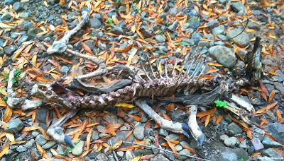
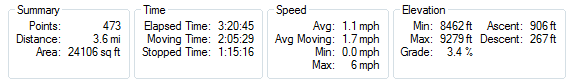
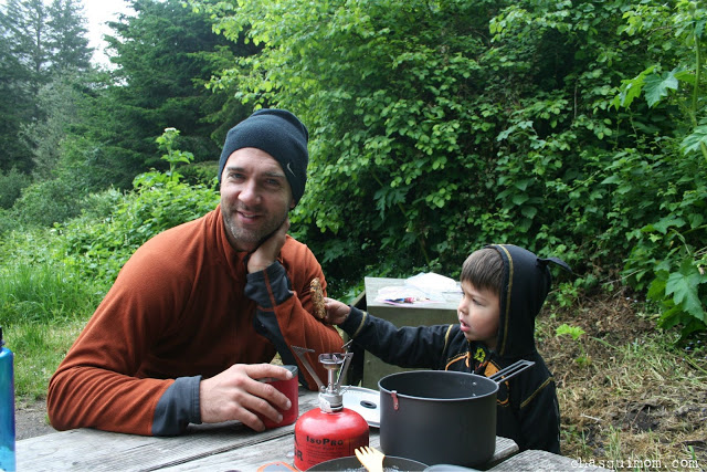
Family Hiking

Hiking & Rock Scrambling: Bearfence Mountain ~ Shenandoah National Park


Awesome.

I could finish my post with that picture of the top of Bearfence Mountain.  Everyone around me in the East Coast kept saying, "Now remember our mountains are not like California mountains" but I've learned to love all my National Parks.  National Parks are like my children, you can't compare them to one another because that would be mean, and each one provides its own uniqueness.  Instead, I have learned to enjoy each child, in this case Virginia's Shenandoah National Park, for what it is.


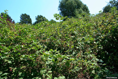
I recently read "Wilderness Society's "15 National Parks for Fall Color" and Shenandoah was No.2 on their list, so I was very excited to visit during fall peak period.  We don't have as many "Fall Colors" in the San Francisco Bay Area as the East Coast does, so it was a nice change in weather and scenery for our family.


Appalachian Trail and Bearfence Mountain

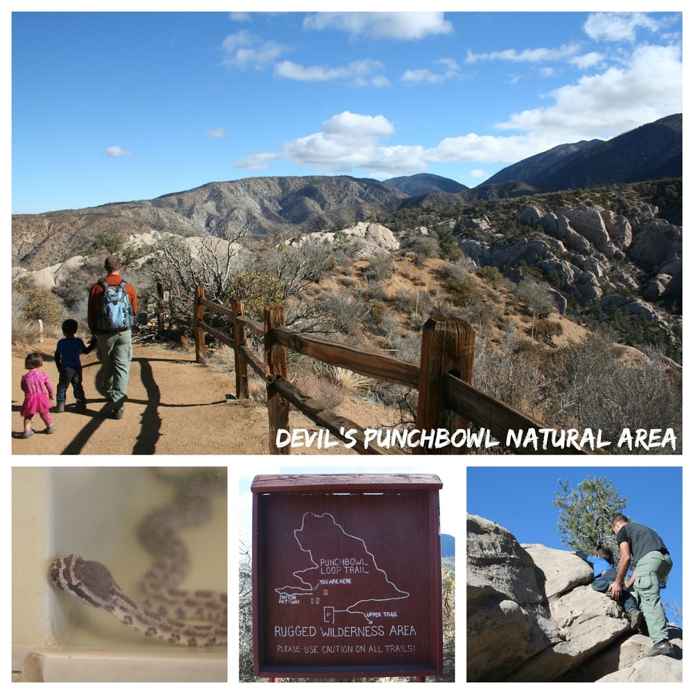
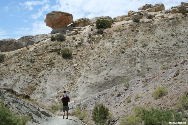
As a family of hikers at heart, we were very excited to hike on the Appalachian Trail even if it was a tiny section of it.  Jennifer Chambers of Hiking Along also recommended Bearfence Mountain because it would give us 360 degree view of Shenandoah, its beautiful fall colors, and her recommendation did not disappoint.  She also knew that my toddlers would love rock scrambling at the top of Bearfence Mountain which they certainly did!

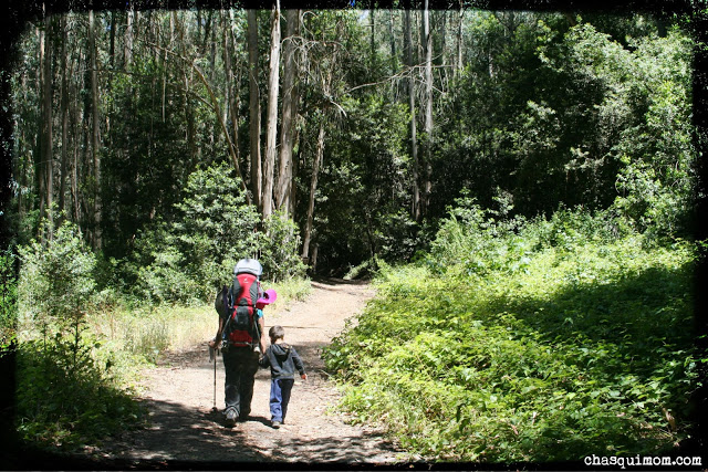
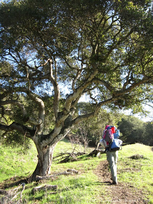
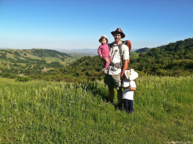
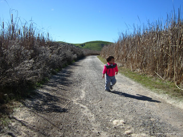
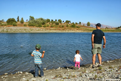
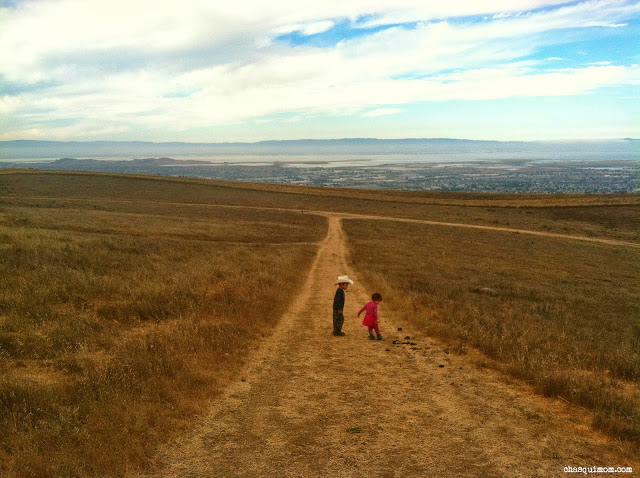
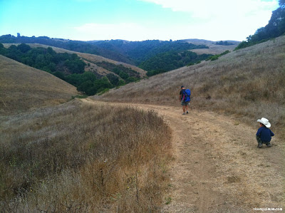
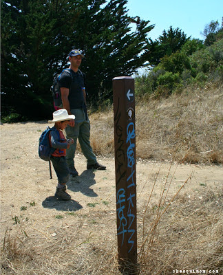
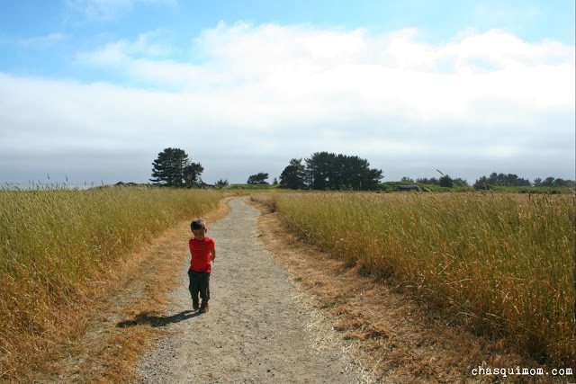
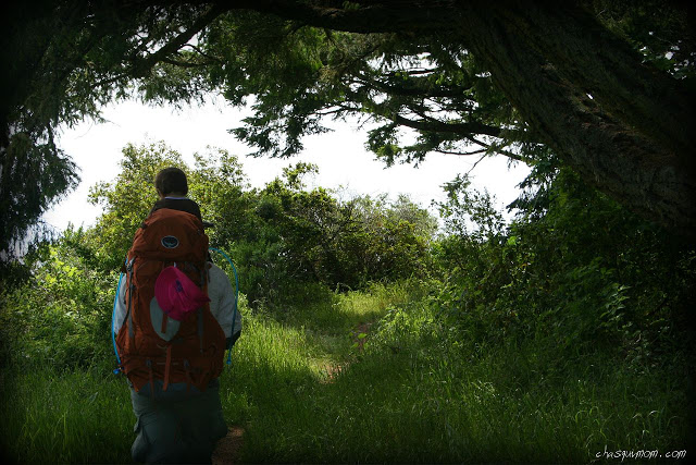
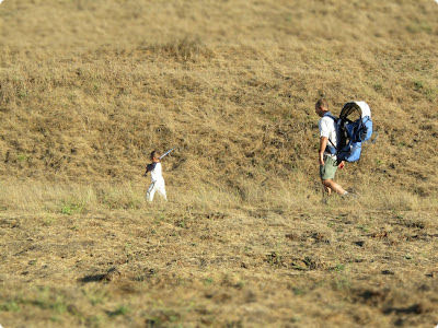
Our first steps on the Appalachian Trail near Bearfence Moutain.
Trail Directions & Description: Parking lot is off of mile marker 56 on Skyline Dr in Shenandoah National Park.  If you follow the Bearfence Mountain Trailhead Kiosk, this is a 1.2 mile circuit hike with less than 300 ft elevation.  We took the first turnoff to the viewpoint so the hike was shorter than 1.2 miles and took us about 1.5-2 hours.

For more detailed trail information please visit: Lewis Mountain Area Road and Trail Map (National Park Service)

The trail starts off with wooden steps which always motivates my son to hike more than an uphill trail with no steps.  I don't know why but he loves going uphill on stairs but he loves to race to the top...I'm just happy he's not complaining about going uphill!

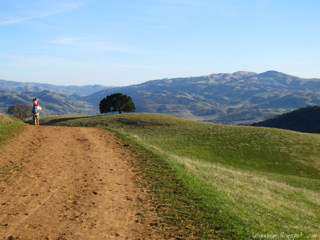
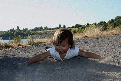
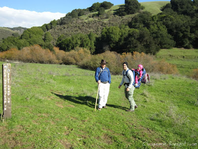
My boy on the crossroads of the AT and Bearfence Mountain Trail

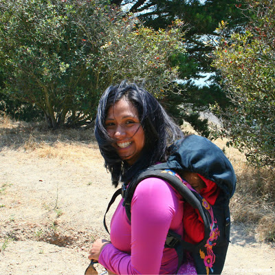
We went south on the Appalachian Trail, to the 180 degree Bearfence Mountain view point.  It was a very slight up hill with a partial stone trail, easy enough for my 3 and 4 year old children and I, a 5 month pregnant lady!  The overall elevation change is about 300 ft, which is like going up a small hill but it still was a good little workout for us.


It was a very beautiful cool fall hike up to the view point, where we took a little break to enjoy the amazing views looking unto the west of Shenandoah National Park.  We had promised our children as we left Big Meadows campground that we would find more ladybugs and caterpillars on our hike.  Of course the second we sat down we found the fuzzy caterpillars and the bright red ladybugs.

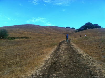
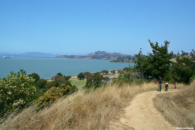
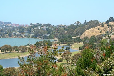
180 degree Bearfence Mountain View Point.  Oh beautiful fall!
At the time we were a little confused because Jennifer Chambers had told us there was 360 degree view point, and we walked around looking for it but then we realized that we'd find it during the rock scramble.  The kids thoroughly enjoyed the first view point but they heard that we were going "rock climbing" aka rock scrambling and they were itching to go climb!

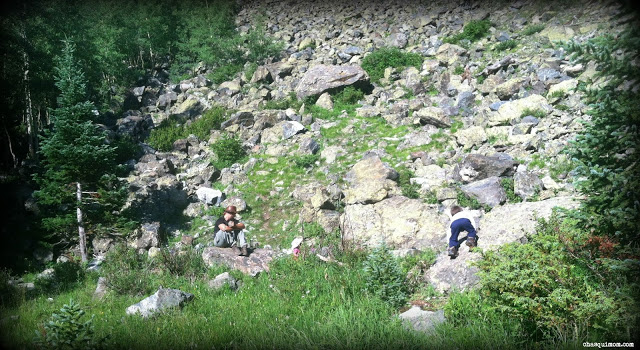
Time to Family Rock Scramble!

The New Outdoor Experiences.....

We experienced two new outdoor "aspects" on our hike to Bearfence Mountain:

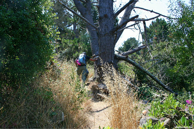
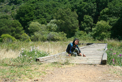
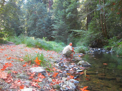
  1. Rock Scrambling: It'ts kind of a hybrid of hiking and rock climbing, with no ropes or climbing gear and not really on a traditional trail.  For a more detailed description of rock scrambling please visit "Basic Rock Scrambling".  The difficulty of  Bearfence Mountain rock scramble climb was easy enough for my four year old son and a five month pregnant Chasqui Mom to complete.  Granted we were still very cautious and hand guided our son down certain sections of the way. Note: There is both an uphill and downhill rock scrambling on Bearfence Mountain.
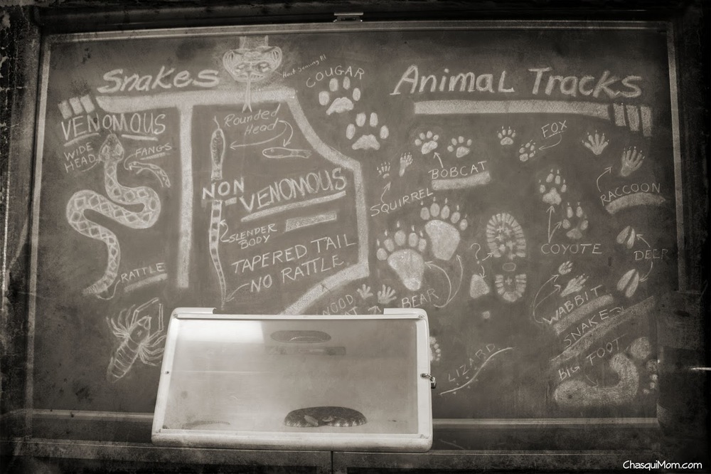
  2. Trail Blazing:  This isn't very common in California, or at least in the San Francisco Bay Area.  What is it? It's a painted mark on rocks, posts or trees to designate the way or trail.  I can see how someone can easily get lost with all the foliage/snow covering the ground or in this case the trail on the rocks (see middle picture in collage).  It also provided a "game" for our children to find the next blaze on the trail, kind of like hide-and-seek for toddlers.
But the best new outdoor experience was seeing Shenandoah National Park in its most beautiful time of the year and enjoying the 360 degree view of this awesome park from the top of Bearfence Mountain!

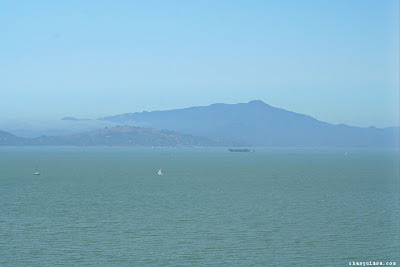
View of the west 1st picture, view of the east
I would highly recommend this hike if visiting Shenandoah National Park, especially during Fall.  It's a great short hike with a kick that families with little ones can enjoy, not to mention amazing views of the park and the great feeling a "conquering" a mountain with toddlers.


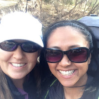
Thanks again to Jennifer Chambers of Hiking Along who recommended Bearfence Mountain for our adventurous family.  That is the great thing about being a blogger is that I get to meet like-minded people who instinctively know where we can enjoy the outdoors to the fullest!


Also if you are in the Washington DC greater area.  Chambers newest book "Best Hikes with Kids: Washington, DC, The Beltway and Beyond" would be a great resource to find family friendly hikes.  Bearfence Mountain is listed as a "difficult family hike" in the book due to the rock scrambling, but it is highly recommended by Chambers.

Hike Date: October 20, 2014

Join in on the conversation by leaving a comment here! You can also join in on the conversations on FacebookInstagram and Twitter that is updated daily with outdoor activities and other wonderful posts and links from #OutdoorFamilies!

A Wondrous World of Family Hiking in Muir Grove


Between every two pines is a doorway to a new world
~ John Muir ~

Have you ever seen a child romp through the forest? Have you listened to a child talking while walking through the mountains? Sure, hiking with children is difficult, slower, tedious and harder on your back, but there is a different level of wonder that is seen through a child's eyes.

Muir Grove in Sequoia National Park might not be a big attraction but it truly is a nice hike.  The great thing about Sequoia National Park is that there are Sequoias very near the General's Highway.  This gives great accessibility BUT this also means very large crowds which is something my family is not a big fan of.  We wanted to see the Sequoias but wanted the solitude of the "Outdoors", so off we headed hiking to Muir Woods near Dorst Creek Campground.


Hiking to the Sequoias

This is a moderate, family-friendly, 4.2 mile round trip hike to Muir Grove, but in all reality we added a little over 2 miles for a total of 6.3 miles from our campground in Dorst Creek.  We walked from our campsite to the trailhead but we got a little confused about where it was, we eventually found the Muir Grove trailhead but added two miles over all to the hike.  Every step adds up when you think about it.  The trailhead is near the campsite #178, which crosses a little bridge over Cabin Creek.


Immediately on the trail, we enjoyed the sounds of the flowing Cabin Creek and were glad the creek was not dried up yet due to California's severe drought.  It was quite refreshing to hear water flowing and to see the greenery all around us.

The hike has a slight uphill trail to Muir Grove with sections of flat and down hill sections.  The trail is a very shaded with just one section of exposed granite halfway to Muir Grove.  There were signs of bears everywhere....almost every fallen tree had been shredded by bears so we made sure our son never ran ahead.  I happily told my son to blow his whistle as much as he wanted!  Thankfully we never saw a bear while hiking to Muir Grove.  All we saw was lush beautiful forest greenery!!


Ferns galore...


Just hiking along...


My daughters view point from down below...

I would suggest taking a kid carrier for little ones who can't hike this distance.  My 4 year old son was able to hike the entire 6.3 miles but my 2 year old could not.  Of course when we saw the Sequoias down the trail, everyone got excited to see the REALLY BIG TREES!!

Entering Muir Grove

Doesn't matter how many times I see Sequoias I'm always blown away by their sheer size.  They provide a perspective that only Sequoias can provide.  Just seeing the Sequoias brought back my happy childhood memories of endlessly running around the base of the trees with my older brother. I was very happy we had hiked out to Muir Grove with my children.


"Daddy, Mommy! Those trees are REALLY BIG! And they have caves!" my toddlers squealed.  Now I understand why my parents brought my brother and me to Sequoia National Park so much.

When we arrived to Muir Grove, a couple of hikers were having lunch but they quickly packed up and left.  We packed our lunch as well: Bolillo sandwiches.  We enjoyed a picnic all by ourselves in the middle of Muir Grove.  After lunch, my son and I explored the "caves" and I happily listened to my son imagining finding bears in the tree hollows and pretending to scare them.  A little bit of family time at Muir Grove....


Time to EXPLORE....


Daughter hugging daddy, surrounded by the Sequoias hugging us....


Always look up....


The world from inside the tree, from my daughters eyes....

I must say this might not be a popular hike in Sequoia National Park but it was my family favorite.  Muir Grove...where we played hide and seek, had Bolillo sandwiches and pretended we were giant bears in the tree trunks.  Welcome to the world of family hiking, it's more fun this way.


Trail Report Detials
Who: Two Adults, Two Toddlers
Family Friendly: Moderate
Mileage: 4.2 miles from Trailhead, 6.3 actual from campsite


Elevation Change: 896 ft
Trails Description: Out and back trail, slight uphill hike


What's your favorite day hike in Sequoia National Park?


Join in on the conversation by leaving a comment here! You can also join in on the conversations on Chasqui Mom's FacebookInstagram and Twitter that is updated daily with outdoor activities and other wonderful posts and links from #OutdoorFamilies!

Related Posts and Links:

Hiking the California Coast: Tomales Point ~ Point Reyes National Seashore

Point Reyes National Seashore is a National Park jewel in the San Francisco Bay Area.  Point Reyes will always have a special place in my heart, because it was where we had our first family backpacking adventure.  Not only is Point Reyes a great place for family backpacking, it also has many fantastic location for numerous day hikes.


Ever since my husband and I "discovered" Point Reyes we have always wanted to hike out to Tomales Point, but we just haven't found the opportunity to make it there.  Even though Point Reyes is in the San Francisco Bay Area, it's still 2.5 hour drive to reach the trail head from the East Bay!  It was definitely worth the drive, since we had an out-of-town guest coming to California for the first time.  We wanted to show the beauty of the California coast, so off we went to Tomales Point.


Hiking the California Coast

When you think about hiking on the California coast, everyone thinks about warm sunshine, beautiful views of the Pacific ocean and cliffs.  I would say that on all our coastal hiking outings: Año Nuevo SPRancho Corral de TierraBaker BeachPirates Cove and Backpacking Point Reyes have been for the most part, completely the opposite of sunny/warm and Tomales Point was no different!


Weather Conditions ~ The majority of the hike was foggy, it wasn't until 4 p.m. that the sun FINALLY broke through the fog.  It was cold, misty, foggy and windy during most of the hike and then winds became stronger after the sun broke through the fog!  I was almost knocked down a couple times near "Windy Gap" by the gusts!  I normally bring multiple layers for myself and especially for the kids since they get cold sitting in the carriers.

Foggy trail near same location below

Fog-less Tomales Point  
I usually do not like "Out and Back" trails because I want to see new scenery the entire hike but since it was foggy one way and sunny on the way out, it was like two completely different hikes!  Everything looked different from the foggy morning hike.  We were also able to see the tide roll into Tomales Bay, which none of us have ever seen before!

Bird Rock in the Pacific Ocean
Trail Conditions ~ Tomales Point Trail is an out and back trail, 4.75 miles (one way) for a total 9.5 miles.  We were aiming to hike to the bluffs but we were not committed since 9.5 miles is a really long hike with toddlers.  We did not complete the entire trail, we opted out to not hike the last 0.5 miles to the bluffs (see trail report below).  Everything I read about this hike said it was an easy "10 mile" hike but everything takes twice as long with kids.  With that said, my toddlers LOVED this hike and the adults did too!

The trail itself was mostly single track with some wider trail sections.  It was a combination of hiking on beach sand and compact dirt.  A huge motivator to get my kids hiking and out of the carriers is SAND. There was a trail section where we were hiking uphill (with toddlers on our backs), in sand, "bushwhacking" our way through the tall wildflowers...I don't know about you but that was HARD.  I made it about 20 ft and then my daughter yelled "Ooh sand!! I want to get out!!" and I happily let her out.  My kids love to bring their shovels in case they find sand on hikes. 

Getting There ~ Tomales Point Trail Head is at the end of Pierce Point Road a 40 minute drive from the Bear Valley Visitor Center, which I highly recommend visiting.  Directions to Tomales Point Trailhead.


Abundant Wildlife

One of the main attractions of Tomales Point is the wildlife, in particular the Tule Elk.  I was hoping to see a few Tule Elk but I was surprised that we hiked all day with the Tule Elk.  Of course we always kept our distance since wildlife should never be disturb, but we took many moments to just stop and stare at these beautiful creatures.  National Park Service states that "In 2009, over 440 were counted at Tomales Point" and we definitely saw at least 50 elk during our hike.

Can you find the Elk scratching it's ear like a dog?

Seeing wildlife with kids is really amazing, so many teachable moments that I will need to write another post about it soon.  My kids haven't really grasped the concept of specific type of animals, so when we told them those animals were "Tule Elk" they just gave us blank stares.  When I told them they were kind of like deer they were a little confused because they didn't look like deer.  It wasn't until we saw the bucks with antlers, that my toddlers were satisfied with telling me that we were hiking with "Reindeer". 

Why did the turkey cross the road?
We also found some wild turkeys crossing the trail.  As we let them cross our path, I joked with our children that we were going to eat them and my son turned around and said "Mommy, we don't eat turkeys!".  Sorry buddy, we do and they are delicious!  Wild turkeys are not native to Point Reyes National Seashore, so maybe we could have eaten them...


Wildlife Proximity ~ We've had a few close wildlife encounters in the past, so we are very careful when wildlife is nearby.  As we were hiking along the ridge, a herd of Tule Elk (bucks) ran across the trail 30 feet ahead of us.  The low bushes hid the elk, so we could not see them until they were running across the trail (picture above).  Thankfully we had our "herd" of children near by and my daughter (two years old) was up high in the carrier. My daughter was able to see the herd running and said, "Daddy, that is beautiful!".


Wildflowers Galore

I have never hiked where I was completely surrounded by wildflowers.  My hiking ground is the San Francisco East Bay hills that dry up the second the rainy season stops, so all the hills surrounding me are currently golden brown with a few sparse wildflowers.  The California coast stays a little more damp due to the fog, so even our precious California Golden Poppies were out in droves!


The one flower that stopped us in our tracks was the Cobwebby Thistle - Cirsium Occidentale (spiky pink "flower").  We found it near the last mile of the Tomales Point Trail, the closer we got to the end the more abundant they became.  I could only identify the California Golden Poppy, and some type of purple lily but we were always surrounded by wildflowers.  If you have allergies to pollen, I would suggest waiting until wildflower season is finished because we were covered in pollen!

My daughter was in HEAVEN...she absolutely loves flowers, one of her favorite things about the outdoors.  It took us forever to walk through the field of flowers (about 4 ft high) because she had to stop and smell all the flowers.  I had to "part the waters" with my hiking sticks so she could walk through and not get hit in the face.


Trail Report Details

Who: Four Adults, Two Toddlers
Family Friendly: Difficult
Mileage: 8.5 miles Round trip


Elevation Change: 1256 ft
Trails: Tomales Point Trail (Out and Back) 


Approximate Time: 4 hours (Moving time) ~ 7 hours 15 mins (Breaks Included)
Method: Toddlers Partially Hiking/Carriers


I would not suggest this hike in its entirety for families new to hiking, hence the difficulty rating but if your are used to hiking with your kids this hike would be a great all day hike.  A more family friendly hike at Tomales Point Trail would be hiking to Windy Gap (approx 1 mile - 2 miles roundtrip) and exploring the barns near the trail head.  I absolutely loved this hike, from the wildflowers, wildlife to hiking the beautiful California coast, Tomales Point is a hike definitely worth the drive, effort and time.  


Have you been to Point Reyes National Seashore before?  If so what parts?


Join in on the conversation by leaving a comment here! You can also join in on the conversations on Chasqui Mom's FacebookInstagram and Twitter that is updated daily with outdoor activities and other wonderful posts and links from #OutdoorFamilies!


Related Posts and Links:
  1. Point Reyes National Seashore - National Park Service Site
  2. Backpacking at Point Reyes: Day 1, Day 2, Day 3

Spring Time Hiking at Basin Falls ~ Uvas Canyon County Park

Uvas Canyon County Park is a very small but beautiful park in the South Bay.  Located south of San Jose in Morgan Hill, this park contains about 6 miles of hiking, four waterfalls and creeks for everyone to enjoy.

Photo Courtesy of +Paul McWilliams.
On this occasion, I had a arranged a #HIRL (Hangout In Real Life) with a Google+ friend +Paul McWilliams and his family, and invited friends of mine.  Three - 2 year olds, one - 4 year old and five parents!! I was the only solo parent hiking with two kids, since my husband was riding the Tierra Bella Century that day! What a better way to spend the day hiking to waterfalls and meeting up with new and old friends.  It may have been the first +Google+ Toddler #HIRL history!

As hiking parents of little ones we knew that our mileage was not going to be long, so we aimed for the Waterfall Loop and if still felt energetic we were going to head to Triple Falls. Granted the latter never happened!

Waterfall Loop along Swanson Creek
Most of the hike was an uphill towards the waterfalls but it was not a difficult uphill since my two year old daughter hiked most of the way up. Still for toddler-carrying parents any uphill is a sweaty trek! We hiked counter-clockwise on Waterfall Loop, one side follows along the creek closely and the other side is a plain fire road trail. The creek-side trail, had actual creek crossings and bridges to walk across.  Two great features to keep kids hiking - water and bridges!

Creek Crossing!! ~ Photo Courtesy of +Paul McWilliams 

Bridges Make a Hike Fun ~ Photo Courtesy of +Paul McWilliams 
During a little carrier break, my daughter and I walked over to look at the flowers and she screamed, "Snake!!" and jumped backwards on the trail.  I only saw branches until a heard something rustle by my feet and saw something slither!! Of course I screamed and jumped back to where my daughter was standing but as I took a closer look it was a lizard carrying another lizard by the neck, I thought maybe they were mating but the lizard was definitely biting the other lizards neck.

After our lizard encounter, we continued on the spur and in a few minutes we were at Basin Falls which brought excitement to everyone, especially the little ones. There were lots of smiles from all the kids and parents when we saw the falls.  We tried to "relax" during our break at Basin Falls, but as always with kids, they are always trying to "not" fall into the water.

Chasqui Mom and niños!! Photo Courtesy of +Paul McWilliams 

Splashing at Basin Falls!! 
Basin Falls Spur - Photo Courtesy of +Paul McWilliams 
There was lots of splashing with sticks, rock throwing, investigating the water basin at Basin Falls and earthworms that came out out from under the leaves.  Lunch was eaten and after my daughter decided to not "accidentally" fall into the water, we packed up and headed back to Waterfall Loop (Fire road trail side).

Heading back! Photo Courtesy of +Paul McWilliams 

We took another spur to Black Rock Falls, which wasn't as impressive as Basin Falls but the rocks were black!


Most of the kids were done hiking by then so we hurried back to the parking lot.  Thankfully the rest of the trail was downhill so everyone was able to hike fast to the cars.


Trip Report Details

Who: Three families - Five Adults, Four Toddlers
Family Friendly: Moderate
Mileage: 2.8 miles roundtrip


Elevation Change: 586 ft
Trails: Counter Clockwise Waterfall Loop, Basin Fall & Black Rock Falls Spurs


Time: Approx. 1 hour 30 minutes (moving time)
Method: Toddlers Partial Hiking/Carriers


There aren't too many waterfalls in the San Francisco Bay Area, but cheers to family hiking and waterfalls that we do have!!


Waterfalls are great for family hikes! What is your favorite waterfall hike?

Join in on the conversation by leaving a comment here! You can also join in on the conversations on Chasqui Mom's FacebookInstagram and Twitter that is updated daily with outdoor activities and other wonderful posts and links from #OutdoorFamilies!

Related Posts and Links:

  1. Santa Clara County Parks - Uvas Canyon
  2. Chasqui Mom: South Bay Hiking

Family Peak Bagging: Tolman Peak at Garin Dry Creek Pioneer

This is not about bagging a 14er, not even close! Tolman Peak does not reach 1,000 ft but that does not mean we didn't get great views of the San Francisco Bay Area!

View of the San Francisco Bay Area from Tolman Peak
If you are not familiar with "Peak Bagging", that is an outdoor term for reaching the peak of a mountain like one of Colorado's famous mountains above 14,000 feet.  Technically our little family "bagged" Tolman Peak, at only 947 ft, it is still peak bagging!  Tolman Peak is more like a hill but from the top you can see the entire San Francisco Bay Area, from the South Bay to out past San Francisco.

Garin Dry Creek is surprisingly remote once a mile has gone by.  I would consider Garin Dry Creek an "urban outdoors" park because its right up against two cities Union City and Hayward.  Surrounded by California State East Bay, cemeteries and residential areas.  Yet on almost every occasion we've been there we have encountered wildlife (alive and dead) and felt like we were miles away.

"Tolman Peak has a little kick to it!"

On this warm winter day, we wanted a relaxing hike to let the kids burn some energy so we decided to hike at Garin Dry Creek, Tolman Peak.  We only need to hike to Gossip Rock and then we can say we have hiked on every trail at Garin Dry Creek!  It was a busy day at the park that even the May Road Entrance parking lot was full.  We actually had to park outside on the Mission Blvd, which added 0.55 miles to this 4.75 mile hike (from May Parking Lot).

Shady May Trail

May Trail is very shady and is not much like the rest of the park, which is exposed grassy hills.  Our kids have issues with hiking fast up even the slightest uphill so even though Tolman Peak has some elevation gain the majority of the hike is perfect for my not-so-energetic two year old daughter.  We continued onto High Ridge Loop Trail which is a fire road and could still hear all the traffic sounds from cars and the BART train.

Ladybugs were plentiful throughout the day which motivated the kids moving to find the next ladybug down the trail. Near the fork of High Ridge Loop and Tolman Peak Trail there was a waterhole for the grazing cattle and they all were laying in the shade. When I'm hiking alone with the kids, we normally hike to the waterhole and the kids throw rocks in the pond so the kids were a little astonished to see the cows in "their spot".

Our kids were in their hiking "groove" along the Tolman Peak Trail which followed a creek that actually had water flowing in it!  Dry Creek was not dry and the sounds of croaking frogs made my kids happy.  We reached a little bridge that was surrounded by large Pine and Eucalyptus trees, all of a sudden I realized that even though we were probably less than 2 miles away from the busy streets of Hayward I felt I like I was 100 miles away from civilization.  No more traffic or train sounds, all the other park visitors were gone and we were alone with the sounds of the croaking frogs and my kids screaming! Sometimes there's no need to drive far away to get into the Great Outdoors.


After a little break near the bridge, we finally made it to the base of Tolman Peak and it was time to hike uphill.  We didn't want the kids to get burned out nor spend hours on end going up hill so I carried my daughter in my Ergo and my husband picked up our boy unto his shoulders.  Tolman Peak definitely has a little kick to it, let's just say my husband and I got a workout!

I love My Hiking Family!

Where is Tolman Peak?

Obviously Tolman Peak exists...I was just a little confused about where the actual peak was. According to the East Bay Regional Park District map, Tolman Peak was just south of the South Fork Trail near the bench, but I could not find the circular peak marker that you normally find at the peaks.  According to our Garmin GPS the peak was north of the bench near some rock formations, either way we were at the top and we enjoyed our views of the Bay.

Even if it's a warm day down below in suburbia-land, going up on the East Bay Hills always allows for the direct chilly ocean wind cut right through us.  I always think that we won't need our jackets but a few minutes on top of Tolman Peak led to wearing every piece of clothing in our packs!  After we all bundled up we all hiked down on South Fork Trail, which was a single track trail and somewhat steep in sections.


We tried to hurry back to the car since I was cold and couldn't warm up! My daughter decided that she wanted to hike at her own pace so it took a little longer than we hoped but I'm always happy when she hikes because she doesn't hike long distances like her brother. We were hungry and only packed snacks since we planned on eating out afterwards, but we were all running low on energy and needed to finish.  Promises of treats, finding more ladybugs moved everyone along and we finally finished our lovely family peak bagging at Tolman Peak.

Side Note:  The great thing about hiking with kids is that everything slows down and you get to enjoy the small beauties of nature.  The San Francisco Bay Area never gets real "Winter" weather other than rain and with due to drought conditions in California our East Bay hills have been terribly dry.  Even with the tiny bit of rain we have received recently the hills been showing signs of Spring.


Trip Report: Garin Dry Creek Regional Park 

Who: Family - Two Adults and two toddlers
Mileage: 5.3 miles (From the Mission Blvd)
Time: 4 hours - Toddlers partially carried
Elevation Change: Approx 1,000 ft 
Family Friendly: Moderate


Trail Directions (Lollipop): From May Rd Entrance Parking Lot - May Trail 0.12 Miles - Slight right onto High Ridge Loop 0.32 miles - At the 2nd fork continue straight to Tolman Peak Trail 0.88 miles - At the Fork take a left (counter clockwise) continue on Tolman Peak Trail for another 0.82 miles - Right onto South Fork Trail for 1.29 miles and continue back Tolman Peak, High Ridge Loop and May Trail to parking lot.


I love my urban outdoor parks! What's your go to park whether urban or not?


Related Posts and Links:

  1. Implosion Hike...What's Not to Like?!
  2. A Chilly Hike at Garin Regional Park
  3. New Year's Day Hike: Garin Dry Creek
  4. Garin/Dry Creek Regional Park


Join in on the conversation by leaving a comment here! You can also join in on the conversations on Chasqui Mom's FacebookInstagram and Twitter that is updated daily with outdoor activities and other wonderful posts and links from #OutdoorFamilies!

Out of this World: Vasquez Rocks & The Pacific Crest Trail


Vasquez Rocks, the Pacific Crest Trail and this hiking family. On a quick trip down south to the greater Los Angeles area I decided to do a little solo hike with my toddlers at Vasquez Rocks.  All I knew about Vasquez Rocks Natural Area Park was that an episode of the original Star Trek was filmed there a long time ago.  FYI, I only knew that fact because I watched a Big Bang Theory episode that was fake filmed at Vasquez Rocks so I researched it and Vasquez Rocks was a real location.

Vasquez Rocks is part of the Department of Parks and Recreation County of Los Angeles but it is a 20-30 drive east of Santa Clarita, California.  You can't really tell that Los Angeles is a desert until you leave the main metropolis area and can see the natural environment and really enjoy the beauty of  it, like Vasquez Rocks.  You can see this parks main features from the freeway and it is actually on the outskirts of Agua Dulce, California.  Off the freeway the drive to Vasquez Rocks is very rural and ranch-like, we even saw a buffalo on one of the ranches.


The Interpretive Center looked like a space ship to my kids.  It has a modern look to it, I'm assuming it was designed to compliment the rock formations but not only was the design modern it had a LEED Platinum Certification.  Layman's terms means that this center has the highest level of being "Green" which is fantastic!  The Interpretive Center had a diagram of Vasquez Rocks, a few reptiles and spiders, as well as a Hollywood history of all the movies that had been filmed at Vasquez Rocks.  Outside the center was a small area that housed some native birds.


The Pacific Crest Trail at Vasquez Rocks

The Pacific Crest Trail (PCT) is a trail that runs from the border of Mexico/California to just across the Canadian border.  Almost every hiker that I know dreams of hiking the PCT, so any time I get a chance to hike on it, I do! Even just one mile on the PCT with my kids, satisfies my future dream just a little bit.  I didn't even know that the PCT went through Vasquez Rocks until the day before visiting so I was pleasantly surprised when I saw it on the map.  FYI: I brought EXTRA snacks and food just in case I ran into a PCT thru-hiker but I didn't run into anyone except some tourists.


We started out on the PCT (AKA the Geology Trail - 0.9 miles) near the Interpretive Center.  From the beginning there were giant rocks right along the trail which made the hike terribly slow because my kids had to explore every rock, hole and "mini-cave."  I'm not complaining, I want my kids to explore but I'd prefer they explored at least 100 ft down the trail vs. 10 feet down the trail! But alas the caves must be explored and my patience must be tested constantly on the trail.

We hope that someday we can do hike the entire PCT as a family, but probably not all in one sitting! PCT section hiking is more up our alley, but it won't be for a few more years until our little ones can hike longer distances and carry a pack.  Either way, I was getting a little nostalgic with the idea at some point in the future I was to return to Vasquez Rocks and remember that I had been there before with my babies.

It took a little while to get into the groove of hiking but everyone enjoyed the little 0.9 mile hike on the PCT.  There was exploring of the caves, playing with the sandy trail and even touching of the spiky Yucca Whipple-Our Lord's Candle.  My son has a fascination with prickly plants, I just make sure they aren't poisonous before he touches them.

The Geological Trail had many markers with the descriptions on the pamphlet, sadly I'm so busy with the kids on the trail I never get a chance to see what the markers are all about, but the geological formations are just amazing to see all along this tiny section.  When we had reach the famous section of the Vasquez Rocks, my kids starting yelling with glee, "Those rocks are Crocodile Rocks!!" and indeed they did look like crocodile heads.  One of the great things about hiking with kids is the fact that they help you view the world in a beautiful imaginative way.

The famous Vasquez Rocks are really neat, they are giant slabs of rock shooting out of the ground!  We hiked along the back side of the rocks and I was a little saddened by the graffiti and trash I found along there.  I picked up as much trash as I could but still I don't understand why people have to put "I was here" on these beautiful rocks.

The Pacific Crest Trail continued but my children could not, so once we reached the picnic/parking lot area for viewing the rock formations, we headed down another trail back to the Interpretive Center.  There is a dirt road which you can take to iconic Vasquez Rocks but we opted to hike on the PCT.  I almost took the dirt road back but decided to stay on the trail and I'm glad we did because we saw some hieroglyphs and a Road Runner, which of course was too fast to snap a picture of it!


Vasquez Rocks is a great park, truly felt like I was in a different planet! Great rock formations, family friendly trails, a great "green" center and it has the wonderful Pacific Crest Trail.  My suggestions would be:
  • Take lots of water! We visited on a cool day but it is still in the desert and it got very warm.
  • If you have time check out more of the longer trails, such as in SoCal Hiker's visit.
  • Visit the Interpretive Center! It's a really neat place and the employees are very informative.
  • Please take children on the Pacific Crest Trail.  You don't have to be a backpacking ninja to hike on the PCT.  Even a 0.9 mile hike is worth enjoying the PCT with your family.
Trip Report Details
Who: One Adult and two toddlers
Mileage: 1.8 miles (0.9 miles on the PCT)
Time: 1 hour (51 minutes to be exact)
Elevation: 7 ft - very flat
Family Friendly: Very Easy

I truly had lots of fun with my kids at Vasquez Rocks, knowing that it was a hideout for the California Bandido Tiburcio Vasquez (hence the namesake) and with all the Hollywood film history, makes hiking at Vasquez Rocks Natural Area Park out of this world!


Join in on the conversation by leaving a comment here! You can also join in on the conversations on Chasqui Mom's FacebookInstagram and Twitter that is updated daily with outdoor activities and other wonderful posts and links from #OutdoorFamilies!


Related Posts and Links:

  1. Family Desert Hiking: Devil's Punchbowl Natural Area
  2. The Pacific Crest Trail Association
  3. SoCal Hiker: Hiking the PCT in Vasquez Rocks

Pirates Cove Adventures with Amigos~ Guest Post on Latino Outdoors

Queremos aventura, algo diferente! My friend, Lorena has caught the "Outdoor Adventure Bug" as I call it.  I had to find a hike that lived up to our previous adventures like Rancho Corral de Tierra at Golden Gate National Recreation Area.  We tossed around ideas like Mt. Tamalapais, Pinnacles National Park, and the Santa Cruz Mountains, but nothing sat well with me.  I literally spent days looking for an adventurous place to hike, especially since Lorena and her husband Eliu had just returned from an Anniversary trip to the sierras trip and then I found Pirates Cove....


If you want to go there....
The 5.9 mile loop hike starts at Tennessee Valley Road in Mill Valley, which has a dirt parking lot, bathrooms and picnic tables. Start hiking on Tennessee Valley Road and take a quick right onto Fox Trail which is an uphill 1.0 mile hike to Coyote Ridge.  Fox Trail turns continues to Coast Fire Rd for 0.9 miles, which has FANTASTIC views of Muir Beach.  Turn left onto Coastal Trail for 1.0 mile to Pirates Cove spur.   NOTE: Pirates Cove spur is very rugged and steep, please take caution.

Return back up the spur and continue straight up the stairs and head to the right for 1.1 miles on an uphill hike on Coastal Trail.  Continue on Tennessee Valley Trail on a 1.1 downhill hike back to the parking lot.


Mileage: 5.9 Miles
Elevation: Approx. 1,800 ft
Elapsed Time: 6 hours 28 minutes (Including Lunch Break)
Group: 7 Adults & 2 Toddlers
Family Friendly (Difficulty Level 1-10): Level 6


Related Posts and Links:
  1. Latino Outdoors: Pirates Cove Adventure with Amigos
  2. The Hidden National Park - Rancho Corral de Tierra

Join in on the conversation by leaving a comment here! You can also join in on the conversations on Chasqui Mom's FacebookInstagram and Twitter that is updated daily with outdoor activities and other wonderful posts and links from #OutdoorFamilies!

A Tale of Two Mountain Mamas: The Minimalist and the Planner

Mamá Selfie - Photo Courtesy of Two Groms and a Mom
I've been doing lots of #HIRL this year! That's hashtag lingo for "Hangout In Real Life", so when Teresa from Two Groms and a Mom and I had a chance to meet up, we did! We first met over social media and quickly found out that we have lots in common: our children's ages, our Latino culture, California roots and of course loving the outdoors.

I like to follow rules, have plans and sometimes a plan for a plan.  Sounds a little crazy but I love to be prepared for everything that could happen on the trail.  Some of it is due my personality, but my accountant training, and background as a former law enforcement officer means I'm always doing a "risk assessment" when we head out to the outdoors, and plan accordingly.  I always plan for the worst and expect the best because of certain previous bad outdoor experiences.  My planning for day hikes with my toddlers sometimes feels like a mini-backpacking trip but it's the way I feel most comfortable going into the outdoors with my children.

Groms and Chasqui Niños - Photo Courtesy of Two Groms and a Mom
There is no one-way of hitting the trail as it seemed apparent when Two Groms and a Mom and Chasqui Mom went hiking with their children! Here's a chance to learn about our methods and see what works for you to hit the trail with your kids!


The Pack

Teresa: My pack is the Deuter Kid Comfort II kid carrier. It’s hard to say how much hiking the baby will want to do, so a capacious kid carrier lets me carry a toddler and the essentials.

Melissa: My pack is the Teton Sports Escape 4300 Ultra LightBackpack and the Ergobaby Sports Carrier.  I find it easier to carry all my gear in a large backpacking pack (including the small carrier) because it does not all fit in my larger kid carrier.  My toddler also likes to vary from hiking to being carried quite often and I find it easier to carry her on my shoulders or to front-carry her in the Ergo with the backpack on.
  
What's Inside?

Teresa: For a morning on the trail with a two- and five-year old, I pack:

Photo Courtesy of Two Groms and a Mom

  • An ultralight Eagle Creek pouch with everyday kid/baby essentials:
    • 2 diapers
    •  A Ziplock bag full of baby wipes
    • Sunscreen
    • 4 Fruit Snacks
    • 4 Clif Z/Luna Bars
  • A trail-appropriate toy or two
  • Shade canopy for the Deuter pack
  • An extra layer for each of us
  • 3 bottles of water or a hydration bladder tucked in the Deuter H20 compartment
  •  iPhone
What’s Missing?
  •  Lunch. My kids ate a big breakfast just before we left the house, so I figured they would be fine with snacks on the trail and lunch at home after our hike.  I was wrong! They ended up eating a sandwich, goldfish, and fruit snacks out of Melissa’s stash. Not my finest mom moment.
  •  Backcountry essentials. I tend to treat day hikes like a walk in the park, not like an adventure in the woods. It’s not uncommon for me to leave behind a compass, first aid supplies, etc.  Sure, it might make for a lighter pack, but it doesn't exactly ingratiate me to those who do prepare properly.

What's Inside?

Melissa: For a morning on the trail with a two- and four-year old, I pack:

Not all items pictured.  Need more food!

  • 4 Diapers
  • Baby Wipes packet
  • 100 oz Hydration Reservoir
  • A Water Bottle
  • Family First Aid Kit
  •  Epi-Pens (2 Qty) and Allergy Pills
  • Small Roll of Toilet Paper/"Poop" Shovel
  •  iPhone and Large Camera
  •  Peruvian Tablecloth/Blanket
  • 3-4 Trail Toys and a small child backpack (items to be carried in)
  • Garmin GPS
  • Two extra layers (Fleece and jacket)
  • Food and Snacks
    • Clif Kid Z Bars (4 qty)
    • Clif Bars (2 qyt)
    • Gold Fish Crackers (2 separate baggies)
    • Trader Joe's Chianti Red Wine Artisan Salami
    • Mozzarella Cheese Sticks (4 qty)
    • Yogurt Tubes (4 qty)
    •  Turkey and Cheese Sandwiches (2 qty)
    • Toaster Pastries (2 qty)
    • Fruit Snacks (Lots of it)
    • Trail Mix or Dried Fruit


What’s Excessive?
  •  Lots of it is excessive but there's a reason behind all my gear that I "need" to take.  The Peruvian blanket is probably the most excessive and space/weight consuming, I like it for pictures.  Too many useless trail toys as well as food.  Sometimes my picky eater decides to eat while hiking so I have everything in the world that he might possibly eat!
  • Technology wise: The Garmin GPS isn't really helpful for a 1-2 mile hike, but I like to know the "numbers" after a hike.  I also like to take high resolution pictures with my larger camera but in all reality iPhone pictures are probably good enough.
  • Large First Aid Kit: I have EVERYTHING in my first aid kit in case of any medical incident.  I'm a little paranoid since I have Exercise Induced Anaphylaxis hence the dual Epi-Pens and allergy pills  but half of the kit could be safely left behind.

How I'll Pack Differently Next Time

Teresa:
  • I learned a great lesson while my kids ransacked Melissa’s lunch stash: trailside hunger fosters more omnivorous eating! Hikes are a great opportunity to introduce new foods to picky kids. You’ll be seeing fewer packaged trail snacks from me, and more of the food that gets ignored in the school lunchbox.
  • The basics: I love that Melissa keeps a multitool within reach! There’s a reason this is a backcountry essential. I’m putting together a little kit of trail essentials that will go on every hike from now on, which will include a multitool, a headlamp, energy bars, a whistle, a small first aid kit, and a compass.


Melissa:
  •  I don't need to entertain the kids! Nature will entertain the kids so I shouldn't bring so many toys or bring one toy that would be appropriate for that hike.  My kids did great chasing bubbles on a previous hike, but not on this particular joint hike.  The bubbles worsened my toddler's meltdown, which wasn't the purpose of the bubbles! Fail.
  • Teresa dressed her kids in warm clothes and a fleece sweater.  Even though I checked the weather and knew it wasn't going to be awfully cold, I still brought our down jackets.  More bulk and weight in my pack than I probably needed.  My daughter ended up wearing hers but the other two jackets were unnecessary.  This is when my backpacking mentality is too much for day hiking.
  • Smaller First Aid Kit! Not too much explaining here but if I needed the WHOLE first aid kit then we are probably in more trouble than my first aid kit can handle.  Time to call or send for help!

It's great to learn from one another and I look forward to meeting more outdoor parents like Teresa! I love helping others learn how to get outdoors with their children and hope you can take one of our approaches or a combination of the two to get outdoors with your family.  To hear more on Teresa's point of view head on over to Two Groms and a Mom!

How do you prepare for day hike with your children? Are you a minimalist or a planner?

Join in on the conversation by leaving a comment here! You can also join in on the conversations on Chasqui Mom's FacebookInstagram and Twitter that is updated daily with outdoor activities and other wonderful posts and links from #OutdoorFamilies!

Family Desert Hiking: Devil's Punchbowl Natural Area


On a little trip to the greater Los Angeles area, we decided to get out of the hustle and bustle of Los Angeles and headed out for a desert hike at Devil's Punchbowl Natural Area in Pearblossom, California near Palmdale.  The park is very remote, far away from the "main civilization" of Palmdale, on the skirts of the San Gabriel Mountains.  We arrived on a perfect fall day but I could imagine how hot the park gets in the middle of summer.

Devil's Punchbowl Visitor Center
The parking lot was pretty empty and I was not expecting the visitor center to be open at all, so I was surprised to find it open and was glad we decided to check it out!  There was no mention on the website that the visitor center had animals so it was quite surprising to see all the live spiders, snakes and insects as well as some taxidermy animals.  The ranger was very happy to show us the around the tiny Visitor Center, gave us a little lesson on the Honey Ants that you can eat alive.  We didn't want to eat them but apparently they taste sweet, like candy!  They also had a neat Animal Track Chalkboard Art.


RATTLESNAKES ~ The ranger told us the baby rattle snake (collage featured above) was born a few days prior to our visit.  He blew air into the vent which made the rattle snakes shake their rattles, something we've never experienced!  My son cried to leave but he still wanted to see the snakes, intriguing fear!

Punchbowl Loop Trail (1 Mile)
I don't know why I still have the belief that we could quickly hike five miles with our toddlers, but we opted out to hike Punchbowl Loop Trail which started in the Visitor Center/Picnic Area, the ranger suggestion.  The canyon looked deep, deserted and dry which would be great to find a dry creek bed for the kids to play in, so down we went into the canyon.  How can long can one mile take?


With having to touch every rock, spiky bush, sand piles and climb every rock my children encountered this one-mile loop took us a whopping two hours for this family of four!  It was a beautiful day to hike, the weather would get nice an warm when the sun was shinning and would cool off when the sun hid behind the clouds.  We sat took pictures, let the kids roll around in the trail, though after visiting the visitor center I was a little paranoid of snakes!

The Dry Creek Bed
We took a little off shoot trail down to the dry creek bed before head out of the canyon.  Earlier the ranger explained to us that normally there is "some" water all year round but the minimal rain has cause the creek to go dry.  A little sad but a dry creek bed is also fun to explore with little ones.  There were amazing sand rock formations as well as seeing how the creek has shaped the boulders over hundreds of years.  My kids also love sand and the creek bed provided lots of soft sand for them to play with, better than a playground sand box!


Lunch, climbing boulders, throwing rocks, playing in the sand and maybe some napping in the dessert sun took place in that dry river bed.  There may or may not have been some "Flash Flood" survivor reenactment ala Bear Grylls down in the creek bed, just in cased it rained on us.  Having so much fun in the creek, we reluctantly packed up and started hiking up hill out of the canyon.

Up and Out of Canyon
Hiking up hill is always a little challenging with toddlers and we had about 0.5 miles left.  My kids can barrel down the mountain on a slight down hill, but throw in a little uphill with a tiny bit of warm temperature and they wilt!  It's rather irritating how long it takes to hike up hill, knowing that my son has the ability and energy to hike five miles...it's a mental block he has but then again he's only four.

We got to see the creek from a different perspective going up the trail and saw lots of birds hanging out in the canyon rocks across the creek.  We coaxed the kids with candy all the way back to the parking lot.  My son sprinted on the flat sections of the trail but then wilted then instant we hit an uphill section.

Taking an Uphill Break!
My only complaint about Punchbowl Loop Trail is the trash I saw thrown into the canyon near the parking lot.  If you start hiking near the Visitor Center (counter clockwise on the trail map) it's very clean until you start hiking up hill towards the parking lot.  So many cans, bottles, food wrappers...I always pick up trash on the trail but there was so much thrown into the canyon.  Seems like a place people come to hangout after hours to drink.

Trail Report Details
Devil's Punchbowl Natural Area - Trail: Punchbowl Loop
Mileage: 1-1.5 miles (extra to the creek bed)
Elevation Change: 343 ft (per Strava)
Time with Toddlers: 2 hours
Family Friendly: Yes - Check weather!

Devil's Punchbowl has lots of geological features, Native American history, as well as being very near by the San Andreas fault and other smaller faults.  It's a great small park to visit if you are in the Palmdale area!  For more information please visit their website at Devils-Punchbowl.com or visit their Facebook Page.


This was our first time hiking in the desert! Where have you been desert hiking with your family?


Join in on the conversation by leaving a comment here! You can also join in on the conversations on Chasqui Mom's FacebookInstagram and Twitter that is updated daily with outdoor activities and other wonderful posts and links from #OutdoorFamilies!

Family Hiking Adventure Completed: 2013 Trails Challenge

In the beginning of 2013, I signed up for the Trails Challenge through Regional Parks FoundationEast Bay Regional Park District, (EBRPD) and Kaiser Permanente.  Its a program to promote "Healthy Parks, Healthy People" for Bay Area Residents to explore the parks as well as promoting healthy living!  Each year the program comes out with a list of specific trails in parks that must be completed: Five of the listed trails or 26.2 miles (marathon) of trails.  We completed the challenge by hiking but the challenge can also be completed by biking the trails.

Last year I was unable to complete the challenge due to travel and illness but this year not only did I complete the five trails but we did it as a family, hiked over 26.2 miles in East Bay Parks!  We also had a lot of fun exploring my local East Bay parks.  Here's a little overview of all the parks we visited this year!


Mileage: 2.5 Miles
Memorable Fact: This was my FIRST time hiking solo with my two toddlers.


Mileage: 5.2 miles
Memorable Fact: Never seen the hills so green.


Mileage: 3.4 miles
Memorable Fact: We hiked very close to cows!


Mileage: 7.1 miles
Memorable Fact: Accidentally hiked in the dark, heard coyotes and it's the HARDEST hike I've done in the East Bay hills.


Mileage: 3.1 miles
Memorable Fact: The Four "Famous" Trails Intersection are on this hike.


Miles: 2.6 miles
Memorable Fact: The longest 2.6 miles we hiked with our toddlers, great views of the SF Bay.


Miles: 2.5 Miles
Memorable Fact: First time hiking along the quarry.

The Trails Challenge is a great way to explore East Bay parks, stay healthy, a great way to get motivated to get outdoors.  Living in the San Francisco Bay Area is a very urban environment but we definitely get outdoors in our surroundings.  National and State Parks are great but local parks are my go to places almost on a daily basis.  Can't wait for 2014 Trails Challenge!


Do you have a favorite local East Bay Regional Park? For those not in the East Bay, what is your favorite local park?

Join in on the conversation by leaving a comment here! You can also join in on the conversations on Chasqui Mom's Facebook and Twitter that is updated daily with outdoor activities and other wonderful posts and links from #OutdoorFamilies!

Hiking Along Quarry Lakes Regional Recreation Area


Quarry Lakes Regional Recreation Area is a local East Bay Park located in Fremont, California.  In all my years of living near by we have never visited this park!  I've seen it hundreds of times, driving by it and seeing it from above on BART (the train) but once again the 2013 Trails Challenge brought us to a nice little park.  If you would like to read about our other 2013 Trails Challenge hikes please click here!

Quarry Lakes is a very family friend recreation area, activities including hiking, biking, swimming, fishing, picnicking, boating, dog walking as well as hosting many organized walks and running events!  Quarry Lakes is located near the Niles District near the border of Fremont and Union City surrounded by a residential area, there is a $5 parking fee.


Our 2.5 mile hike started on Old Creek Trail (about 1 mile) near the Boat Launch parking lot, the trail is just a gravel path wide enough for bikes, walkers and hikers.  There are lots of benches around the lakes to take breaks!  As parents we've recently decided that our son will no longer be carry on our hikes since he's weighing 40 lbs or more and our backs can't take it anymore, so our hikes have significantly been shorten and have very little elevation.  Long story short Quarry Lakes is a great place to for my son to hike!

Along Old Creek Trail we saw Canadian Geese!


We skipped rocks!


And most importantly played in the dirt! My Dirt Angel Girl!


We made it to the Western Pacific Trail which follows the BART Tracks....my son got excited and screamed with glee every time a train passed by!  We saw a little lizards and lots of vultures flying above.  It was a great easy hike to stretch our legs, complete another 2013 Trails Challenge hike and get outdoors!!


Related Posts and Links:
  1. Chasqui Mom's 2013 Trails Challenge Hikes
  2. Quarry Lakes Regional Recreation Area - East Bay Regional Park District
  3. Regional Parks Foundation - 2013 Trails Challenge

Implosion Hike...What's Not to Like?!

Saturday, August 17, 2013 was the last day Warren Hall stood at California State University East Bay (CSUEB) in the Hayward Hills.  As a 2004 CSUEB graduate (formerly known as Cal State Hayward), I wanted to see where I had many computer, accounting, french classes and the building where I paid thousands of dollars go down into the ground.

Photo Courtesy of +Paul McWilliams of Not a Moment to Lose
We decided to hike out to the hills south of Warren Hall at Garin Dry Creek Regional Park, a short 1.5 mile hike to where we wanted to set up.  The implosion was schedule for 9:00 a.m. so we woke up early, got the kids ready and headed out to Garin Dry Creek at 20 minute drive.  Garin Dry Creek is a very family friendly park for hikers, so far in the past year we have visited this park five times with our toddlers!


Our toddlers were terribly cranky that morning and everything was a struggle...getting out the door to hiking this very easy hike.  My three year old son has done more difficult hikes than this 1.5 mile hike but he was just not a happy hiker that morning.  My daughter also wanted in and out privileges from her carrier and she was not happy that we did not grant her those privileges.  I was a little worried that we were going to miss the implosion because we only had one hour to make this 1.5 mile hike.  I know that sounds ridiculously slow but if you have ever hiked with toddlers one mile an hour is usually a normal pace.

All the hikers, mountain bikers and photographers that we encountered on the trail had the same idea to go up on the hills behind Warren Hall so there was a steady flow of people around us.  We started our hike on Old Homestead Trail (0.25 miles) to Peak Loop Trail (0.8 mile).  As we arrived to the intersection of Peak Loop and Vista Peak, we saw all the spectators on the hills ready with their camera and I saw top floors of Warren Hall.  As we turned up a slight hill we heard the implosions go off and down came Warren Hall...I was a little irritated that we weren't situated to take pictures but I did see the building go down with my own eyes.


Thankfully, I had a Google+ friend +Paul McWilliams who was stationed down at a parking lot on Mission Blvd and he was able to take the moving picture above.  My kids were a little scared when they heard the implosion but they soon calmed down and made it up the hill so we could see the smoke disappear.  We talked to other bystanders, saw a rancher and his daughter ride by us on a horse and once everyone had left we decided to get closer to see the wreckage.


We continued back on Peak Loop Trail for another 0.44 miles when we realized that the hill in the distance were we saw a lot of spectators was actually not in Garin Dry Creek but on CSUEB property.  It seemed like it was an impromptu trail and we thought about crossing the little valley to get to it but decided against it.  We weren't planning on doing an actual hike but we ended up hiking in a new section of Garin Dry Creek that we've never been too, Ziele Creek Trail!

Beautifully Red Poison Oak ~ Ziele Creek Trail
I don't know how many times I can say this, but Garin Dry Creek is a very family/toddler friendly park difficulty wise, except for all the poison oak around the shaded Ziele Creek area.  If your child understands what poison oak is then great, but my son does not under completely understand what it is.  He's starting to understand not to touch it because it can hurt him.  He actually grabbed a whole branch but didn't get a rash. On the other hand, my husband who barely brushed some poison oak had to deal with rashes for almost two weeks.


We actually got a little turned around as well as some other hikers across the creek due to the fallen leaves on the trail which made it disappear...technically we weren't lost but I can see how easily you can lose the trail.  I guided the hikers across the creek to the trail and then we found the actual trail which was a little bit above us on the hill.  Back on the trail we continued trucking along Ziele Creek Trail and eventually found a dead deer carcass in the semi dried up creek.


In our first hike at Garin Dry Creek, we saw a large buck in the distance and I've heard of mountain lion sightings at Garin Dry Creek, so I know there is lots of animal activity in this park surrounded by urbanization.  All along Ziele Creek we found animal bones (well I hope it was animal bones) so it was quite surprising to find a whole small deer carcass that looked almost like it recently was alive, that nature for you.
.

We eventually emerged from the shady Ziele Creek Trail (1.13 miles) and headed on a familiar trails, Peak Loop and Old Homestead Trail for another mile or so.  My son hiked the entire 4.4 mile trek and my daughter was carried so we actually hiked much faster than we normally do.  My son can hike about five miles when there's hardly any elevation change but my daughter is not so much a hiker yet.  She's a lover of dirt, the first step of becoming a hiker!

Trip Report: Garin Dry Creek Regional Park

Who: Family - Two Adults and two toddlers
Mileage: 4.4 miles
Elevation Change: 1,031 ft
Family Friendly: Moderate


An implosion hike was a great way to see Warren Hall go down and spend our Saturday morning with our kids.  Just for fun here's a close up NBC's video of Warren Hall's last stand!  Thanks for the memories Warren Hall and for giving us one more family memory to add to our list!

Related Posts and Links:
  1. Not a Moment to Lose - Paul McWilliams
  2. Garin Dry Creek Regional Park
  3. A Chilly Hike at Garin Regional Park
  4. New Year's Day Hike: Garin Dry Creek
  5. WATCH: Cal State East Bay's Warren Hall Imploded
  6. California State University East Bay, Hayward
  7. East Bay Regional Park District - Garin Dry Creek Pioneer Regional Park

The Grand Hiking Views at Grand View Park San Francisco - Guest Post for Mommy Hiker

Living in the suburbs of the San Francisco Bay Area, I always try to find an excuse to go into the city of San Francisco.  Whether to visit family, friends or just a to visit my husband on his lunch break, I'm always willing to visit the "City by the Bay."  A part of me desires to live in "The City", another part of me loves the suburb life, and another part loves the solitude of "The Outdoors".  I've been able to find a happy medium with our "Urban Hikes" in and out of San Francisco area.


My family and I decided to start our Labor Day weekend with a hike up to Grand View Park, which is in the Sunset District of San Francisco, the west side of the city and south of Golden Gate Park.  It's a 1-acre park that has fantastic 360 degree views of San Francisco and beyond, if there's no fog!  We lucked out on arrived on a perfect clear afternoon.

Click here to read the entire article on Mommy Hiker's awesome blog!

Family Urban Hiking at Miller Knox Regional Shoreline

I love exploring the not-known and underdog parks of the Bay Area.  A couple weeks after we had recovered from our last backpacking trip in early July we decided to go on an local hike.  I had already completed the five required trails the East Bay Regional Park District (EBRPD) lists in the 2013 Trails Challenge but my husband needed one more to complete the challenge, so we headed out to Miller Knox Regional Shoreline in Richmond.

Old Country Road to West Ridge Trail
When I think of Richmond lots of negativity pops up in my mind, gangs, shootings, high murder rates so when the EBRPD listed this hike of course I was very interested because I didn't even know there was a shoreline park in Richmond and second of all after reviewing Miller/Knox's website I saw that it had a beach! Just because a place has a bad reputation don't be scared to go exploring and in this case urban hiking!

Urban hiking might mean different things to people but to me it means exploring parks in the immediate urban area, such as the San Francisco Bay Area as well as "hiking" in large cities like San Francisco!  You can definitely get some good hikes and elevation change with the hills in San Francisco!!

Driving to Miller/Knox was a little different because as soon as we got off the freeway it was very industrial, followed by million dollar homes, boats on the Marina and then a pond/playground park at Miller/Knox.


The hike began at Old Country Road Trail with an immediate somewhat steep climb (20%).  We had decided after our last backpacking trip that my son's time of being carried in a carrier had ended, so we were going to choose easier hikes, but somehow we keep ending up picking "steep" hikes. Oh well, my little three year old boy is a crazy good hiker for his age.  This section was very tiny and my daughter was also very determined to hike so we let her slowly climb the "mountain".


The views going up Old Country Road were fantastic.  It was still a little foggy around the coast but we could see the tops of Golden Gate Bridge, city views of San Francisco, Angel Island, Mount Tamalpais, San Rafael Bridge and the actual Bay was looking great that day.  Hiking by the Bay is a little tricky because the weather is so finicky, when the wind is blocked it gets rather warm, then it's very cold and breezy, then the fog could roll back in at any moment.  So even if it's a sunny day I always dress in layers, bring sweaters and jackets when hiking along the Bay.

The Pond at Miller Knox
Mount Tamalapais

Can you see the tops of Golden Gate Bridge?
We made it to the top of the first hill and took a little break and enjoyed views of the marina below us.  My son climbed the only tree at the top of the hill while my daughter played in the dirt and my husband decided to Zillow the houses in the marina, quite expensive I might say.  There were apartments, townhouses and single family homes in this tiny marina.


We had seen the hill we were going to come down when we first started the hike and I had wished we had brought our hiking poles but we hadn't.  At the steepest point it was a 42% grade (down hill) hike and our kids were determined to hike it themselves, so while my husband and son made it down pretty quick I spent my time trying to help my daughter to not slide down hill.  I am notorious with falling down on the trail, even when I'm just standing still, I know it's ridiculous.

West Ridge Trail (left) Old Country Road (right)

At this point, I know why the EBRPD categorized this hike as moderate due to all of its hills.  I read a little later that this used to the a Richmond Rambler Motorcycles trails, which makes sense with all the hills.  Now it's open to hikers (w/dogs), equestrian riders and mountain bicycles on specific trails.  We huffed it up to the second hill, called False Gun with even more great views of the Bay but didn't stay too long because the wind was almost knocking us over!

I love dirt!
Heading up to False Gun
We left False Gun and headed on to a "hiker only" trail called Crest Trail. We had a little confusion there because there was fence blocking an obvious trail that had the "Restoring Land" sign and hikers hiking on the forbidden land.  We didn't go over the fence...headed on the correct trail that had a switch back that took us back to where we thought we were going to in the first place the radio towers.

Crest Trail to Radio Towers
It was much less windy once we came off the ridge so we were able to warm up, but once we started up to the radio towers again the wind picked up with a furry!  My son is a great hiker but if temperature is a little to warm or he's a little out of sorts then he will drag his feet.. The second he saw the radio towers, he yelled "Mommy let's go see the spaceship!!".  Sure enough that helped him get to the top.

It's a Spaceship!!
It was almost all down hill after the radio towers so my son got into his hiking groove and my daughter fell asleep in my ERGO carrier.  With all that cool wind blowing in her face she had no other choice than to fall asleep! It was a really gentle down slope on Marina View Trail, behind a large water tower all the way down to the old Richmond Ramblers Motorcycle building off of Dornan Grove Trail.  Dornan Grove Trail ends on Dornan Dr (paved street).  We continued hiking on the street for a few minutes before getting back on Old Country Road (trail) again.

Chasqui Mom
Richmond Ramblers Motorcycler
There were small sections through the hike where we found blackberries, but once we got back onto Old Country Road, we were surrounded by a forest of blackberry bushes!

Didn't you know Batman also hikes?!
Blackberry Forest!!!

It was a quick easy up hill again towards the Old Country Road spur we started on and soon we were off to explore Keller Beach, which will be coming soon!


I'm sure glad that we decided to do a family hike in this urban park.  Miller/Knox is just another reminder that you really don't have to drive far our of the urban environment to enjoy the outdoors.  Have you found treasure parks like Miller Knox Regional Park in your urban world?  What did you like the most about your urban hike? Please leave your comments below!


Related Posts and Links:
  1. Bears, Waterfalls and Decisions at Hetch Hetchy
  2. Miller Knox Regional Shoreline - East Bay Regional Park District
  3. Tilden Regional Park - 2013 Trails Challenge Completed!
  4. Wordless Cooley Landing, East Palo Alto


The Colorful Colorado River Trailhead, Rocky Mountian National Park

Our first hike in Rocky Mountain National Park (RMNP)  was an easy one but gorgeous one.  We were itching to get exploring since we had been in the car for a few days and had been running errands our first day in the Colorado.   We stayed in a cabin in the Grand Lake which is in the west side of RMNP, not the main entrance which is around Estes Park on the east side of the park.


We were still adjusting to the altitude so we wanted a short and easy hike so I searched the internet for family friendly hikes and found this wonderful organized list of RMNP hikes by RockyMountainNationalPark.com.  The hike was listed as 3.7 miles one way but we weren't attempting to hike an almost 8 mile trek with the kids on our first day.  We decided we go out as far as we felt comfortable and turn back, I had been dealing with some post-root canal tooth pain so I wasn't keen on pushing it.


We picked the Lulu City trek which started on the Colorado River Trailhead.  The trail it self was fairly flat other than the initial two switch backs at the beginning of the trail.  We never made it to Shipler's Cabin or Lulu City, but like I mentioned earlier we just wanted to get out and hike.  The trail was very beautiful, open meadows with hundreds of wildflowers, that followed the Colorado river.  I was really amazed with all the "green" around me because I am so used to hiking in dry summer San Francisco East Bay hills.

Earlier in the day it hailed on us (we were in our cabin), a rare thing for Californians to experience, so the trail had tons of puddles for my children to splash in!  Thank you +Hi-Tec USA for making awesome boots!  My son was breaking in his brand new Hi-Tec Reno Waterproof Jr. Hiking boots for the first time in Rocky Mountain National Park!  They still have some mud on it, the way it's supposed to be!


I'm so used to California "brown" summers that I was in love with every mushroom, fern and wildflower that I saw.  Including the Colorado State Flower: The Rocky Mountain Columbine (2nd flower pictured), which stopped me dead in my tracks and I said, "That's the most beautiful flower I've ever seen!" It was all by itself in between some trees.


My son hiked most of the day and my daughter hiked small portions of the trail but was mostly carried.  We made it to a very large open meadow on one side of the trail and a very rocky portion on the other side of the trail and decided to take a long break.  My son climb on every rock he could, my daughter played in the dirt, while us parents tried to relax and snooze on the rocks.


We weren't sure how far the cabins were but decided we were going turn back after our break.  After we finished the hike we were figured only 0.3 miles away from the cabins from the large meadow.  Oh well, there will be a next time!  We could see all the dead trees that were infected by the "beetle" along the trail and it was very prominent across the meadow on the mountainside.  The rocky meadow was very picturesque and I wish we could have stayed for the sunset but we were all getting hungry and looking forward to having dinner at The Grand Lake Lodge.


We quickly packed up and headed back down the trail, stopped for a few breaks so the kids could skip rocks on the Colorado River.  We also saw some elk in the far distances in a meadow.  I was so excited to see wildlife since we had seen fresh tracks earlier in the day.  We saw some moose and more elk on the drive back which was nice as well, but there something more exciting about seeing wildlife when there is nothing in between you and the animal.


TRAIL REPORT


I'm a "numbers" person so I always include our hiking information...about 3 hours averaging 1 mph.  Some day we will hike faster!


9,300 ft is a big difference from hiking in the San Francisco Bay Area.  I loved it!!


Our 3.6 mile trek in Rocky Mountain!

We had only seen a tiny portion of Rocky Mountain and I already fell in love with the park as well as the "Never Summer Wilderness" which was across the valley, on the trail we hiked.  The name made me laugh, is it really "Never Summer" there?  Off we went to the Grand Lake Lodge where we enjoyed our delicious dinner and view of Grand Lake and Rocky Mountain National Park!


Related Posts and Links:
  1. Summer Road Trip 2013
  2. Dinosaur National Monument, Oh My!!
  3. Favorite Family Hikes in Colorado's Rocky Mountain National Park by RockyMountainNationalPark.com
  4. Rocky Mountain National Park by National Parks Service
  5. Grand Lake Lodge

Dinosaur National Monument, Oh My!!

What fun we had at Dinosaur National Monument, in Utah!  Our first intention was to camp at Green River Campground at Dinosaur NM on our second night of our road trip, but due to a bad storm and cranky toddlers we opted out to stay in a hotel in Heber City about 2.5 hours east of Dinosaur NM.  It worked out for the best since the kids (and parents) got to take a swim in a pool!


Sorry National Park Service, about my son climbing your sign....I guess that is what happens when you put a three year old in climbing gym, that has been sitting in the car for a few hours.  We had calculated our break correctly and stopped to see DINOSAURS!  My kids were ecstatic, especially since my husband recently gave our son a dinosaur book and he's been memorizing all the names.  Our boy was ready to see the Allosaurus!


I was terribly fascinated with this mountain rock formations, apparently that how rocks are in Utah.  I love California but Utah has some pretty cool locations that I definitely want to go back to.  My only complaint is the lack of available coffee locations that stay up past 7 p.m.


How cool is a ANY visitor center with a dinosaur in front of it?! I wish I would have recorded my kids faces with the saw the "real" dinosaur.  My daughter was terrified and my son screamed, "I WANT TO RIDE IT!!!" Sorry buddy....

We did a little shopping at the Visitor Center and purchased our new National Parks Passport, an Apatosaurus which my son named him "T-Rex" (ironic) and a stuffed Stegasaurus for our little girl.  Then we took the "Roller Coaster" (the Tram, but it's cooler if you call it a roller coaster to toddlers) up to the Quarry Hall Exhibit Center.  I wish I could have read all the signs, learned more about the history and taken better pictures but we had a little boy that saw a giant wall with Dinosaur bones in it that looked very climbable...so here are a few.


It was truly fantastic to see how perfectly the dinosaurs fossils were preserved.  I think we know there were dinosaurs that roamed the Earth because we learn about them in school, read about them in books, see them in movies but seeing these fossils with my own eyes made me really understand that these creatures were truly alive.  They roamed the same land I was roaming with my own children thousands and thousands of years after these creatures died.

Well since the dinosaurs roamed the earth so must we! Of course we decided to hike back down from Quarry Hall Exhibit Center to the Visitor Center on the Fossil Discovery Trail!  It was quite warm high 80's maybe even low 90's so we hiked a very short distance.  Just enough so we could all stretch our legs before the next couple of hours in the car.


The beginning of our 1.3 mile hike!


The only shade we found!  Loving all the rock formations.


Below is our little jaunt on the trail at Dinosaur National Monument on Strava.


Everyone got a little exercise and most importantly the kids got to run around and burn some energy before getting back into the car for the next few hours!  I really wish we had more time to spend at Dinosaur NM but with a time crunch to get to Colorado, we had to say goodbye to the land where dinosaurs once roamed. Apparently there are nice auto tours, hiking, camping and river rafting at Dinosaur NM.  Hopefully we will have a chance to come back some day and enjoy it more.  Until then I leave you with a desert flower....


Related Posts:
  1. Summer Road Trip 2013
  2. The Colorful Colorado River Trailhead, Rocky Mountain National Park

The Excellent Año Nuevo State Park

I must say hiking at Año Nuevo State Park, has been my favorite hike so far this year!  Over Father's Day weekend, I wanted to take my husband to a spectacular hike, as part of his celebration of being a great dad and this was the perfect one.  The California Coast, island ruins, sand dunes, the Pacific Ocean, and did I mention the wonderful elephant seals?! This whole hike was four miles with spectacular views.  


This is very kid/toddler friendly hike with hardly any elevation change.  Portions of the trail are in the sand dunes, so we kicked off our hiking boots and experienced our first time barefoot hiking for a couple of miles, which was quite fun.

Getting There
If you are coming from the immediate SF Bay Area, you have two choices to get to Año Nuevo in Pescadero.  Highway 92 to Pacific Coast Highway 1 through San Mateo/Half Moon Bay or the Southern Route through Highway 17 to Santa Cruz to Pacific Coast Highway 1.  On this occasion we took the southern route and encountered lots of traffic but on the return trip we took the northern route with no traffic at all.

Guided Seal Walks and Wilderness Permit
From December 15 - March 31, hikers can only enter into the Wilderness Protection Area with a park guide (docent) and by reservation only.  For more information about making reservations and fees during this please visit Reserve America - Año Nuevo Public Walks and for more general information Año Nuevo's Broucher on Guided Walks.

Since we arrived in the "off-season" reservations were not required, there were no extra California State Park fees other than regular park fees (approx. $10) and a docent was not required to hike.  We did have to check into the Visitor's Center (Marine Education Center) to acquire our Wilderness Permit, which was free.  We didn't have a chance to fully check out the Visitor Center but it did have an impressive interactive information area.

I tried not to get my hopes up about seeing elephant seals just in case they were not there but when we arrived the park rangers informed us that were lots of elephant seals out at North Point.  I finally told our toddlers that we were going to see the elephant seals and boy were they excited, as well as I!  Even a month and a half later my kids are talking about seeing the elephant seals.

Beginning of the trek, views of Año Nuevo Island Ruins 
The Trail
We took the Año Nuevo Point Trail all the way to North Point Trail, approximately two miles (one way), four miles round trip.  The hike from the Visitors Center to the Staging Area (which is the at the border of the Wilderness Protection Area), is a little under one mile, partially paved and hard packed dirt trail.  There is a pond near Cove Beach but it could hardly been seen through the tall plants.  My toddlers usually love being near water sources but since they could not see the pond we just skipped hanging out there.

Tall grass...

Entrance to the protected area
Our little adventure began after we entered the protected area!  Not only did we have better views of the ruins on Año Nuevo Island but the trail opened up and there were lots of low bridges on the trail, which is always a great hiking motivation for my kids.  Soon after we entered the protected area there were also large sand dunes and lots of them!


I will let the following speak for itself.....


As well as.....


If that's not fun then I don't know what is!  The only thing that got my kids hiking again is the fact that we still hadn't seen the elephant seals.  We could actually hear them near by as well and see them from the island.  The sand dunes started near South Point trail head but we continued on and headed towards North Point.  As you can see above we kicked off our boots and started our first time barefoot hiking and I don't know about you but I love the feel walking in sand!


The trail after the sand dunes near South Point was a mixture of sand, grass and twigs but there were portions of it near Bight Beach and North Point that were all sand, so we continued hiking barefoot.  With each step we could hear the Elephant Seals barking louder and louder and we eventually saw them at a vista point near North Point.  Of course we wanted to get as close as we could safely get so we continued onto North Point and encountered more sand dunes for my children to roll in!

North Point view from trail
After hearing the elephant seals barking for a while now, we finally made it to North Point!  My kids were so ecstatic to see them...the elephant seals were swimming, sleeping, barking and even fighting.  Even though it was not required to hike out with a docent at this time of year, the docents were still on the trails talking to hikers.  The docent explained to us that the elephant seals were all young males with a few babies still lurking around and even let us touch a piece of their molten fur.  He explained the larger males come back in a few months, so the ones we saw were "teenager" elephant seals.


I could have stayed there all day watching the elephant seals but we had to get out of the protected area by 5 p.m. At our 1 mph hiking rate, we didn't want to risk it so we stayed at North Point for half an hour and started back through all the sand dunes.  I truly never seen my kids so happy on a hike, so I will be adding sand dunes to "kid-friendly" hikes.  Our return trip was the same except we decided to take the Upper Pond Trail near the pond which was quite nicely covered with wildflowers and even some wild strawberries.


I truly loved this hike and it reminded me of how great California is! When we want mountains we head to the east for a couple of hours, if we want spectacular view of the Bay Area we just head up on our local East Bay hills and if we want to see the beautiful Pacific Ocean and California coast we head out west for an hour and find this great California State Park!


So here's to this happy California family enjoying one of its great State Parks, Año Nuevo State Park in Pescadero!


Chasqui Mom's Toddler Hiking Cycle

Bonbon Break
Since I've been pregnant I've hiked with my children, who are now toddlers.  In my last few hikes and in particular on my most recent hike to  Tilden Regional Park in Berkeley, I clearly saw a "Toddler Hiking Cycle" (as I will call it) with both my children.  We've done one to twelve mile day hikes with our toddlers and this "cycle" seems to repeat itself no matter the distance.

Note: This chart is not based on scientific fact, but my own personal observations on my own children over the years.  Each child has different levels of energy and each parent should know their own child's limitations.  Times are just an approximation.


"Lets Go" Stage (15-30 Minutes)
This stage starts from when the car hits the parking lot.  My kids (and myself included) are so excited to get out of the car, that many important items may be forgotten.  In my most recent hike, my son got fixated on going through a street tunnel that we drove by so he refused to take his token "Cowboy Hat" and his flashlight.  Five minutes into our hike he was on a verge of a meltdown because he didn't have his flashlight and 20 minutes later he was wearing my sunhat.  I quickly ran to the car and grabbed his flashlight but did not bring his hat.  As the parent, being organized, bringing "comfort items" and being relaxed go a long way for a smooth transition.

"The Groove" Stage (1-3 hours)
"The Groove" stage is my favorite part of the cycle because everyone is happy and hiking!  Energy levels are up, and the whole family is moving along and enjoying the outdoors.  I know my 21 month old daughter is in the "groove" when she's singing on the trail or when she say's "Mommy, look at me! I'm hiking!".  Depending on how long your toddlers can hike this stage can last between one to three hours so enjoy it as much as you can!

My daughter singing on the trail!

"Carry Me" Stage (30-60 Minutes)
I normally try to calculate ending our hikes during this stage to avoid going into a meltdown later on.  Currently, my three year old son can hike approximately 3-5 miles and my 21 month old daughter can hike 1.5 miles.  My husband and I usually take our large carriers for longer hikes and for shorter easier hikes we take one large carrier and our ERGO baby carrier.  When they ask to be carried, I usually try to coax my toddlers to hike a little longer with candy or chocolate.  Sometimes that gives them the energy boost needed hike another 30 minutes.  Parental actions such as hand holding, giving candy/chocolate, putting your child in their carrier or on your shoulders, is essential to hiking with toddlers.

"Nap Time" Stage (1 hour)
I prefer for nap time to be during the car ride home after hiking because my kids have never been good "car seat" kids.  Also, if they fall asleep during the "Carry Me" their naps might be disrupted during the transition to their car seats.  I'm more of a free-spirited parent when it comes to nap time but if your child has a specific daily nap time, just make sure your child is in their carrier at that time or you can always lay a blanket down on the trail and proceed with their normal nap schedule.  Who wouldn't want to sleep outside?  Here's our son during his "Nap Time" at Pinnacles National Park during this past winter.


My suggestion to parents is either hike fast to cover lost ground during the nap or slow down and enjoy the scenery to let your toddler get a restful nap.

"Meltdown" Stage (15-30 Minutes)
Every parent has experienced a meltdown whether at a home, store, restaurant and they also occur on the trail.  Usually hiking meltdowns occur because my children have reached their hiking limit and are tired.  More recently hiking meltdowns are caused because we leave a fun water source, so I let our kids have their time at a creek, pond or even a puddle.  That's why I try to calculate to end our hike during the "Carry Me" Stage before their complaints turn into a full down meltdown.  Sometimes meltdowns are inevitable so I just let me kids have their meltdown on the trail until they are done.  Remember it's nature and no one is usually around to hear all the crying so don't stress about it.  Parents should stop hiking and normally proceed with whatever method you use to stop a meltdown but most importantly take a breather and be patient.

Someone is not happy!
I was recently asked how did I get my toddlers to hike "long" distances, so I'd like to give a few tips on how to "train" toddlers to hike.  Just like a runner who trains for a marathon, toddlers also have to "train" to hike:

  1. Walk every day - Start small, leave the stroller behind and walk with your toddler around the block.  Once your toddler is comfortable with a distance add a little bit more distance.
  2. Walk or hike slow - Hike at your child's pace and make sure you have time to complete a one or five mile hike without feeling hurried.  I consider myself a "hiker" and our family averages one mile in one hour.
  3. Motivation Toys - Motivate your toddler during daily walks to run, bring a scooter, toy doll stroller, etc.  My daughter will run around the block if she has her baby stroller because that is what I do with our jogging stroller.
  4. Attractive Locations - Pick hiking trails that have attractive qualities for toddlers. My toddlers love water, so I usually pick parks that have little streams or an ocean park.  Parks with caves or tunnels are also good locations because the children are having so much fun they will forget they are hiking.
If you have anymore suggestions or questions just let me know by leaving a comment below.  Remember be patient, enjoy the scenery and have a fun time hiking with your little ones!

Related Posts:

  1. Toddler Nap Time During a Hike

Outdoor Father Series: "Discovering the World" by Jesse Avery

In honor of Father's Day coming up on Sunday, June 16th, I will be featuring three outdoor father's favorite experiences with their children.  Last up! My husband, Jesse Avery enjoys the outdoors through hiking, backpacking, camping, cycling, traveling and almost anything you put in front of him.  Jesse is an electrical engineer in the San Francisco Bay Area during the day and a great outdoors man during his free time.

I hesitate to call our backpacking trip to Point Reyes National Seashore my favorite outdoor experience but there was just so much about that adventure that was exciting and meaningful, and hey, if it was my favorite it was my favorite.

Outdoors or indoors I love seeing my kids discovering something.  I remember my own joy as a kid when I learned how to fish, swim, and jump off of big rocks into big rivers.  I still remember the first time that I saw Yosemite Valley as an adult and the awe I felt.  Watching my two children see new things and learn different bugs, and plants, and sights and sounds and skills in the outdoors lets me experience that joy and awe all over again, and helps remind me what a magnificent world we live in. 

Malakawena Beach, Big Island, Hawaii

This is not related to the Point Reyes trip – but the first time I realized what a pleasure discovery is was when we took David to the Big Island.  He was nine months old; we went to the beach and took him into the ocean for the first time.


When he first got in the water he was nervous, and went stiff as a board when the water first hit his chest.  Then he got curious and splashed a little and got some in his mouth, he made a face, then smacked his lips and splashed again, fear very quickly giving way to joy, and so he spent most of the afternoon happily splashing around in the Pacific Ocean, swallowing who knows how much and giggling so much it hurt me to watch.  Jthat same dayust watching him experience the ocean for the first time reminded me just how great the ocean is.

Now back to Point Reyes and staying with the beach theme: David and Sophia love the beach and the sand and the ocean so much that when we went to the Wildcat Camp beach on the second day they would let nothing stop them from enjoying it.  The beach is such a great place and it is worth any price to play in the sand and the water that both kids got naked and played for more than an hour in conditions so cold that Melissa and I had to wear our sweaters and huddle together for warmth.  At one point David was sliding on his belly through the sand for warmth because putting on his clothes would mean play time is over and he wasn't ready for that.  That’s how much fun the beach is, as an adult I have evidently forgotten that fact.

Wildcat Camp Beach, Point Reyes National Seashore
On our way down to the beach that same day I remember we found a field of ferns and other dense, low green plants still covered in morning dew.   There were butterflies flying around, the air was pretty still and the sun was just starting to break through the fog, Sophia stopped her walk and went up to the ferns to just stand there and stare.  The whole scene was so beautiful and alien to her I thought she must be thinking  it was a fantasy landscape out of one of her Tinkerbell movies and I figured as she was standing there that she was imagining of herself as a little fairy princess.  Just another moment I understood just how beautiful and powerful some places can be for the imagination.


Being outdoors with nowhere to be and no one to see provides a little more time to letting David ‘help’ as well, also known as learning new skills.  David is in this phase, which I honestly hope he never grows out of, where he wants to do everything I’m doing.  If daddy is riding his bike then David has to ride his bike, if daddy is making pancakes then David has to be on a chair cracking eggs and stirring the batter, if daddy is kicking a soccer ball, then David needs to kick a soccer ball, you get the idea.  Anyway he saw that I was lighting a match to start the stove to make food and coffee, so he had to help.  So at first when he wanted to help I held his hand and showed him how to light the match and put it up to the stove to light the burner, then I just sat next to him and talked him through it.  He had some trouble getting enough speed on the match to make it light, but he figured it out, he burned his fingers a couple of times when he let the match burn down too far before he put it to the stove, but again he figured it out.  So after the first night whenever it was time to cook David lit the match and helped me light the burner. 

There are of course other aspects of camping where ‘helping’ doesn’t work quite so well.  When we first arrived at camp and were setting up our tents David wanted to help, specifically spiking down the tent…  For a little boy the joy of hitting things outweighs the joy of setting something up.  I use my boots as a hammer in the back-country when a hammer is necessary, David followed suit and hit the tent spikes, the tent, the table, the other tent, his dad, his little sister, and then the tent again.  At one point he barreled into the tent so hard that he caved half of it in and I thought a pole was going to snap and I’d be sleeping under the stars, but the tent survived.

Another reason I love being with the kids outside – I get to spend time with them.  Melissa was very tired on the final day, so she refused to carry Sophia and Sophia refused to walk, so I got to carry my daughter pretty much the whole five hours back to the car from camp.  I rarely get to spend time with her since if Melissa is within sight then dad is nothing by chopped liver…  Anyway we spent time looking at flowers, singing all of her favorite songs (Barney, Veggie Tales and the Bunny Song…), looking at banana slugs, greeting other hikers and then exploring Divide Meadow.  That was probably the most time I've spent that close to Sophia ever, and it wasn’t magical, or earth shattering, but it was very nice and in general hiking with them provides me that opportunity with both kids, which again is very nice.


All that said - it’s a lucky Saturday when I get to spend all day with my family and this adventure in Point Reyes let us spend three whole days together finding plants and bugs and critters and water and sand and all sorts of other fascinating bits of the outdoors.

At any rate – I think my favorite part of being outdoors with the kids is watching them experience new things and learn how to be just a little bit more self-sufficient – hiking 20 minutes more on their own, finding a cool bug on their own, building a tent, or a fire.  I look forward to spending as many years as possible hiking around California, the USA and maybe even the world with them.... - Jesse -