Bay Area Hiking

Happy Times at Black Diamond Mines: Family Backpacking [Video]

We truly had happy times at Black Diamond Mines Regional Preserve.  Backpacking with children is ALWAYS an adventure, lots of fun and work! For our first backpacking trip of 2014, we chose a local overnight trip to Stewartville Backpack Camp at Black Diamond Mines in Antioch, CA.  


This a family-friendly 3.2 mile hike-in camp in the East Bay hills.  Trip Report will be coming soon! Until then enjoy my little video of our fun and successful backpacking adventure with our little ones!


Thank you for watching!!


Related PostsSnake Encounters on the Trail with Kids


Join in on the conversation by leaving a comment here! You can also join in on the conversations on Chasqui Mom's FacebookInstagram and Twitter that is updated daily with outdoor activities and other wonderful posts and links from #OutdoorFamilies!

Hiking the California Coast: Tomales Point ~ Point Reyes National Seashore

Point Reyes National Seashore is a National Park jewel in the San Francisco Bay Area.  Point Reyes will always have a special place in my heart, because it was where we had our first family backpacking adventure.  Not only is Point Reyes a great place for family backpacking, it also has many fantastic location for numerous day hikes.


Ever since my husband and I "discovered" Point Reyes we have always wanted to hike out to Tomales Point, but we just haven't found the opportunity to make it there.  Even though Point Reyes is in the San Francisco Bay Area, it's still 2.5 hour drive to reach the trail head from the East Bay!  It was definitely worth the drive, since we had an out-of-town guest coming to California for the first time.  We wanted to show the beauty of the California coast, so off we went to Tomales Point.


Hiking the California Coast

When you think about hiking on the California coast, everyone thinks about warm sunshine, beautiful views of the Pacific ocean and cliffs.  I would say that on all our coastal hiking outings: Año Nuevo SPRancho Corral de TierraBaker BeachPirates Cove and Backpacking Point Reyes have been for the most part, completely the opposite of sunny/warm and Tomales Point was no different!


Weather Conditions ~ The majority of the hike was foggy, it wasn't until 4 p.m. that the sun FINALLY broke through the fog.  It was cold, misty, foggy and windy during most of the hike and then winds became stronger after the sun broke through the fog!  I was almost knocked down a couple times near "Windy Gap" by the gusts!  I normally bring multiple layers for myself and especially for the kids since they get cold sitting in the carriers.

Foggy trail near same location below

Fog-less Tomales Point  
I usually do not like "Out and Back" trails because I want to see new scenery the entire hike but since it was foggy one way and sunny on the way out, it was like two completely different hikes!  Everything looked different from the foggy morning hike.  We were also able to see the tide roll into Tomales Bay, which none of us have ever seen before!

Bird Rock in the Pacific Ocean
Trail Conditions ~ Tomales Point Trail is an out and back trail, 4.75 miles (one way) for a total 9.5 miles.  We were aiming to hike to the bluffs but we were not committed since 9.5 miles is a really long hike with toddlers.  We did not complete the entire trail, we opted out to not hike the last 0.5 miles to the bluffs (see trail report below).  Everything I read about this hike said it was an easy "10 mile" hike but everything takes twice as long with kids.  With that said, my toddlers LOVED this hike and the adults did too!

The trail itself was mostly single track with some wider trail sections.  It was a combination of hiking on beach sand and compact dirt.  A huge motivator to get my kids hiking and out of the carriers is SAND. There was a trail section where we were hiking uphill (with toddlers on our backs), in sand, "bushwhacking" our way through the tall wildflowers...I don't know about you but that was HARD.  I made it about 20 ft and then my daughter yelled "Ooh sand!! I want to get out!!" and I happily let her out.  My kids love to bring their shovels in case they find sand on hikes. 

Getting There ~ Tomales Point Trail Head is at the end of Pierce Point Road a 40 minute drive from the Bear Valley Visitor Center, which I highly recommend visiting.  Directions to Tomales Point Trailhead.


Abundant Wildlife

One of the main attractions of Tomales Point is the wildlife, in particular the Tule Elk.  I was hoping to see a few Tule Elk but I was surprised that we hiked all day with the Tule Elk.  Of course we always kept our distance since wildlife should never be disturb, but we took many moments to just stop and stare at these beautiful creatures.  National Park Service states that "In 2009, over 440 were counted at Tomales Point" and we definitely saw at least 50 elk during our hike.

Can you find the Elk scratching it's ear like a dog?

Seeing wildlife with kids is really amazing, so many teachable moments that I will need to write another post about it soon.  My kids haven't really grasped the concept of specific type of animals, so when we told them those animals were "Tule Elk" they just gave us blank stares.  When I told them they were kind of like deer they were a little confused because they didn't look like deer.  It wasn't until we saw the bucks with antlers, that my toddlers were satisfied with telling me that we were hiking with "Reindeer". 

Why did the turkey cross the road?
We also found some wild turkeys crossing the trail.  As we let them cross our path, I joked with our children that we were going to eat them and my son turned around and said "Mommy, we don't eat turkeys!".  Sorry buddy, we do and they are delicious!  Wild turkeys are not native to Point Reyes National Seashore, so maybe we could have eaten them...


Wildlife Proximity ~ We've had a few close wildlife encounters in the past, so we are very careful when wildlife is nearby.  As we were hiking along the ridge, a herd of Tule Elk (bucks) ran across the trail 30 feet ahead of us.  The low bushes hid the elk, so we could not see them until they were running across the trail (picture above).  Thankfully we had our "herd" of children near by and my daughter (two years old) was up high in the carrier. My daughter was able to see the herd running and said, "Daddy, that is beautiful!".


Wildflowers Galore

I have never hiked where I was completely surrounded by wildflowers.  My hiking ground is the San Francisco East Bay hills that dry up the second the rainy season stops, so all the hills surrounding me are currently golden brown with a few sparse wildflowers.  The California coast stays a little more damp due to the fog, so even our precious California Golden Poppies were out in droves!


The one flower that stopped us in our tracks was the Cobwebby Thistle - Cirsium Occidentale (spiky pink "flower").  We found it near the last mile of the Tomales Point Trail, the closer we got to the end the more abundant they became.  I could only identify the California Golden Poppy, and some type of purple lily but we were always surrounded by wildflowers.  If you have allergies to pollen, I would suggest waiting until wildflower season is finished because we were covered in pollen!

My daughter was in HEAVEN...she absolutely loves flowers, one of her favorite things about the outdoors.  It took us forever to walk through the field of flowers (about 4 ft high) because she had to stop and smell all the flowers.  I had to "part the waters" with my hiking sticks so she could walk through and not get hit in the face.


Trail Report Details

Who: Four Adults, Two Toddlers
Family Friendly: Difficult
Mileage: 8.5 miles Round trip


Elevation Change: 1256 ft
Trails: Tomales Point Trail (Out and Back) 


Approximate Time: 4 hours (Moving time) ~ 7 hours 15 mins (Breaks Included)
Method: Toddlers Partially Hiking/Carriers


I would not suggest this hike in its entirety for families new to hiking, hence the difficulty rating but if your are used to hiking with your kids this hike would be a great all day hike.  A more family friendly hike at Tomales Point Trail would be hiking to Windy Gap (approx 1 mile - 2 miles roundtrip) and exploring the barns near the trail head.  I absolutely loved this hike, from the wildflowers, wildlife to hiking the beautiful California coast, Tomales Point is a hike definitely worth the drive, effort and time.  


Have you been to Point Reyes National Seashore before?  If so what parts?


Join in on the conversation by leaving a comment here! You can also join in on the conversations on Chasqui Mom's FacebookInstagram and Twitter that is updated daily with outdoor activities and other wonderful posts and links from #OutdoorFamilies!


Related Posts and Links:
  1. Point Reyes National Seashore - National Park Service Site
  2. Backpacking at Point Reyes: Day 1, Day 2, Day 3

Spring Time Hiking at Basin Falls ~ Uvas Canyon County Park

Uvas Canyon County Park is a very small but beautiful park in the South Bay.  Located south of San Jose in Morgan Hill, this park contains about 6 miles of hiking, four waterfalls and creeks for everyone to enjoy.

Photo Courtesy of +Paul McWilliams.
On this occasion, I had a arranged a #HIRL (Hangout In Real Life) with a Google+ friend +Paul McWilliams and his family, and invited friends of mine.  Three - 2 year olds, one - 4 year old and five parents!! I was the only solo parent hiking with two kids, since my husband was riding the Tierra Bella Century that day! What a better way to spend the day hiking to waterfalls and meeting up with new and old friends.  It may have been the first +Google+ Toddler #HIRL history!

As hiking parents of little ones we knew that our mileage was not going to be long, so we aimed for the Waterfall Loop and if still felt energetic we were going to head to Triple Falls. Granted the latter never happened!

Waterfall Loop along Swanson Creek
Most of the hike was an uphill towards the waterfalls but it was not a difficult uphill since my two year old daughter hiked most of the way up. Still for toddler-carrying parents any uphill is a sweaty trek! We hiked counter-clockwise on Waterfall Loop, one side follows along the creek closely and the other side is a plain fire road trail. The creek-side trail, had actual creek crossings and bridges to walk across.  Two great features to keep kids hiking - water and bridges!

Creek Crossing!! ~ Photo Courtesy of +Paul McWilliams 

Bridges Make a Hike Fun ~ Photo Courtesy of +Paul McWilliams 
During a little carrier break, my daughter and I walked over to look at the flowers and she screamed, "Snake!!" and jumped backwards on the trail.  I only saw branches until a heard something rustle by my feet and saw something slither!! Of course I screamed and jumped back to where my daughter was standing but as I took a closer look it was a lizard carrying another lizard by the neck, I thought maybe they were mating but the lizard was definitely biting the other lizards neck.

After our lizard encounter, we continued on the spur and in a few minutes we were at Basin Falls which brought excitement to everyone, especially the little ones. There were lots of smiles from all the kids and parents when we saw the falls.  We tried to "relax" during our break at Basin Falls, but as always with kids, they are always trying to "not" fall into the water.

Chasqui Mom and niños!! Photo Courtesy of +Paul McWilliams 

Splashing at Basin Falls!! 
Basin Falls Spur - Photo Courtesy of +Paul McWilliams 
There was lots of splashing with sticks, rock throwing, investigating the water basin at Basin Falls and earthworms that came out out from under the leaves.  Lunch was eaten and after my daughter decided to not "accidentally" fall into the water, we packed up and headed back to Waterfall Loop (Fire road trail side).

Heading back! Photo Courtesy of +Paul McWilliams 

We took another spur to Black Rock Falls, which wasn't as impressive as Basin Falls but the rocks were black!


Most of the kids were done hiking by then so we hurried back to the parking lot.  Thankfully the rest of the trail was downhill so everyone was able to hike fast to the cars.


Trip Report Details

Who: Three families - Five Adults, Four Toddlers
Family Friendly: Moderate
Mileage: 2.8 miles roundtrip


Elevation Change: 586 ft
Trails: Counter Clockwise Waterfall Loop, Basin Fall & Black Rock Falls Spurs


Time: Approx. 1 hour 30 minutes (moving time)
Method: Toddlers Partial Hiking/Carriers


There aren't too many waterfalls in the San Francisco Bay Area, but cheers to family hiking and waterfalls that we do have!!


Waterfalls are great for family hikes! What is your favorite waterfall hike?

Join in on the conversation by leaving a comment here! You can also join in on the conversations on Chasqui Mom's FacebookInstagram and Twitter that is updated daily with outdoor activities and other wonderful posts and links from #OutdoorFamilies!

Related Posts and Links:

  1. Santa Clara County Parks - Uvas Canyon
  2. Chasqui Mom: South Bay Hiking

Family Peak Bagging: Tolman Peak at Garin Dry Creek Pioneer

This is not about bagging a 14er, not even close! Tolman Peak does not reach 1,000 ft but that does not mean we didn't get great views of the San Francisco Bay Area!

View of the San Francisco Bay Area from Tolman Peak
If you are not familiar with "Peak Bagging", that is an outdoor term for reaching the peak of a mountain like one of Colorado's famous mountains above 14,000 feet.  Technically our little family "bagged" Tolman Peak, at only 947 ft, it is still peak bagging!  Tolman Peak is more like a hill but from the top you can see the entire San Francisco Bay Area, from the South Bay to out past San Francisco.

Garin Dry Creek is surprisingly remote once a mile has gone by.  I would consider Garin Dry Creek an "urban outdoors" park because its right up against two cities Union City and Hayward.  Surrounded by California State East Bay, cemeteries and residential areas.  Yet on almost every occasion we've been there we have encountered wildlife (alive and dead) and felt like we were miles away.

"Tolman Peak has a little kick to it!"

On this warm winter day, we wanted a relaxing hike to let the kids burn some energy so we decided to hike at Garin Dry Creek, Tolman Peak.  We only need to hike to Gossip Rock and then we can say we have hiked on every trail at Garin Dry Creek!  It was a busy day at the park that even the May Road Entrance parking lot was full.  We actually had to park outside on the Mission Blvd, which added 0.55 miles to this 4.75 mile hike (from May Parking Lot).

Shady May Trail

May Trail is very shady and is not much like the rest of the park, which is exposed grassy hills.  Our kids have issues with hiking fast up even the slightest uphill so even though Tolman Peak has some elevation gain the majority of the hike is perfect for my not-so-energetic two year old daughter.  We continued onto High Ridge Loop Trail which is a fire road and could still hear all the traffic sounds from cars and the BART train.

Ladybugs were plentiful throughout the day which motivated the kids moving to find the next ladybug down the trail. Near the fork of High Ridge Loop and Tolman Peak Trail there was a waterhole for the grazing cattle and they all were laying in the shade. When I'm hiking alone with the kids, we normally hike to the waterhole and the kids throw rocks in the pond so the kids were a little astonished to see the cows in "their spot".

Our kids were in their hiking "groove" along the Tolman Peak Trail which followed a creek that actually had water flowing in it!  Dry Creek was not dry and the sounds of croaking frogs made my kids happy.  We reached a little bridge that was surrounded by large Pine and Eucalyptus trees, all of a sudden I realized that even though we were probably less than 2 miles away from the busy streets of Hayward I felt I like I was 100 miles away from civilization.  No more traffic or train sounds, all the other park visitors were gone and we were alone with the sounds of the croaking frogs and my kids screaming! Sometimes there's no need to drive far away to get into the Great Outdoors.


After a little break near the bridge, we finally made it to the base of Tolman Peak and it was time to hike uphill.  We didn't want the kids to get burned out nor spend hours on end going up hill so I carried my daughter in my Ergo and my husband picked up our boy unto his shoulders.  Tolman Peak definitely has a little kick to it, let's just say my husband and I got a workout!

I love My Hiking Family!

Where is Tolman Peak?

Obviously Tolman Peak exists...I was just a little confused about where the actual peak was. According to the East Bay Regional Park District map, Tolman Peak was just south of the South Fork Trail near the bench, but I could not find the circular peak marker that you normally find at the peaks.  According to our Garmin GPS the peak was north of the bench near some rock formations, either way we were at the top and we enjoyed our views of the Bay.

Even if it's a warm day down below in suburbia-land, going up on the East Bay Hills always allows for the direct chilly ocean wind cut right through us.  I always think that we won't need our jackets but a few minutes on top of Tolman Peak led to wearing every piece of clothing in our packs!  After we all bundled up we all hiked down on South Fork Trail, which was a single track trail and somewhat steep in sections.


We tried to hurry back to the car since I was cold and couldn't warm up! My daughter decided that she wanted to hike at her own pace so it took a little longer than we hoped but I'm always happy when she hikes because she doesn't hike long distances like her brother. We were hungry and only packed snacks since we planned on eating out afterwards, but we were all running low on energy and needed to finish.  Promises of treats, finding more ladybugs moved everyone along and we finally finished our lovely family peak bagging at Tolman Peak.

Side Note:  The great thing about hiking with kids is that everything slows down and you get to enjoy the small beauties of nature.  The San Francisco Bay Area never gets real "Winter" weather other than rain and with due to drought conditions in California our East Bay hills have been terribly dry.  Even with the tiny bit of rain we have received recently the hills been showing signs of Spring.


Trip Report: Garin Dry Creek Regional Park 

Who: Family - Two Adults and two toddlers
Mileage: 5.3 miles (From the Mission Blvd)
Time: 4 hours - Toddlers partially carried
Elevation Change: Approx 1,000 ft 
Family Friendly: Moderate


Trail Directions (Lollipop): From May Rd Entrance Parking Lot - May Trail 0.12 Miles - Slight right onto High Ridge Loop 0.32 miles - At the 2nd fork continue straight to Tolman Peak Trail 0.88 miles - At the Fork take a left (counter clockwise) continue on Tolman Peak Trail for another 0.82 miles - Right onto South Fork Trail for 1.29 miles and continue back Tolman Peak, High Ridge Loop and May Trail to parking lot.


I love my urban outdoor parks! What's your go to park whether urban or not?


Related Posts and Links:

  1. Implosion Hike...What's Not to Like?!
  2. A Chilly Hike at Garin Regional Park
  3. New Year's Day Hike: Garin Dry Creek
  4. Garin/Dry Creek Regional Park


Join in on the conversation by leaving a comment here! You can also join in on the conversations on Chasqui Mom's FacebookInstagram and Twitter that is updated daily with outdoor activities and other wonderful posts and links from #OutdoorFamilies!

Pirates Cove Adventures with Amigos~ Guest Post on Latino Outdoors

Queremos aventura, algo diferente! My friend, Lorena has caught the "Outdoor Adventure Bug" as I call it.  I had to find a hike that lived up to our previous adventures like Rancho Corral de Tierra at Golden Gate National Recreation Area.  We tossed around ideas like Mt. Tamalapais, Pinnacles National Park, and the Santa Cruz Mountains, but nothing sat well with me.  I literally spent days looking for an adventurous place to hike, especially since Lorena and her husband Eliu had just returned from an Anniversary trip to the sierras trip and then I found Pirates Cove....


If you want to go there....
The 5.9 mile loop hike starts at Tennessee Valley Road in Mill Valley, which has a dirt parking lot, bathrooms and picnic tables. Start hiking on Tennessee Valley Road and take a quick right onto Fox Trail which is an uphill 1.0 mile hike to Coyote Ridge.  Fox Trail turns continues to Coast Fire Rd for 0.9 miles, which has FANTASTIC views of Muir Beach.  Turn left onto Coastal Trail for 1.0 mile to Pirates Cove spur.   NOTE: Pirates Cove spur is very rugged and steep, please take caution.

Return back up the spur and continue straight up the stairs and head to the right for 1.1 miles on an uphill hike on Coastal Trail.  Continue on Tennessee Valley Trail on a 1.1 downhill hike back to the parking lot.


Mileage: 5.9 Miles
Elevation: Approx. 1,800 ft
Elapsed Time: 6 hours 28 minutes (Including Lunch Break)
Group: 7 Adults & 2 Toddlers
Family Friendly (Difficulty Level 1-10): Level 6


Related Posts and Links:
  1. Latino Outdoors: Pirates Cove Adventure with Amigos
  2. The Hidden National Park - Rancho Corral de Tierra

Join in on the conversation by leaving a comment here! You can also join in on the conversations on Chasqui Mom's FacebookInstagram and Twitter that is updated daily with outdoor activities and other wonderful posts and links from #OutdoorFamilies!

Family Hiking Adventure Completed: 2013 Trails Challenge

In the beginning of 2013, I signed up for the Trails Challenge through Regional Parks FoundationEast Bay Regional Park District, (EBRPD) and Kaiser Permanente.  Its a program to promote "Healthy Parks, Healthy People" for Bay Area Residents to explore the parks as well as promoting healthy living!  Each year the program comes out with a list of specific trails in parks that must be completed: Five of the listed trails or 26.2 miles (marathon) of trails.  We completed the challenge by hiking but the challenge can also be completed by biking the trails.

Last year I was unable to complete the challenge due to travel and illness but this year not only did I complete the five trails but we did it as a family, hiked over 26.2 miles in East Bay Parks!  We also had a lot of fun exploring my local East Bay parks.  Here's a little overview of all the parks we visited this year!


Mileage: 2.5 Miles
Memorable Fact: This was my FIRST time hiking solo with my two toddlers.


Mileage: 5.2 miles
Memorable Fact: Never seen the hills so green.


Mileage: 3.4 miles
Memorable Fact: We hiked very close to cows!


Mileage: 7.1 miles
Memorable Fact: Accidentally hiked in the dark, heard coyotes and it's the HARDEST hike I've done in the East Bay hills.


Mileage: 3.1 miles
Memorable Fact: The Four "Famous" Trails Intersection are on this hike.


Miles: 2.6 miles
Memorable Fact: The longest 2.6 miles we hiked with our toddlers, great views of the SF Bay.


Miles: 2.5 Miles
Memorable Fact: First time hiking along the quarry.

The Trails Challenge is a great way to explore East Bay parks, stay healthy, a great way to get motivated to get outdoors.  Living in the San Francisco Bay Area is a very urban environment but we definitely get outdoors in our surroundings.  National and State Parks are great but local parks are my go to places almost on a daily basis.  Can't wait for 2014 Trails Challenge!


Do you have a favorite local East Bay Regional Park? For those not in the East Bay, what is your favorite local park?

Join in on the conversation by leaving a comment here! You can also join in on the conversations on Chasqui Mom's Facebook and Twitter that is updated daily with outdoor activities and other wonderful posts and links from #OutdoorFamilies!

Hiking Along Quarry Lakes Regional Recreation Area


Quarry Lakes Regional Recreation Area is a local East Bay Park located in Fremont, California.  In all my years of living near by we have never visited this park!  I've seen it hundreds of times, driving by it and seeing it from above on BART (the train) but once again the 2013 Trails Challenge brought us to a nice little park.  If you would like to read about our other 2013 Trails Challenge hikes please click here!

Quarry Lakes is a very family friend recreation area, activities including hiking, biking, swimming, fishing, picnicking, boating, dog walking as well as hosting many organized walks and running events!  Quarry Lakes is located near the Niles District near the border of Fremont and Union City surrounded by a residential area, there is a $5 parking fee.


Our 2.5 mile hike started on Old Creek Trail (about 1 mile) near the Boat Launch parking lot, the trail is just a gravel path wide enough for bikes, walkers and hikers.  There are lots of benches around the lakes to take breaks!  As parents we've recently decided that our son will no longer be carry on our hikes since he's weighing 40 lbs or more and our backs can't take it anymore, so our hikes have significantly been shorten and have very little elevation.  Long story short Quarry Lakes is a great place to for my son to hike!

Along Old Creek Trail we saw Canadian Geese!


We skipped rocks!


And most importantly played in the dirt! My Dirt Angel Girl!


We made it to the Western Pacific Trail which follows the BART Tracks....my son got excited and screamed with glee every time a train passed by!  We saw a little lizards and lots of vultures flying above.  It was a great easy hike to stretch our legs, complete another 2013 Trails Challenge hike and get outdoors!!


Related Posts and Links:
  1. Chasqui Mom's 2013 Trails Challenge Hikes
  2. Quarry Lakes Regional Recreation Area - East Bay Regional Park District
  3. Regional Parks Foundation - 2013 Trails Challenge

Implosion Hike...What's Not to Like?!

Saturday, August 17, 2013 was the last day Warren Hall stood at California State University East Bay (CSUEB) in the Hayward Hills.  As a 2004 CSUEB graduate (formerly known as Cal State Hayward), I wanted to see where I had many computer, accounting, french classes and the building where I paid thousands of dollars go down into the ground.

Photo Courtesy of +Paul McWilliams of Not a Moment to Lose
We decided to hike out to the hills south of Warren Hall at Garin Dry Creek Regional Park, a short 1.5 mile hike to where we wanted to set up.  The implosion was schedule for 9:00 a.m. so we woke up early, got the kids ready and headed out to Garin Dry Creek at 20 minute drive.  Garin Dry Creek is a very family friendly park for hikers, so far in the past year we have visited this park five times with our toddlers!


Our toddlers were terribly cranky that morning and everything was a struggle...getting out the door to hiking this very easy hike.  My three year old son has done more difficult hikes than this 1.5 mile hike but he was just not a happy hiker that morning.  My daughter also wanted in and out privileges from her carrier and she was not happy that we did not grant her those privileges.  I was a little worried that we were going to miss the implosion because we only had one hour to make this 1.5 mile hike.  I know that sounds ridiculously slow but if you have ever hiked with toddlers one mile an hour is usually a normal pace.

All the hikers, mountain bikers and photographers that we encountered on the trail had the same idea to go up on the hills behind Warren Hall so there was a steady flow of people around us.  We started our hike on Old Homestead Trail (0.25 miles) to Peak Loop Trail (0.8 mile).  As we arrived to the intersection of Peak Loop and Vista Peak, we saw all the spectators on the hills ready with their camera and I saw top floors of Warren Hall.  As we turned up a slight hill we heard the implosions go off and down came Warren Hall...I was a little irritated that we weren't situated to take pictures but I did see the building go down with my own eyes.


Thankfully, I had a Google+ friend +Paul McWilliams who was stationed down at a parking lot on Mission Blvd and he was able to take the moving picture above.  My kids were a little scared when they heard the implosion but they soon calmed down and made it up the hill so we could see the smoke disappear.  We talked to other bystanders, saw a rancher and his daughter ride by us on a horse and once everyone had left we decided to get closer to see the wreckage.


We continued back on Peak Loop Trail for another 0.44 miles when we realized that the hill in the distance were we saw a lot of spectators was actually not in Garin Dry Creek but on CSUEB property.  It seemed like it was an impromptu trail and we thought about crossing the little valley to get to it but decided against it.  We weren't planning on doing an actual hike but we ended up hiking in a new section of Garin Dry Creek that we've never been too, Ziele Creek Trail!

Beautifully Red Poison Oak ~ Ziele Creek Trail
I don't know how many times I can say this, but Garin Dry Creek is a very family/toddler friendly park difficulty wise, except for all the poison oak around the shaded Ziele Creek area.  If your child understands what poison oak is then great, but my son does not under completely understand what it is.  He's starting to understand not to touch it because it can hurt him.  He actually grabbed a whole branch but didn't get a rash. On the other hand, my husband who barely brushed some poison oak had to deal with rashes for almost two weeks.


We actually got a little turned around as well as some other hikers across the creek due to the fallen leaves on the trail which made it disappear...technically we weren't lost but I can see how easily you can lose the trail.  I guided the hikers across the creek to the trail and then we found the actual trail which was a little bit above us on the hill.  Back on the trail we continued trucking along Ziele Creek Trail and eventually found a dead deer carcass in the semi dried up creek.


In our first hike at Garin Dry Creek, we saw a large buck in the distance and I've heard of mountain lion sightings at Garin Dry Creek, so I know there is lots of animal activity in this park surrounded by urbanization.  All along Ziele Creek we found animal bones (well I hope it was animal bones) so it was quite surprising to find a whole small deer carcass that looked almost like it recently was alive, that nature for you.
.

We eventually emerged from the shady Ziele Creek Trail (1.13 miles) and headed on a familiar trails, Peak Loop and Old Homestead Trail for another mile or so.  My son hiked the entire 4.4 mile trek and my daughter was carried so we actually hiked much faster than we normally do.  My son can hike about five miles when there's hardly any elevation change but my daughter is not so much a hiker yet.  She's a lover of dirt, the first step of becoming a hiker!

Trip Report: Garin Dry Creek Regional Park

Who: Family - Two Adults and two toddlers
Mileage: 4.4 miles
Elevation Change: 1,031 ft
Family Friendly: Moderate


An implosion hike was a great way to see Warren Hall go down and spend our Saturday morning with our kids.  Just for fun here's a close up NBC's video of Warren Hall's last stand!  Thanks for the memories Warren Hall and for giving us one more family memory to add to our list!

Related Posts and Links:
  1. Not a Moment to Lose - Paul McWilliams
  2. Garin Dry Creek Regional Park
  3. A Chilly Hike at Garin Regional Park
  4. New Year's Day Hike: Garin Dry Creek
  5. WATCH: Cal State East Bay's Warren Hall Imploded
  6. California State University East Bay, Hayward
  7. East Bay Regional Park District - Garin Dry Creek Pioneer Regional Park

The Grand Hiking Views at Grand View Park San Francisco - Guest Post for Mommy Hiker

Living in the suburbs of the San Francisco Bay Area, I always try to find an excuse to go into the city of San Francisco.  Whether to visit family, friends or just a to visit my husband on his lunch break, I'm always willing to visit the "City by the Bay."  A part of me desires to live in "The City", another part of me loves the suburb life, and another part loves the solitude of "The Outdoors".  I've been able to find a happy medium with our "Urban Hikes" in and out of San Francisco area.


My family and I decided to start our Labor Day weekend with a hike up to Grand View Park, which is in the Sunset District of San Francisco, the west side of the city and south of Golden Gate Park.  It's a 1-acre park that has fantastic 360 degree views of San Francisco and beyond, if there's no fog!  We lucked out on arrived on a perfect clear afternoon.

Click here to read the entire article on Mommy Hiker's awesome blog!

Family Urban Hiking at Miller Knox Regional Shoreline

I love exploring the not-known and underdog parks of the Bay Area.  A couple weeks after we had recovered from our last backpacking trip in early July we decided to go on an local hike.  I had already completed the five required trails the East Bay Regional Park District (EBRPD) lists in the 2013 Trails Challenge but my husband needed one more to complete the challenge, so we headed out to Miller Knox Regional Shoreline in Richmond.

Old Country Road to West Ridge Trail
When I think of Richmond lots of negativity pops up in my mind, gangs, shootings, high murder rates so when the EBRPD listed this hike of course I was very interested because I didn't even know there was a shoreline park in Richmond and second of all after reviewing Miller/Knox's website I saw that it had a beach! Just because a place has a bad reputation don't be scared to go exploring and in this case urban hiking!

Urban hiking might mean different things to people but to me it means exploring parks in the immediate urban area, such as the San Francisco Bay Area as well as "hiking" in large cities like San Francisco!  You can definitely get some good hikes and elevation change with the hills in San Francisco!!

Driving to Miller/Knox was a little different because as soon as we got off the freeway it was very industrial, followed by million dollar homes, boats on the Marina and then a pond/playground park at Miller/Knox.


The hike began at Old Country Road Trail with an immediate somewhat steep climb (20%).  We had decided after our last backpacking trip that my son's time of being carried in a carrier had ended, so we were going to choose easier hikes, but somehow we keep ending up picking "steep" hikes. Oh well, my little three year old boy is a crazy good hiker for his age.  This section was very tiny and my daughter was also very determined to hike so we let her slowly climb the "mountain".


The views going up Old Country Road were fantastic.  It was still a little foggy around the coast but we could see the tops of Golden Gate Bridge, city views of San Francisco, Angel Island, Mount Tamalpais, San Rafael Bridge and the actual Bay was looking great that day.  Hiking by the Bay is a little tricky because the weather is so finicky, when the wind is blocked it gets rather warm, then it's very cold and breezy, then the fog could roll back in at any moment.  So even if it's a sunny day I always dress in layers, bring sweaters and jackets when hiking along the Bay.

The Pond at Miller Knox
Mount Tamalapais

Can you see the tops of Golden Gate Bridge?
We made it to the top of the first hill and took a little break and enjoyed views of the marina below us.  My son climbed the only tree at the top of the hill while my daughter played in the dirt and my husband decided to Zillow the houses in the marina, quite expensive I might say.  There were apartments, townhouses and single family homes in this tiny marina.


We had seen the hill we were going to come down when we first started the hike and I had wished we had brought our hiking poles but we hadn't.  At the steepest point it was a 42% grade (down hill) hike and our kids were determined to hike it themselves, so while my husband and son made it down pretty quick I spent my time trying to help my daughter to not slide down hill.  I am notorious with falling down on the trail, even when I'm just standing still, I know it's ridiculous.

West Ridge Trail (left) Old Country Road (right)

At this point, I know why the EBRPD categorized this hike as moderate due to all of its hills.  I read a little later that this used to the a Richmond Rambler Motorcycles trails, which makes sense with all the hills.  Now it's open to hikers (w/dogs), equestrian riders and mountain bicycles on specific trails.  We huffed it up to the second hill, called False Gun with even more great views of the Bay but didn't stay too long because the wind was almost knocking us over!

I love dirt!
Heading up to False Gun
We left False Gun and headed on to a "hiker only" trail called Crest Trail. We had a little confusion there because there was fence blocking an obvious trail that had the "Restoring Land" sign and hikers hiking on the forbidden land.  We didn't go over the fence...headed on the correct trail that had a switch back that took us back to where we thought we were going to in the first place the radio towers.

Crest Trail to Radio Towers
It was much less windy once we came off the ridge so we were able to warm up, but once we started up to the radio towers again the wind picked up with a furry!  My son is a great hiker but if temperature is a little to warm or he's a little out of sorts then he will drag his feet.. The second he saw the radio towers, he yelled "Mommy let's go see the spaceship!!".  Sure enough that helped him get to the top.

It's a Spaceship!!
It was almost all down hill after the radio towers so my son got into his hiking groove and my daughter fell asleep in my ERGO carrier.  With all that cool wind blowing in her face she had no other choice than to fall asleep! It was a really gentle down slope on Marina View Trail, behind a large water tower all the way down to the old Richmond Ramblers Motorcycle building off of Dornan Grove Trail.  Dornan Grove Trail ends on Dornan Dr (paved street).  We continued hiking on the street for a few minutes before getting back on Old Country Road (trail) again.

Chasqui Mom
Richmond Ramblers Motorcycler
There were small sections through the hike where we found blackberries, but once we got back onto Old Country Road, we were surrounded by a forest of blackberry bushes!

Didn't you know Batman also hikes?!
Blackberry Forest!!!

It was a quick easy up hill again towards the Old Country Road spur we started on and soon we were off to explore Keller Beach, which will be coming soon!


I'm sure glad that we decided to do a family hike in this urban park.  Miller/Knox is just another reminder that you really don't have to drive far our of the urban environment to enjoy the outdoors.  Have you found treasure parks like Miller Knox Regional Park in your urban world?  What did you like the most about your urban hike? Please leave your comments below!


Related Posts and Links:
  1. Bears, Waterfalls and Decisions at Hetch Hetchy
  2. Miller Knox Regional Shoreline - East Bay Regional Park District
  3. Tilden Regional Park - 2013 Trails Challenge Completed!
  4. Wordless Cooley Landing, East Palo Alto


The Hidden National Park - Rancho Corral de Tierra

Have you ever heard of Rancho Corral de Tierra?


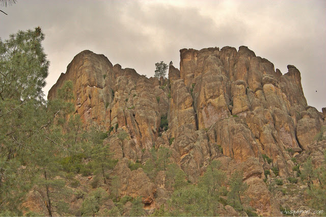
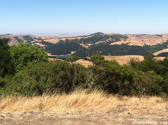
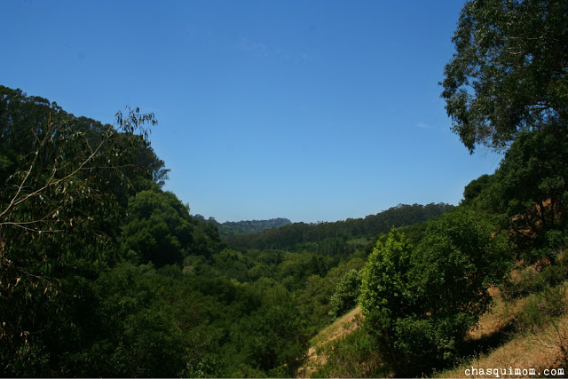
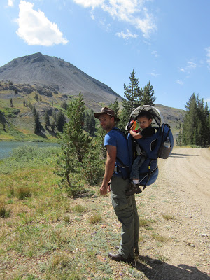
Well there it is, Peak Mountain at Rancho Corral de Tierra, part of the Golden Gate National Recreation Area (National Park Service) in my San Francisco Bay Area backyard, a National Park that I did not know about and I bet a lot of Bay Area residents don't know about it too.  A few months ago we were driving down Highway 1 from San Francisco and I saw trails above Montara (south of Pacifica)and told my husband, "I want to hike there!".  I pulled out my phone to find out what park that was but it didn't show the "green area" which designates a park other than McNee Ranch State Park, which was next to the area I wanted to hike in.  I thought it must be private property and forgot about it.

Labor Day Weekend was coming up and my husband had seen an article on an addition to the Golden Gate National Recreation Area, Rancho Corral de Tierra only to find out it was where I was wanted to hike a few months earlier.  I started researching for hiking trails, seen if anyone else had written a post or been up there with toddlers but I couldn't find anything in the particular section we wanted to hike.  Only a very rough "trail map" by the National Park Service with a warning about steep, eroded trails.

"Rancho Corral de Tierra", Map., July 2013., National Park Service. Web. 12 Sep. 2013.
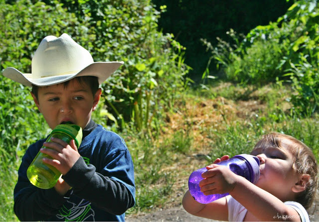
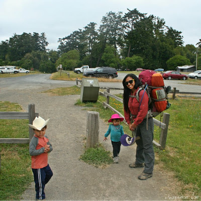
If you haven't noticed by now, we like adventure and when we figured out that this was a "rarely visited", underdeveloped park we were immediately intrigued.  Before I even start writing about our hike, I would like to state that we knew this was NOT a kid-friendly hike and I would not encourage beginner family hikers to hike this mountain.  With that said I know our abilities, my husband and I are strong hikers/backpackers (for years) as well as my children's limitations. We felt that we were capable of doing this hike with our children.

Rancho Corral de Tierra Farallon Trailhead
Finding the trailhead was a little difficult, I kind of eyeballed it and we decided to meet up with our friends, Eliu, Lorena and Esdras at Montara State Beach.  Then we drove a few blocks across Highway 1 to 2nd Street and Farallon/Kanoff Street.  Low and behold we found the trailhead and the end of Kanoff Street.


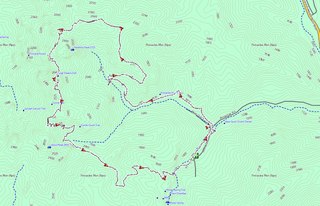
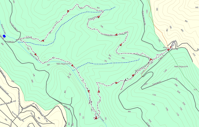
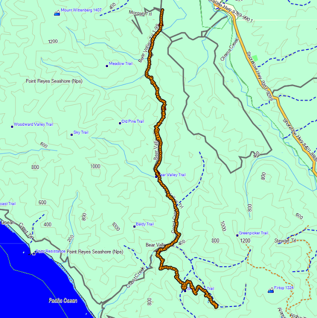
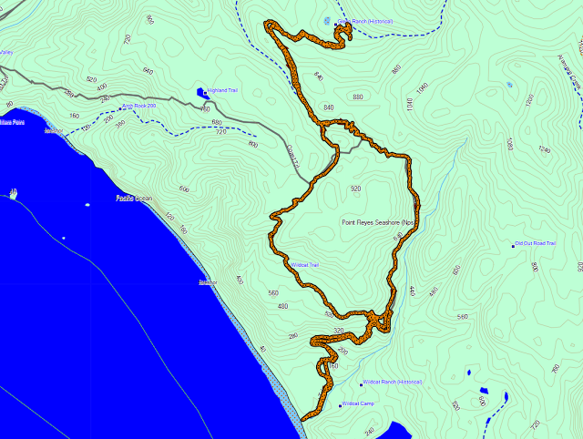
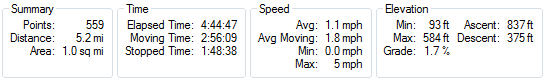
I normally don't put our GPS information at the beginning of a post but it is needed as a point of reference as you read about our this hike.  The Farallon Trailhead is where the black arrow is located. 


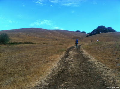
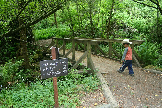
We started our hike (red line) heading northeast from the trailhead towards McNee Ranch State Park, on Farallon Trail. That is the last trail name that will be written because there were no more named trails in this park! If we continued on Farallon Trail it would have taken us to McNee Ranch State Park.  

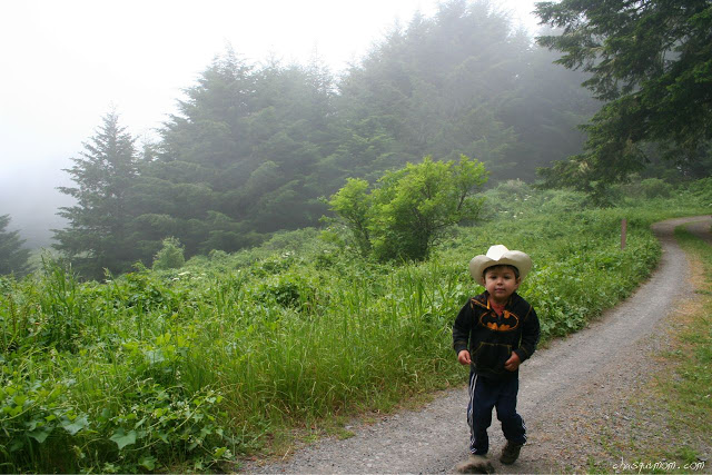
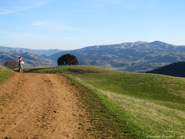
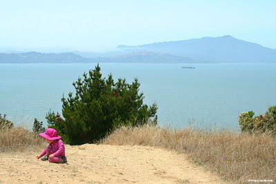
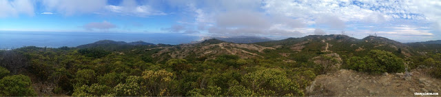
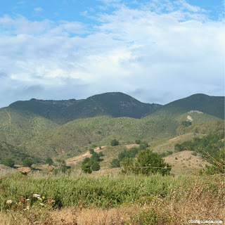
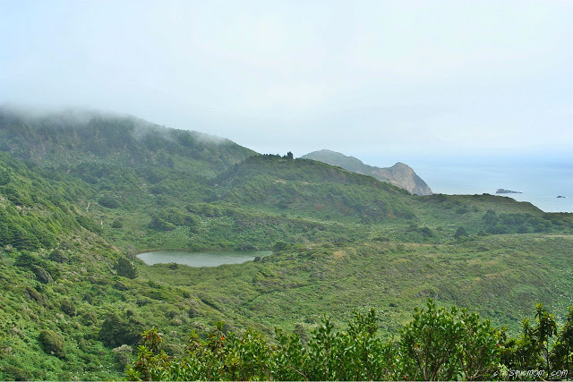
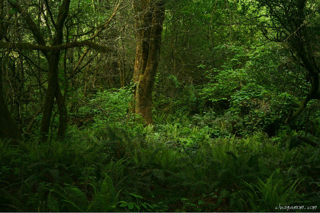
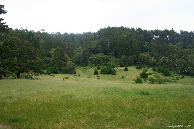
Peak Mountain shrouded in Fog
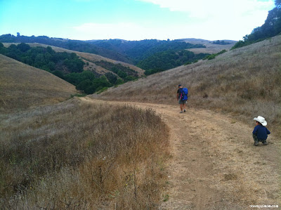
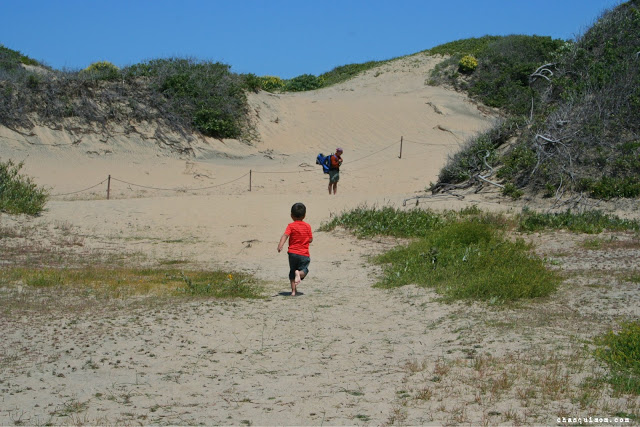
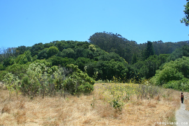
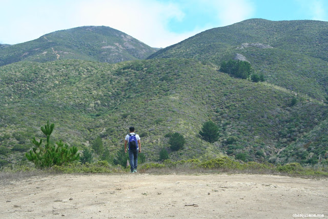
The beginning portion of the trail was dried up grass fields and low lying coastal plants. 90% of the trail was uphill until we reached Peak Mountain.  I guess I knew that it was going to be all up hill but the fog had rolled in so we couldn't see HOW much of the trail was uphill.  We made it to the top of our first hill and took a break to figure out where in the world to go next.

Not even THE steep hill!

Siri, Where are we?
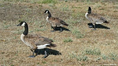
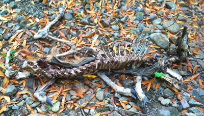
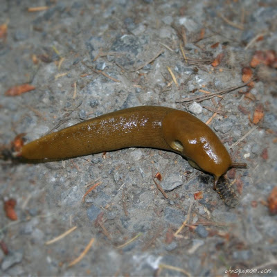
With no trail markers, we weren't lost but we really didn't know where to go next, my husband pulled his GPS, I inspected my phone and we still couldn't figure out with certainty where to go so we made and educated guess and headed east down the hill. But before we left the top of our first hill we saw our first and only wildlife during the trip.  I believe it was a Garter Snake, the specifics I would not know but if you can identify this snake please leave me a comment!
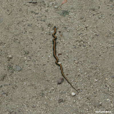
Garter Snake?
In the picture below, the trail is visible but at the time we didn't know where we were going. The trail eventually started on the right middle side of the picture, followed the ridge to the pine trees, followed the ridge and to the left you can see a faint trail going in between some power lines to Peak Mountain on the left side of the picture.

Looking for the trail.
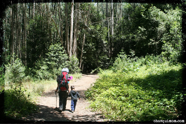
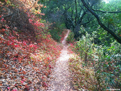
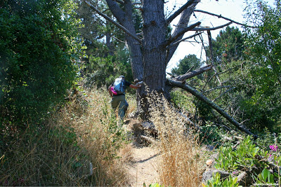
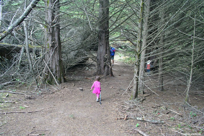
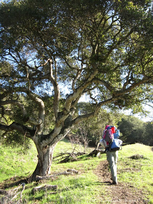
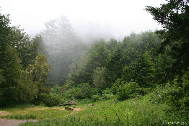
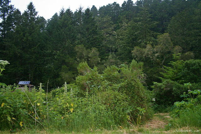
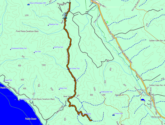
But before we actually reached the first ridge, we came down this hill and walked into a forest of pine trees that reminded me of scenery at Point Reyes National Seashore.  We found an illegal "campground" or a dump site...a fire ring with broken mattresses, recliners, tires, trash, remnants of illegal fireworks and last but not least condoms hanging in the trees....thanks people who probably don't love the environment.


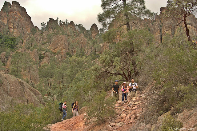
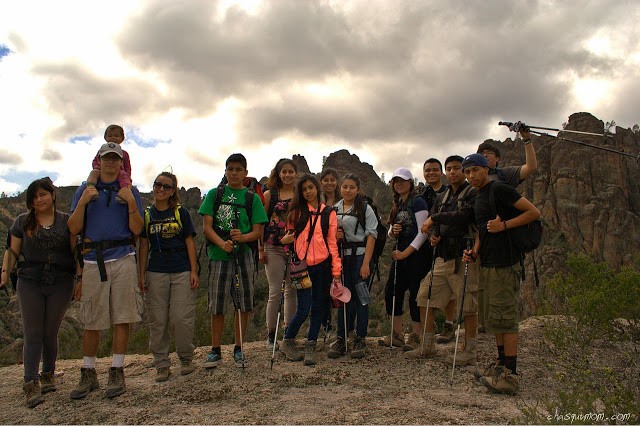
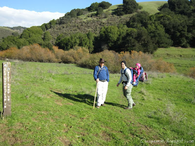
From Left to Right: Esdras, Lorena and Eliu

All of our hiking buddies were our musician friends from church.  From the right we have Eliu who plays and makes guitars, Lorena (who has hiked with me before at Tilden Regional Park) is a great singer, and Esdras (on the left, who plays almost every instrument) is a piano player and our worship leader.  We had Mexicans, Salvadoreans, Peruvians and my husband who is an "Honorary Latino" (he's Caucasian) hiking and exploring at an unknown National Park, Fantastic!
Lorena, where's the trail?
We followed what we thought was a trail but ended up turned around in some tall grass bushes and decided to turn back to where the had trail split off.  If you look at the map above, we turned back in the middle of the trail (red line) where there is a tiny loop and headed south through the forest.  I pulled out my phone again to check out Google Earth, to see if we could find our way to the "actual" Rancho Corral de Tierra.  I don't know if at this point we were on private or county land but we continued on through the pine forest.  My husband was the first to emerge from the forest and he started laughing and says, "Come and look at this!" and this is what we saw....


Up we went....


Sliding....


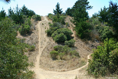
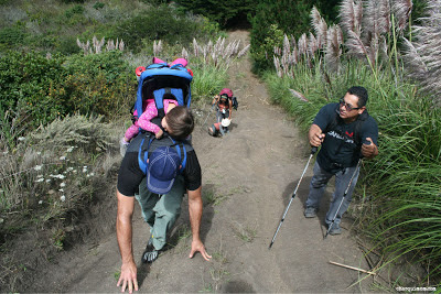
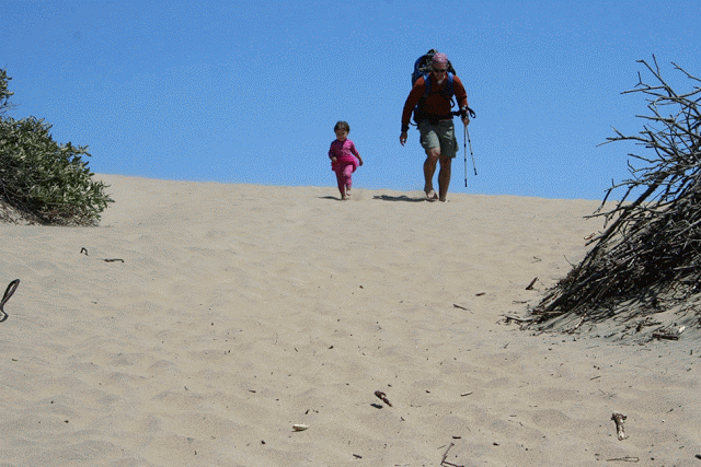
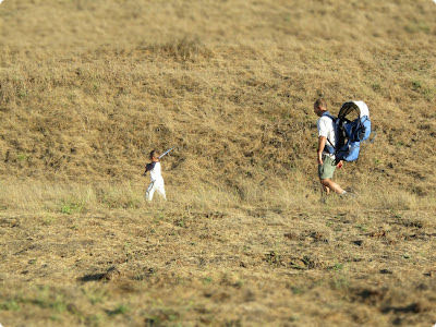
This was the steepest trail we've ever done with our children, I've never had to actually use my hiking poles to jam into the ground so I could pull myself up mountain.  I did that quite often on this hike!  My son was having a blast, crawling on all fours at some points saying, "Mommy, I'm rock climbing!", not really buddy but ok!  The circled area is this steep section, a 50% grade (pictured below).


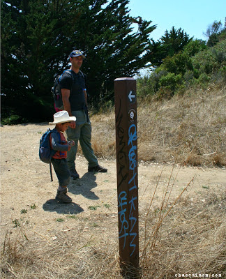
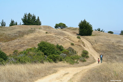
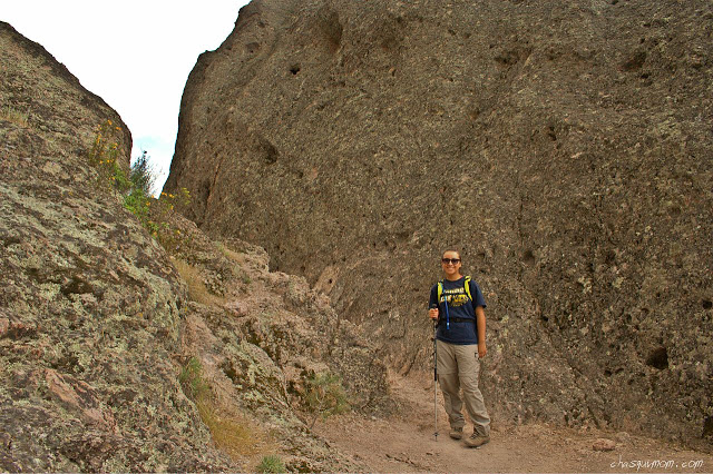
We all survived the steep section and relieved to find a flat trail/fire road at the top, still not knowing if we were going the correct way (trespassing signs were around us) we headed north on the trail and we were finally happy to see that our efforts had paid off and we had found the elusive Rancho Corral de Tierra!!!


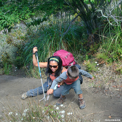
It took us a little while to find the actual entrance with possible trespassing, but we were determined to find it and we did.  I felt like I could finally relax and enjoy the steep hike!  The hike went along the ridge line along the tall grassy bushes, by the pine trees, and followed the ridge.  During sections of the hike Lorena and Esdras would race up the trail and I'd though to myself, "Is that how much energy I had when we didn't have kids?" Hah! I told them they would pay for it later with being sore...

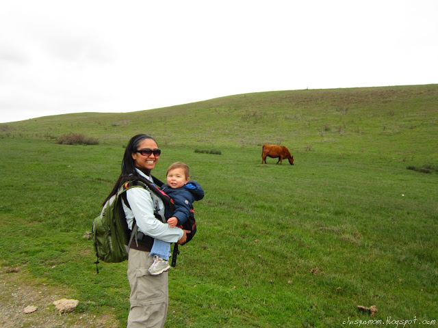
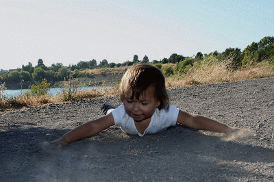
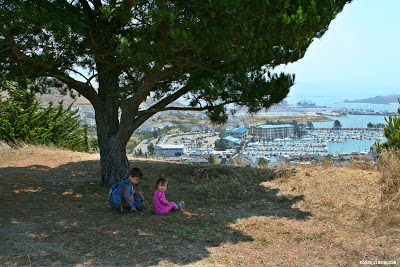
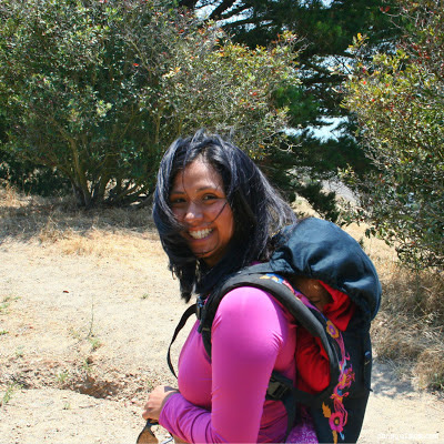
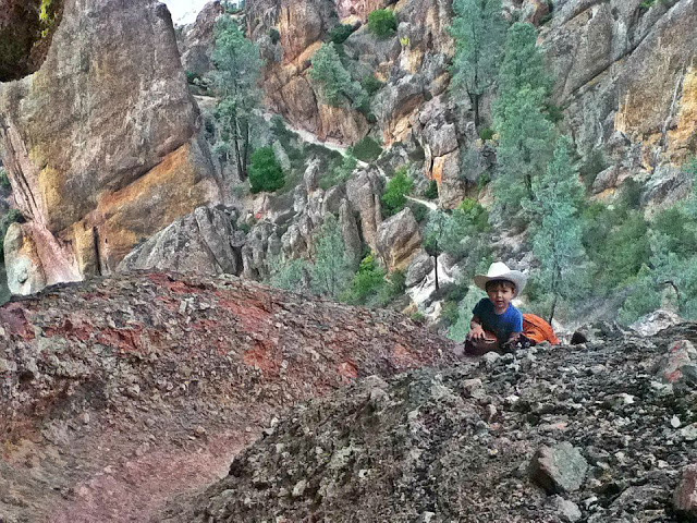
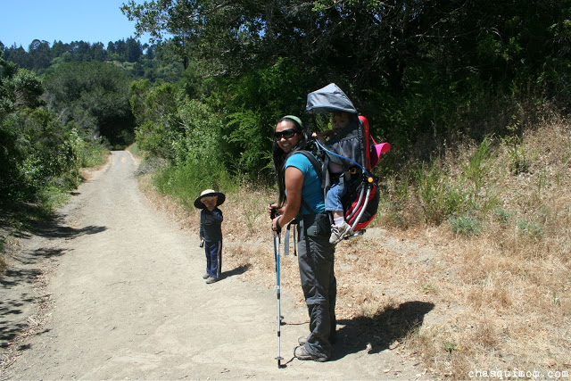
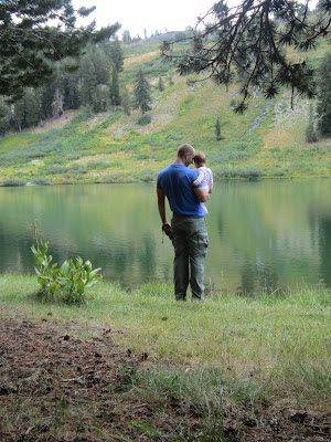
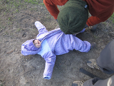
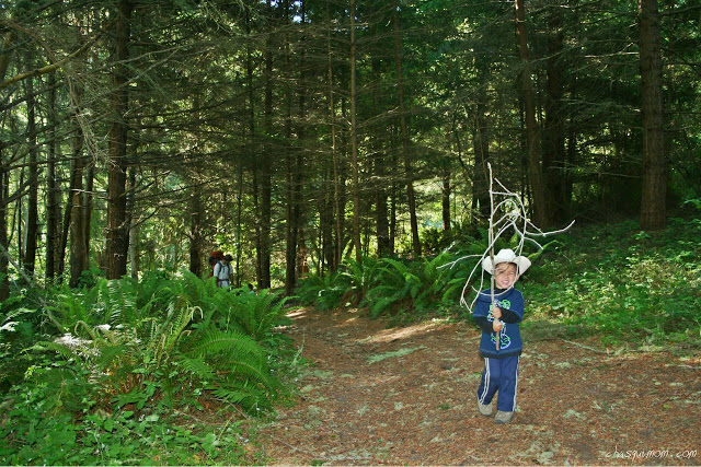
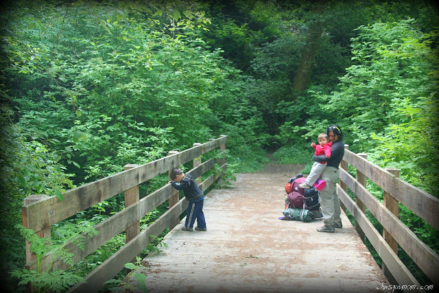
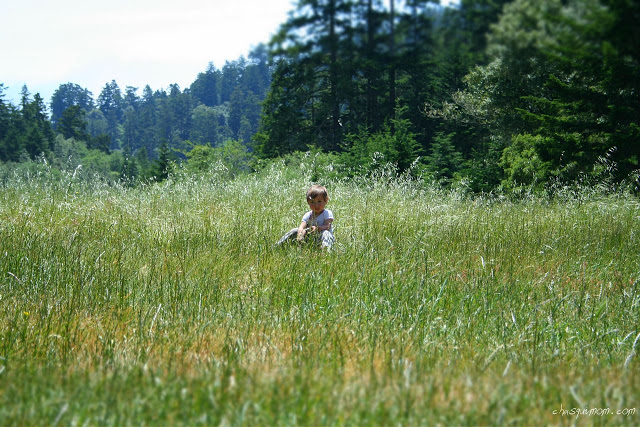
My daughter was being carried most of the time since the trail was too steep for her but steep trails seem to energize my son, until he actually gets tired from hiking straight up a mountain.  We still didn't know where we were going exactly but at some point I turned to my husband and said, "I think we are going up that mountain between the power lines...".  My husband said, "I think we are too..."

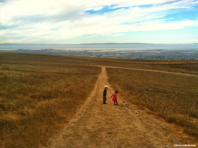
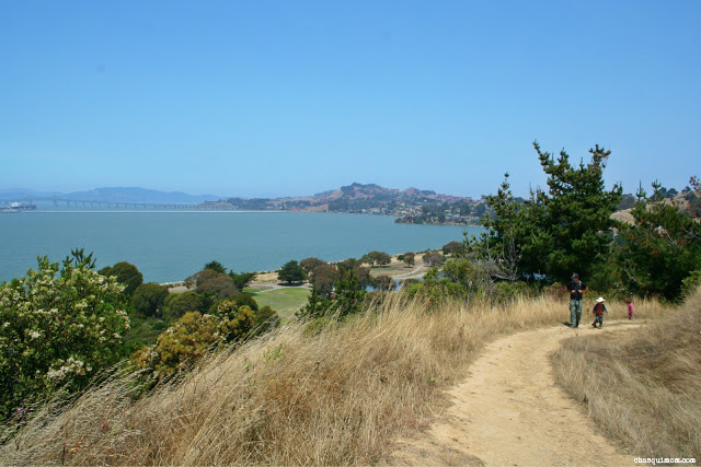
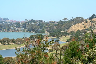
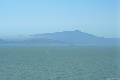
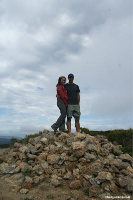
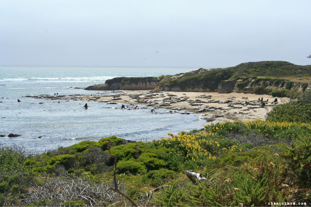
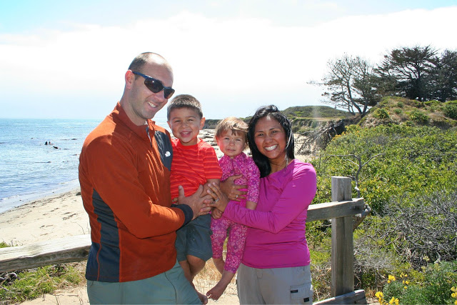
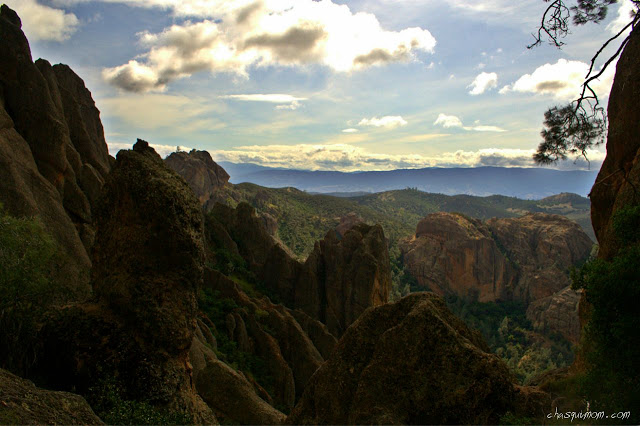
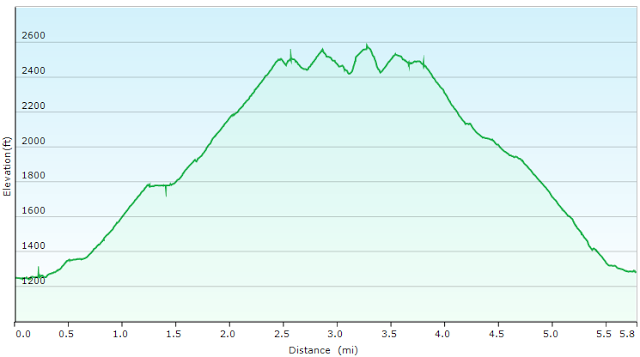
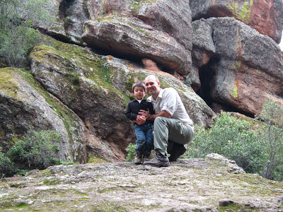
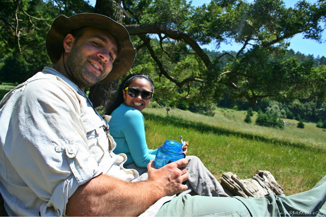
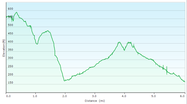
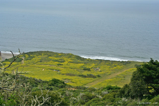
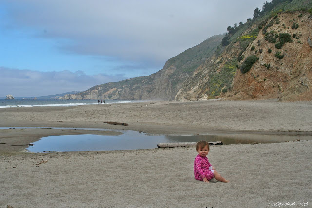
It took us four hours reach the top of Peak Mountain at 1,825 ft from sea level.  The last half mile, my husband had to come back from the peak because my son was too "tired".  When we reached the peak, my son ran around like a wild mountain child...he wasn't tired and hike most of the way down the mountain.  We had amazing views of the Bay Area, from Point Reyes National Seashore, Golden Gate Bridge, Mount Tamalpais, Mount Diablo, Mission Peak, Half Moon Bay and of course the Pacific Ocean. (View pictured at the beginning of the post).
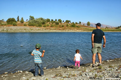
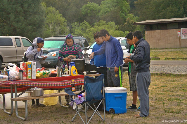
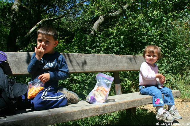
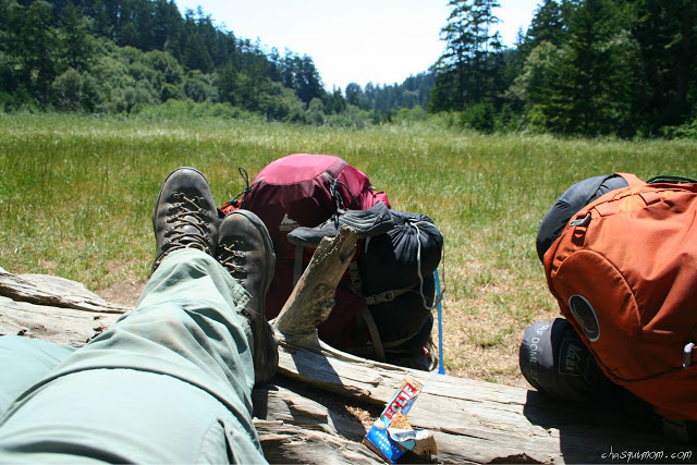
We had a Curry Chicken Wrap (without Curry) or as my husband dubbed them on this trip, "Mountain Tacos", Trader Joe's Salami, Cheese and Banana Chips for lunch and took our glamour shots on Peak Mountain!

Photo Courtesy of Lorena Armas


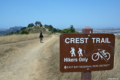
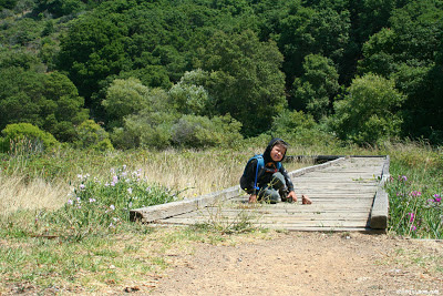
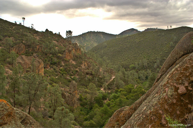
We could see the other peaks and the actual trails from McNee Ranch State Park that had many hikers on it.  We did not see any hikers on this side of the mountain until we were hiking back and saw a couple of hikers on their way up to Peak Mountain.  After lunch, we packed up and headed back down to sea level also known as sliding down the mountain. All of us at some point almost fell down or in may case slid down the trail on my rear end with a child strapped to my back, ouch!  There a no switch backs on this trail, 1,800 feet straight up a mountain.

None of us wanted to go down the extreme steep section near the fire road so we headed down the fire road which eventually dumped us in a residential neighborhood, so we "urban hiked it" to our cars through the streets.  We actually saw an alpaca farm, Alpacas By the Sea walking through the neighborhood which was nice to see!


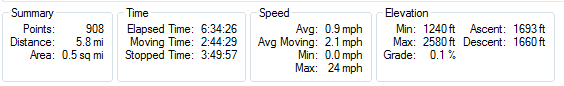
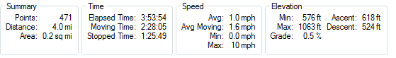
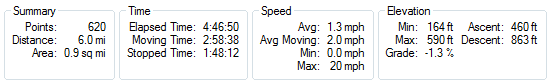
Our friends said if we had shown them the mountain we were going to hike in the beginning they would have been very intimidated and I told them if it wasn't for the fog covering the mountain I would have been intimidated too!! Seven hours, 6.3 miles maybe some bumps and bruises but we all made it to Peak Mountain in Rancho Corral de Tierra - Golden Gate National Recreation Area!  It was an adventure.

Related Posts and Links
  1. Rancho Corral de Tierra - Golden Gate National Recreation Area - National Park Service
  2. Rancho Corral de Tierra - Map by National Park Service
  3. Tilden Regional Park - 2013 Trails Challenge Completed
  4. The Ever Changing Point Reyes National Seashore
  5. Curry Chicken Wrap by Backpacker Magazine
  6. Montara State Beach - California State Park

The Excellent Año Nuevo State Park

I must say hiking at Año Nuevo State Park, has been my favorite hike so far this year!  Over Father's Day weekend, I wanted to take my husband to a spectacular hike, as part of his celebration of being a great dad and this was the perfect one.  The California Coast, island ruins, sand dunes, the Pacific Ocean, and did I mention the wonderful elephant seals?! This whole hike was four miles with spectacular views.  


This is very kid/toddler friendly hike with hardly any elevation change.  Portions of the trail are in the sand dunes, so we kicked off our hiking boots and experienced our first time barefoot hiking for a couple of miles, which was quite fun.

Getting There
If you are coming from the immediate SF Bay Area, you have two choices to get to Año Nuevo in Pescadero.  Highway 92 to Pacific Coast Highway 1 through San Mateo/Half Moon Bay or the Southern Route through Highway 17 to Santa Cruz to Pacific Coast Highway 1.  On this occasion we took the southern route and encountered lots of traffic but on the return trip we took the northern route with no traffic at all.

Guided Seal Walks and Wilderness Permit
From December 15 - March 31, hikers can only enter into the Wilderness Protection Area with a park guide (docent) and by reservation only.  For more information about making reservations and fees during this please visit Reserve America - Año Nuevo Public Walks and for more general information Año Nuevo's Broucher on Guided Walks.

Since we arrived in the "off-season" reservations were not required, there were no extra California State Park fees other than regular park fees (approx. $10) and a docent was not required to hike.  We did have to check into the Visitor's Center (Marine Education Center) to acquire our Wilderness Permit, which was free.  We didn't have a chance to fully check out the Visitor Center but it did have an impressive interactive information area.

I tried not to get my hopes up about seeing elephant seals just in case they were not there but when we arrived the park rangers informed us that were lots of elephant seals out at North Point.  I finally told our toddlers that we were going to see the elephant seals and boy were they excited, as well as I!  Even a month and a half later my kids are talking about seeing the elephant seals.

Beginning of the trek, views of Año Nuevo Island Ruins 
The Trail
We took the Año Nuevo Point Trail all the way to North Point Trail, approximately two miles (one way), four miles round trip.  The hike from the Visitors Center to the Staging Area (which is the at the border of the Wilderness Protection Area), is a little under one mile, partially paved and hard packed dirt trail.  There is a pond near Cove Beach but it could hardly been seen through the tall plants.  My toddlers usually love being near water sources but since they could not see the pond we just skipped hanging out there.

Tall grass...

Entrance to the protected area
Our little adventure began after we entered the protected area!  Not only did we have better views of the ruins on Año Nuevo Island but the trail opened up and there were lots of low bridges on the trail, which is always a great hiking motivation for my kids.  Soon after we entered the protected area there were also large sand dunes and lots of them!


I will let the following speak for itself.....


As well as.....


If that's not fun then I don't know what is!  The only thing that got my kids hiking again is the fact that we still hadn't seen the elephant seals.  We could actually hear them near by as well and see them from the island.  The sand dunes started near South Point trail head but we continued on and headed towards North Point.  As you can see above we kicked off our boots and started our first time barefoot hiking and I don't know about you but I love the feel walking in sand!


The trail after the sand dunes near South Point was a mixture of sand, grass and twigs but there were portions of it near Bight Beach and North Point that were all sand, so we continued hiking barefoot.  With each step we could hear the Elephant Seals barking louder and louder and we eventually saw them at a vista point near North Point.  Of course we wanted to get as close as we could safely get so we continued onto North Point and encountered more sand dunes for my children to roll in!

North Point view from trail
After hearing the elephant seals barking for a while now, we finally made it to North Point!  My kids were so ecstatic to see them...the elephant seals were swimming, sleeping, barking and even fighting.  Even though it was not required to hike out with a docent at this time of year, the docents were still on the trails talking to hikers.  The docent explained to us that the elephant seals were all young males with a few babies still lurking around and even let us touch a piece of their molten fur.  He explained the larger males come back in a few months, so the ones we saw were "teenager" elephant seals.


I could have stayed there all day watching the elephant seals but we had to get out of the protected area by 5 p.m. At our 1 mph hiking rate, we didn't want to risk it so we stayed at North Point for half an hour and started back through all the sand dunes.  I truly never seen my kids so happy on a hike, so I will be adding sand dunes to "kid-friendly" hikes.  Our return trip was the same except we decided to take the Upper Pond Trail near the pond which was quite nicely covered with wildflowers and even some wild strawberries.


I truly loved this hike and it reminded me of how great California is! When we want mountains we head to the east for a couple of hours, if we want spectacular view of the Bay Area we just head up on our local East Bay hills and if we want to see the beautiful Pacific Ocean and California coast we head out west for an hour and find this great California State Park!


So here's to this happy California family enjoying one of its great State Parks, Año Nuevo State Park in Pescadero!


High Peaks at Pinnacles National Park

This is a continuation post of our Youth Group camping and hiking trip from April 2013 at Pinnacles National Park with eleven teenagers, four adults and our two toddlers.

Day 3, Saturday, April 6, 2013:

Bright and early, my husband was already up with the boy breakfast crew.  Apparently the girls pranked the boys by stealing their shoes overnight so the boys decided to retaliated while the girls slept in.  They also made breakfast at the same time.  The girls shoes were missing when they arose from their beauty sleep and let's just say teenage girls are not as forgiving as teenage boys.

What is it with boys/men cooking while camping?
After everyone had been fed, we packed up our lunches we started our enormous task of packing everything up. Some of our youth had never been camping or don't have any experience in properly packing and cleaning up a campsite.  It seemed like an eternity but we eventually got all the camping equipment back in the three vehicles.  There wasn't an obvious competition but the Boy Scouts group (our camp neighbors) were so efficient and fast, they made us look really slow. I explained to our group these Boys Scouts had been doing for years so they wouldn't be discouraged.  We also shadowed them during a good portion of our hike but they were doing their "30 miles in a day" hike and had done few miles in the morning before we even left camp.


Our First View of the High Peaks
Saturday was definitely more crowded that the previous day at Pinnacles! The park had shuttles running between the Visitor Center to the Bear Gulch Day Use Area. Our drivers dropped off our group and took the vehicles back to the Visitor Center and took the shuttle back to the Day Use Area.  I remained with the remainder of the group and had lunch while we waited for the drivers to return.

We finally started hiking and I was in front of the group with our youth student-leader Dixie.  My husband graciously took our son and daughter and hiked in the back of our hiking group. The condors were out and we could see them taking off from their nests. They look like little black specks in the picture above but those were condors.  I absolutely loved seeing so many condors because on our previous trip to Pinnacles we did not see a single condor.


There are a few switch backs on Condor Gulch but not anything difficult.  I was really amazed at the teenagers energy and enthusiasm, especially since most of these teenagers never go hiking.  It was one of our student's first time hiking ever and she was at the front of the line being very enthusiastic, motivating everyone to keep hiking.  At one point she said, "Come on guys! If we run that last two miles we will be done in 15 minutes!".  I thought to myself, maybe we got a future trail runner on our hands....

Overlook view of Condor Gulch Trail
Overlook view towards High Peaks
We took a longer break at the overlook and had a little hiking/backpacking survey.  The views were amazing as you can see from the pictures above.  If you look closely on the left side of the High Peaks the white marks (poop) on the rocks, was where the condors nests were located.  We saw many condors take flight from there homes and soar right above our heads down in the the valley, it was truly amazing!

We continued up Condor Gulch Trail which was a total of 1.7 miles until we reached High Peaks Trail.  During the remainder of the hike my daughter hiked with or at least near me being carried by one of the teenagers.  Of course having my daughter with me slowed me down, so my husband went to the front of the group with our son.  I spent the remainder of the hike at the back of the group but it gave me a chance to get to know that group of teenagers better.  Our normal youth group size at our church events are between 15-20 students so it's hard to get to know everyone.  Hiking and camping as a group gives us, the youth leaders, a chance to build a better relationship with our students.

Esperanza Viva Youth Group and Leaders
Some of the youth were very tired at the halfway point and I'm not going to lie, I was too.  There is a big difference when I am camping and hiking with my own family versus taking a group of other people's teenagers in addition to my family.  There is more planning, stress, constant teaching and motivation and I feel like I'm complaining but I'm not! It is so great to see our students grow, view the world in different ways and seeing them be open to the idea that the world does not revolve around them!  During a difficult part of the hike, one of our students asked if we brought them there to punish them! A little later he asked if we had brought him there to show him how insignificant he was! He asked the latter question after seeing the Balconies and the giant rock formations at the top of High Peaks.

Balconies View from High Peaks Trail

Dixie kicking butt on the trail!
Vanessa getting ready to climb up to the Peaks!
This is my California....
We had to teach a lot of our teenagers correct and safe hiking etiquette like not throwing trash on the ground, letting faster hikers pass by and in particular (my little brother) to not hike on the edge of a cliff trail.  Sadly my camera died soon after the picture above so I hardly  have any pictures from the actual High Peaks.

Photo Courtesy of Noe Garay
High Peaks was an adventure! Many of our teenagers said the felt like they were Indian Jones after we climbed up on the peaks and crawled on the very edge of a giant volcanic rock.  I am very glad that I was not with my husband when we went through the "treacherous" portion of the trail because my son told my husband that he was going to jump into the canyon so daddy could go rescue him with a Pogo stick like "Diego" and then tried to run towards the ledge.  I think I would have gone completely gray if I would have seen that.....

The one amazing thing I will remember for the rest of my life happened right after we finished getting through the difficult part of the peaks.  I was standing there with Dixie, Alexis and Manuel and a condor flew right by our heads, literally 10 feet from us.  None of us had our cameras but I'm pretty sure it's better in our memories then any picture that we would have taken.  Now I that have seen California Condors up close and personal, I have to see the Peruvian Condors as well.

We took another break with two miles left and everyone was exhausted.  Some of the youth didn't understand the concept that food and water is energy for their bodies, and that's when we realized some of had not been drinking or snacking like we had been telling them too.  That's when my mothering skills kicked and I knew it was time for "scare tactics" to make them understand the dangers of dehydration and made them understand that food is energy.  As well as letting them know if we didn't finish before 6 p.m. we would have to hike an extra mile back to the Visitor Center.  Then everyone quickly hiked down to the Bear Gulch parking and we made it to the parking lot before 6 p.m.


TRAIL REPORT


Apparently hiking with a group of teenagers is as slow as hiking with toddlers, approx. 1 mph.


Elevation Change was approx. 1300 feet, highest elevation 2,500 feet but it felt much higher since we were right on the edge of a rock.


Condor Gulch - High Peaks - Bear Gulch Trail

Overall, it was a great first youth camping trip and will definitely be doing more in the future.  With each trip we learn more and more about our youth and how to lead a camping group better as well introducing our church youth to the great creation that God made to enjoy.

Related Posts:


Tilden Regional Park - 2013 Trails Challenge Completed!

This is my second year participating in the Trails Challenge by the East Bay Regional Parks District.  Last year I did not complete the 2012 Trails Challenge because of impeding travel and sickness, so this year I'm making sure not only to complete the minimum five trails required but I'm going for the Marathon Challenge, completing 26.2 miles of listed trails by the EBRPD, of course with my toddlers in tow.

Last week, I was able to enjoy a beautiful weekday hike with my children and my two friends, Lorena and Lucy at Tilden Regional Park, Berkeley, CA.  If I hike during the week, I pick easy flat short trails because I'm usually alone with my children but since I was going to two other adults I thought this hike would be more adventurous.

This hike started at Inspiration Point, which looked over the golden East Bay hills.

Inspiration Point, Tilden Regional Park


I thought there would be a giant sign screaming "Inspiration Point", but there was a small information board which I couldn't read because my kids were trying to run into the parking lot so I asked a someone if we were at Inspiration Point and he said, "Of course! That's why you're inspired!" and smiled.  He probably saw my frantic attempts to stop my kids from running in to the parking lot...


We located the information kiosks and retrieved our park maps and headed to the trail-head which started on Nimitz Way.  Within two minutes of our hike, my son started crying for his flashlight which was in the car.  Thankfully, Lorena and Lucy watched the kids while I ran back to the car to get David's precious flashlight.  During my little jaunt back to the car I had my "revelation" of the Toddler Hiking Cycle, check it out when you have a chance.

We really didn't hike on Nimitz Way, since it's a paved bike trail but we had to go through it to reach Curran Trail where our hike actually began.  It was a quick descent on Curran Trail for 0.13 miles before we took a quick right on Meadow Canyon Trail for 1.43 miles.  I didn't know that the intersection of the Four "Famous" Trails was actually at the Curran/Meadow Canyon Trail intersection, but we will get there soon enough.

Meadows Canyon Trail

Meadow Canyon Trail was mostly exposed slight downhill trail, with patches of shaded areas.  It was the perfect down hill trail that helped my toddlers hike most of the way.  I was considering bringing my double jogging stroller but I was not sure the trail would be wide enough or the terrain would be to rough for a stroller.  I brought my Deuter Kid Carrier 1 to carry my 21 month daughter and hoped my three year old son would hike most of the way.  I don't like hiking with our stroller but take it when I'm by myself with the kids.

Meadows Canyon Trail - My son is wearing my hat....
My son was still feeling a little run down from a cold and was complaining a little bit to be carried.  Lucy was kind enough to give my son a piggy back ride to the halfway point which was only 10 minutes away.  I know my son had it in him to keep walking but he was already on the "edge" after the earlier "almost" meltdown.  Once we reached the halfway point at the intersection of Meadows Canyon and Wildcat Gorge Trail a.k.a Lone Oak Picnic Area, we all had snacks and took a break.  There was a water fountain, toilet pit restrooms, picnic tables and benches at Lone Oak.

The kids ate Lorena's snacks!
There was even a water bowl for dogs at the water fountain, a very dog friendly park.  Throughout our entire hike, there were lots and lots of dogs.  Some were hiking their owners but the majority were dog packs with professional dog walkers.  My daughter was thrilled to see so many dogs at Tilden, this is a girl who played with street dogs in Mexico since she was nine months old, true story.  On the other hand, my son was NOT thrilled with the amount of dogs.  He's terrified of any dog that is not our two Shih Tzu's, even if they are tiny.  We had to pick my son up or block him from the dogs when we encountered them on the trail which also did not encourage him to hike.

My friends (who do not have children) got to experience a full on meltdown courtesy of my daughter when she did not want to leave the water fountain at Lone Oak.  My daughter threw her hissy fit and got over it within five minutes of being in the carrier.  While my daughter screamed, we started our hike on Wildcat Gorge Trail (0.78 miles) and we were quickly in a little field with hundreds of blue dragonflies.  I had never seen so many before in my life and my daughter had forgotten about the water fountain and enjoyed the dragonflies as well.

Dragonfly Field!
Wildcat Gorge Trail followed a creek that is designated a resource protection area for Rainbow Trout and California Newts, sadly we did not see any.  Wildcat Gorge was a very beautiful "green" trail which reminded me of our backpacking trip to Point Reyes National Seashore. The slight ascent up Wildcat Gorge was mostly shaded and easy enough for my daughter and son, it also had railings to protect the creek from dogs and people.  My daughter eventually was out of my carrier and tried to climb over the railing to the creek but of course I never let her succeed.

The creek!
Creek from Lake Anza
We took another break at the intersection of Wildcat Gorge and Curran Trail.  My kids happily threw rocks and of course my son was eventually splashing in the water getting all wet.  We only had 0.75 miles left to hike on Curran Trail, so I didn't mind if he got a little wet.  We debated whether going on to Lake Anza but I didn't know if I could handle another meltdown at Lake Anza knowing that my daughter would have a meltdown leaving the creek.  We opted not to go (next time...) and headed up Curran Trail.  My daughter had a longer hissy fit this time but eventually calmed down and fell asleep.

This section of Curran Trail was very shaded with Eucalyptus trees that made cracking sounds all the time, so I was a little paranoid about the branches breaking off since I've been warned by EBRPD rangers before.  My son was Lucy's hiking partner most of the trip and I with my daughter and Lorena.  We had good conversations and Lorena told me that Tilden's landscape reminded her of her country's landscape, El Salvador. It made me happy and sad that I could show her a little bit of her "home" country here in the Bay Area.

Somewhere on Curran Trail
The nice thing about hiking with friends vs. hiking alone, is that I get to show up in the pictures!  My son was struggling by this point and he needed his mommy, so we switched hiking partners and my little boy hiked with me.  I will take it until the day he doesn't want to hang out with mommy.  All throughout the day there was poison oak along the trail but this section of Curran Trail had an absurd amount of poison oak, so I held my son's hand so he wouldn't jump in it!

Tilden "El Salvador" Regional Park
We arrived at the Four "Famous" Trails intersection again and this time I knew we were there.  This is where the American Discovery TrailBay Area Ridge TrailMokelumne Coast to Crest Trail and the East Bay Skyline National Trail intersect.  I spent a few moments explaining to Lorena about the trails and we were both excited to take pictures at the trail marker.  I was so excited I slipped and fell down with my daughter in my carrier! My daughter did not even wake up with my tumble but I did give Lorena a scare!

Four "Famous" Trails

Before the fall!

Lucy did me the favor again and gave my son a piggy back ride for the last 10 minutes back to the parking lot.  We did a few more photo shots of the view at Inspiration Point before we headed home.  I think I need approximately two more short hikes or one longer hike to reach the Marathoner Challenge but Tilden Regional Park was my 5th park on the Trail Challenge list so my challenge is complete!

TRAIL REPORT


The trail loop is listed at 3.1 miles, but as always with extra running around with the kids we made it a 4.0 mile hike, in almost 4 hours or average 1.0 mph.


Elevation change of about 500 ft over 4 miles.


Inspiration Point - Nimitz- Curran - Meadows Canyon - Wildcat Gorge - Curran Trail


Related Posts:


Outdoor Father Series: "Discovering the World" by Jesse Avery

In honor of Father's Day coming up on Sunday, June 16th, I will be featuring three outdoor father's favorite experiences with their children.  Last up! My husband, Jesse Avery enjoys the outdoors through hiking, backpacking, camping, cycling, traveling and almost anything you put in front of him.  Jesse is an electrical engineer in the San Francisco Bay Area during the day and a great outdoors man during his free time.

I hesitate to call our backpacking trip to Point Reyes National Seashore my favorite outdoor experience but there was just so much about that adventure that was exciting and meaningful, and hey, if it was my favorite it was my favorite.

Outdoors or indoors I love seeing my kids discovering something.  I remember my own joy as a kid when I learned how to fish, swim, and jump off of big rocks into big rivers.  I still remember the first time that I saw Yosemite Valley as an adult and the awe I felt.  Watching my two children see new things and learn different bugs, and plants, and sights and sounds and skills in the outdoors lets me experience that joy and awe all over again, and helps remind me what a magnificent world we live in. 

Malakawena Beach, Big Island, Hawaii

This is not related to the Point Reyes trip – but the first time I realized what a pleasure discovery is was when we took David to the Big Island.  He was nine months old; we went to the beach and took him into the ocean for the first time.


When he first got in the water he was nervous, and went stiff as a board when the water first hit his chest.  Then he got curious and splashed a little and got some in his mouth, he made a face, then smacked his lips and splashed again, fear very quickly giving way to joy, and so he spent most of the afternoon happily splashing around in the Pacific Ocean, swallowing who knows how much and giggling so much it hurt me to watch.  Jthat same dayust watching him experience the ocean for the first time reminded me just how great the ocean is.

Now back to Point Reyes and staying with the beach theme: David and Sophia love the beach and the sand and the ocean so much that when we went to the Wildcat Camp beach on the second day they would let nothing stop them from enjoying it.  The beach is such a great place and it is worth any price to play in the sand and the water that both kids got naked and played for more than an hour in conditions so cold that Melissa and I had to wear our sweaters and huddle together for warmth.  At one point David was sliding on his belly through the sand for warmth because putting on his clothes would mean play time is over and he wasn't ready for that.  That’s how much fun the beach is, as an adult I have evidently forgotten that fact.

Wildcat Camp Beach, Point Reyes National Seashore
On our way down to the beach that same day I remember we found a field of ferns and other dense, low green plants still covered in morning dew.   There were butterflies flying around, the air was pretty still and the sun was just starting to break through the fog, Sophia stopped her walk and went up to the ferns to just stand there and stare.  The whole scene was so beautiful and alien to her I thought she must be thinking  it was a fantasy landscape out of one of her Tinkerbell movies and I figured as she was standing there that she was imagining of herself as a little fairy princess.  Just another moment I understood just how beautiful and powerful some places can be for the imagination.


Being outdoors with nowhere to be and no one to see provides a little more time to letting David ‘help’ as well, also known as learning new skills.  David is in this phase, which I honestly hope he never grows out of, where he wants to do everything I’m doing.  If daddy is riding his bike then David has to ride his bike, if daddy is making pancakes then David has to be on a chair cracking eggs and stirring the batter, if daddy is kicking a soccer ball, then David needs to kick a soccer ball, you get the idea.  Anyway he saw that I was lighting a match to start the stove to make food and coffee, so he had to help.  So at first when he wanted to help I held his hand and showed him how to light the match and put it up to the stove to light the burner, then I just sat next to him and talked him through it.  He had some trouble getting enough speed on the match to make it light, but he figured it out, he burned his fingers a couple of times when he let the match burn down too far before he put it to the stove, but again he figured it out.  So after the first night whenever it was time to cook David lit the match and helped me light the burner. 

There are of course other aspects of camping where ‘helping’ doesn’t work quite so well.  When we first arrived at camp and were setting up our tents David wanted to help, specifically spiking down the tent…  For a little boy the joy of hitting things outweighs the joy of setting something up.  I use my boots as a hammer in the back-country when a hammer is necessary, David followed suit and hit the tent spikes, the tent, the table, the other tent, his dad, his little sister, and then the tent again.  At one point he barreled into the tent so hard that he caved half of it in and I thought a pole was going to snap and I’d be sleeping under the stars, but the tent survived.

Another reason I love being with the kids outside – I get to spend time with them.  Melissa was very tired on the final day, so she refused to carry Sophia and Sophia refused to walk, so I got to carry my daughter pretty much the whole five hours back to the car from camp.  I rarely get to spend time with her since if Melissa is within sight then dad is nothing by chopped liver…  Anyway we spent time looking at flowers, singing all of her favorite songs (Barney, Veggie Tales and the Bunny Song…), looking at banana slugs, greeting other hikers and then exploring Divide Meadow.  That was probably the most time I've spent that close to Sophia ever, and it wasn’t magical, or earth shattering, but it was very nice and in general hiking with them provides me that opportunity with both kids, which again is very nice.


All that said - it’s a lucky Saturday when I get to spend all day with my family and this adventure in Point Reyes let us spend three whole days together finding plants and bugs and critters and water and sand and all sorts of other fascinating bits of the outdoors.

At any rate – I think my favorite part of being outdoors with the kids is watching them experience new things and learn how to be just a little bit more self-sufficient – hiking 20 minutes more on their own, finding a cool bug on their own, building a tent, or a fire.  I look forward to spending as many years as possible hiking around California, the USA and maybe even the world with them.... - Jesse -

The Longest Five Miles at Point Reyes

Saturday, May 11, 2013

Our last day of backpacking at Point Reyes National Seashore was definitely a fun but tiring one, especially for me.  As you can see below, that's my daughter who slept in MY sleeping bag on MY sleeping pad.  She's a very outdoorsy toddler but she can be a little "princess" when she wants to be.  I also had to document this in the middle of the night.


My daughter has issues with sleeping (too many to list) but she has to sleep with me, not next to me but pretty much on top of me all night, it's rather tiring.  Long story short she was not comfortable because she did not have a sleeping pad so at some point in the middle of the night I gave up and let her sleep on my pad in my bag and I "slept" on the hard ground halfway out of her kid's sleeping bag.  I did not sleep well, I was cold and couldn't stay asleep, which set the tone for the rest of the day.  Thankfully I 'm a petite woman so I could almost fit into her sleeping bag.  Ah, what mothers do to make their kids sleep.


Stay hydrated when on the trail!!

The kids and Jesse woke up very refreshed but I did not.  My hips hurt from laying on the ground and I was cranky until I had coffee.  By the way, Starbucks Via Instant Coffee is wonderful, I don't think I could ever go backpacking without coffee or chocolate covered espresso beans.  Once I had my morning coffee and breakfast, I felt 100 times better and had energy to clean and pack up to start our five miles trek to the parking lot.  Five miles really did not seem like a long trek, but it sure felt like it.


We took the same trails that we took on our first day backpacking, but in reverse order: Glen Camp Loop Trail, Glen Trail, Bear Valley, Bear Valley.  It was a gentle down slope which really helped our kids hike a lot.  I am proud to say that my son hike the entire 5 miles to the parking lot! Partially because my husband and I were too tired to carry him but David has hiked 3-4 miles all by himself, we've seen him do it many times.  We had a constant steady flow of trail mix, dried fruit and most importantly chocolate for all of us, especially for the kids.  Jesse and I switched our "hiking buddies" quite often, but I hiked with my son most of the day.

I was really tired from not sleeping, which totally affected my hiking.  I was really slow and sluggish but I just masked it by hiking at my son's pace.  It allowed me to enjoy the beauty of Point Reyes once again.  We took lots and lots of breaks which also made us even slower and made my pack feel heavier and heavier.  As we hiked, all I could think about was what could I do to make my pack lighter but four people's worth of stuff in two people's backpack was just a lot, period.


One of our many breaks was the bridge that connects Glen Trail to Bear Valley Trail.  I held Sophia because she really wanted to go overboard into the river.  The parking lot was 3 miles from the intersection of Glen/Bear Valley Trail, so there were a lot of hikers (day and backpackers) and bikers.  One runner in particular stopped and congratulated us for backpacking with our kids.  She continued to tell us she knew how difficult it was because they had gone on a backpacking trip with their FOUR young children.  Goodness!! All I could think about was how heavy their packs must of been!  Some other hiker thanked me for bringing my kids outdoors.  It was very encouraging to hear nice comments from other people, since I needed to mentally push through my sluggishness and coaxed my son to continue hiking.


Jesse picked up Sophia and hiked as fast as he could to Divide Meadow.  David was tired and I was too tired to carry him so the both of us hiked extremely slow.  Jesse found our beautiful break spot at Divide Meadow, left his pack and came to "rescue" David and I.  The second David saw his daddy, he yelled "Daddy, I'm tired!!" and literally laid down on the trail and fell asleep for a minute!  Poor buddy was really exhausted.  We all made it back to our tree log bench and had our feast of Trader Joe's Salami, dried cranberries and Clif Bars to get some energy back in us.


Best thing about hiking is eating and taking breaks to enjoy the view!!

Western Fence Lizard

My love and Chasqui Mom, photo taken by my three year old!

Artistic photo by my three year old son!

My daughter in Divide Meadow.

After we recharged, we started on our last 1.5 miles or so to the parking lot.  It seemed like an eternity because the kids were completely done, Sophia wanted to "hike" a.k.a play in the dirt and David wanted to be carried and neither of us wanted to carry him.  Jesse was gracious enough to lighten my pack and carry some of my weight.  We started throwing every bribe we could to motivate David...McDonald's, candy, ice cream as long as he made it to the car.  We had about 0.25 miles left and David was really struggling so I ran to the car and dropped of my pack, and ran back to meet them on the trail.  David happily climbed on my back and we all made it back to the car together!

HIKING INFORMATION


Distance hiked was 6 miles but the extra mile was probably due to the walking around on the trails chasing the kids.  It is a 5 mile hike from Glen Camp to Bear Valley Trail parking lot.


Elevation change was very gradual, high point about 600 ft, low point 150 feet.


Glen Camp Loop Trail - Glen Camp Trail - Bear Valley Trail

Overall, it was a rough day but as always we make the best of it.  A few days later the kids were asking to go "sleep in the tent" again.  I love my family and I love being outdoors with them.  Point Reyes was the best place to have our first "Pilot" family backpacking trip.  Three days and 17.5 miles of hiking with my family was wonderful!

Related Posts

The "Go Outside and Play" Photo Contest Finalist!

UPDATE: On Monday, June 3rd my photo was the winning finalist! See HERE. Thank you all who voted! and support please support The Wilderness Society.

A picture from our recent family backpacking trip to Point Reyes National Seashore, has been selected as one of the three finalists for the "Go Outside and Play" Photo Contest by The Wilderness Society.  Let's just say I was really excited this morning!


Please vote for my picture by clicking "Like" on my picture on The Wilderness Society Facebook page by following the directions HERE.

Thank you! Happy Hiking!

The Ever Changing Point Reyes National Seashore

Friday, May 10, 2013:

We all woke up very hungry from our first day of backpacking and we quickly started making coffee and breakfast.  I brought Nido powdered milk for my toddlers but my super picky eater son wouldn't drink it and of course my daughter ate everything in sight.  I couldn't figure out what to have for breakfast so we had instant oatmeal and added some powdered milk to make it "fattier".  We also brought Mini-Wheat's Cereal for the kids in case they didn't want the oatmeal, but I eventually convinced my son to eat oatmeal.  Sometimes I think my son survives on air, but I knew if he didn't eat something he would have a miserable day.  Thankfully after a while, he had some food and became a happier little boy.

Foggy Morning at Glen Camp
It was a very foggy morning and none of the other campers had arrived yet so it was a very quiet morning other than my toddlers squealing. We "quickly" cleaned up and got our packs ready for our day's hike to Alamere Falls.  It was a 3 mile hike (Glen Camp Loop-Stewart Trail) to Wildcat Campground and then a 1.1 mile hike to Alamere Falls. That was our plan, an 8.2 mile round trip for the whole day with our much lighter packs so we could also hike faster.


David hiking on Glen Camp Trail
Glen Camp Loop Trail was fairly flat with a very low grade uphill climb to Glen Trail.  Glen Trail was also a fire road like Bear Valley Trail but it was very beautiful.  Park Rangers were out for their morning routes in their trucks and we saw one horse rider and then we did not see anyone until we reached Wildcat Camp.  We nicknamed a section of this trail, "Nana's Fairyland" because it seemed like a very magical place.

Can you find the spider?

We walked along a portion of the trail where there were hundreds and hundreds of plants (pictured above) that were covered with dew. My daughter walked up to the plants and happily poked the plants so the water trickled down to the ground.  We looked at my daughter and she had a grin from ear to ear and my husband said he could imagine her imagining fairies popping out from the plants.  It really looked like something out of a fairyland story book!  The landscape looked like it should belong in a magical land where fairies, elves and other creatures would be roaming around.  I could see my children's imagination in their faces and I loved it!

Foggy Stewart Trail
The landscape was always changing, one of my favorite things about Point Reyes! The first portion of Glen Trail was very covered woodsy trail which included "Nana's Fairyland".  Stewart Trail opened up to over looking a small wooded valley and then opened up to the view of Wildcat Campground and the Pacific Ocean.  It was very refreshing to see the ocean.  I love the ocean because it's so big, open and knowing that it is the end of the land until Asia.  I love the ocean.


We debated about camping here, but it would have been a longer hike into camp and I read that it could be extremely windy and wet.  Normally I wouldn't care if it was windy and wet but I wanted our first family backpacking experience to be an enjoyable one, so we picked the protected Glen Camp.  My daughter fell asleep at this point in my carrier and I was terribly hot because the fog cleared, it was an opened non-shaded trail and I couldn't take off my sweater.  I hiked as quickly as I could down to Wildcat Campground.


I also decided to use my front day pack (the top portion of my Gregory Deva 70) so I could comfortable carry one of my kids on my back, which worked out pretty well.  It was a somewhat steep trail down to Wildcat Campground but it was doable without my hiking poles.  When we made it to Wildcat Campground we took a little break and my daughter woke up.  My son, David had seen the ocean from the trail so he was already excited to go to the beach but it was still another 1.1 miles to Alamere Falls, up another hill.  We decided to take a longer break at the Wildcat Beach and then hike to Alamere Falls.  When my daughter saw the beach, her reaction was priceless! She literally screamed "THE BEACH!!!!!", put her hands on her face, screamed with joy and did a little dance.  That is the truth.


There was a little creek that flowed into the ocean which of course the kids were immediately drawn too. After about 15 minutes of being there +Jesse Avery and I realized we weren't going to make it to Alamere Falls.  The kids were never going to want to leave this place, they were having so much fun splashing in the water, rolling in the sand and throwing rocks.  We could actually see Alamere Falls from the beach and it looked like we could walk to it but we read that the tide can come in all the way to the cliffs and we didn't want to risk getting stranded out there.


Alamere Falls in the distance, so close yet so far away....

We had our Chicken Pita Lunch on the beach and tried to relax on the beach while the kids played on the beach.  The difference between hiking/backpacking before kids and after having kids is that you can never truly have a break! We tried to rest but one of the kids always needed us to clean sand out of their mouth or we had to observe that they didn't go too deep into the creek, etc.

My husband was really amazed that our kids were not cold because we were freezing, especially myself! I don't know what's been going on with my body lately but anytime I finish exercising I immediately get really cold and stay cold for a long time.  My kids on the other hand were dressed in what they were born in, splashing in the water!  My kids eventually got cold and we dressed them in dry clothes and they had a screaming tearful, almost tantrum goodbye from the beach.  There was no way we were going to make it to Alamere Falls....next time.

We rearranged our packs again and my son (who threw the borderline tantrum) was very tired and needed to take a nap.  I told him he could ride in my carrier and he happily went on my back.  Of course he took a nap on the hardest part of the uphill trail and my husband slowly walked with our daughter because she was determined to walk herself.  We were not in a rush so we took our time, not like I could run up the mountain with my three year old toddler on my back.  We took Stewart Trail (0.9 miles) to Coast Trail which I highly recommend.  It was a very beautiful trail with views of Wildcat Campground, the Pacific Ocean and Wildcat Lake which we had not seen.

Wildcat Lake from Coast Trail
Coast Trail was more "coast-like" trail, short stubby plants and drier than the earlier day's hike, it was windier as well.  Sophia was falling asleep on Jesse's shoulders and I was pretty exhausted from carrying David up Stewart Trail so we stopped in the only shaded portion of the trail for a break.  We tried laying the kids down on our jackets but they didn't survive the transfer and woke up, so Jesse and I laid down while the kids rolled around and had snacks.  Coast Trail had abundant amounts Poison Oak so we made sure that our break area was clear of it.  All I remember from our break was looking up at the sky and seeing the fog roll in and out, it truly reminded me of hiking in the cloud forests of Peru.


Coast Trail eventually became a single track trail and we only passed two hikers who admired us for backpacking with our kids.  One guy said "I saw you guys down at Wildcat and I thought wow!"  I really don't know why people think it's unimaginable to hike with kids, its certainly hard but we love spending outdoor time with our kids. They have taught us to see the smallest things on the trail that I would never stop to see like....

Ladybugs, Flowers, and Wild Strawberries!

 Thank you to my children to allow me to enjoy the little things in life!


Sophia, our Mountain Baby....


David, our Cowboy...

The kids were starting to reach their limit again and we had about a mile of so left picked the pace as well as the kids so we could make it back to camp before sunset and not have to cook in the dark again.  I was terribly paranoid that my son was going to jump in poison oak so I was glad he was riding on "daddy's shoulders".  A few pictures from Coast Trail.....

My friend called this, "Into the Wild".

Beautiful flowers were all along the trail
All in all we made it back to camp with lots of day light to spare so we could actually "relax" as much as parents can with two toddlers.  I was hoping to see some wildlife but we only got to see cute quails roaming around the trails.  We did see beautiful changing landscapes which is always nice to see.  We also had more campers when we returned to Glen Camp, a troop of Boy Scouts and their leaders.  My daughter and I were the only women there for a long time then I saw a few more women hikers arrive later in the evening to set up camp in the campsites behind us.

We had dinner, cleaned up, took a little tour of the whole campground and tried to find some sun to warm up.  My daughter had a late afternoon nap so she wasn't ready to go to sleep but my son was exhausted.  The problem with my son is that the more exhausted he get the harder it is for him to sleep.  He eventually fell asleep and about after an hour of rearranging our packs and cleaning, the rest of us went to sleep.  It was a good day.

HIKING INFORMATION


Hiked 6.3 miles, in 7 hours but half of the time we were not moving, lunch, breaks, etc.


Elevation: Lowest point - Sea Level 0 Feet, Highest Point 900 Feet


Glen Camp Loop Trail - Glen Trail - Stewart Trail - Coast Trail - Glen Trail - Glen Camp Loop


The Very Green Point Reyes National Seashore, Glen Camp

What can I say about Point Reyes National Seashore? Better yet, what can't I say about Point Reyes?!  This was the perfect place to have our first family backpacking trip.  Beautiful landscapes, campgrounds, weather and fairly easy trails.  It was truly a wonderful place to visit with my toddlers.

Somewhere on Bear Valley Trail
We decided to head out before the normal Friday-Sunday weekenders so we planned our trip to be Mother's Day Weekend Thursday-Saturday.  I had been preparing for weeks by organizing meals, calculation of diapers, gear and equipment needed, clothes and anything that would be essential to backpacking with toddlers.  Before I start off with our adventure story I'd like to list some general information:

Hikers: Two Adults and two toddlers
Backpack Weight: +Jesse Avery 56 lbs, Myself 49 lbs (Total 105 lbs)
Location: Glen Camp, Point Reyes
Day 1 Listed Mileage: 4.6 Miles (Bear Valley trailhead to Glen Camp)

Thursday, May 9, 2013

We started the morning by packing our backpacks to the rim, loaded the kids in the car and headed off good ol' IHOP!  We arrived to the Bear Valley Visitor Center at 2 p.m. and checked in to get our permit.  The visitor center entertained my children quite a bit with their life size animal replicas such as orca whales, elephant seals, sharks and a very interactive animal center.

Bear Valley Visitor Center
We parked our car at the very end of the parking lot and made our final preparations to our backpacks before we headed out on the trail.  As I mentioned in many previous posts that transitioning from the car to actually hiking is always chaotic, a crying toddler, someone having to go pee pee, forgetting something in the vehicle, realizing that we left something at home.  In this case, we realized we had forgotten my newly purchased hiking poles for this very trip!  We laughed it off, we were bound to forget something.


We started at the Bear Valley Trail which began at the end of the parking lot.  The majority of the hike to Glen Camp was on Bear Valley Trail which was primarily a fire road, 3.1 miles to be exact.  There were a multitude of horse riders on this portion of trail which led to both excitement and fear from my children and the fact that we had to dodge horse poop piles.  There were lots of runners as well, which my daughter liked to greet with a cute "Hi!" or "Looking mommy! Running!"


We stopped at every bridge so the kids could throw little pebbles.  We saw a multitude of "centipedes" crossing the trails but after a little bit of research the centipedes which actually almond-scented millipedes. Not as abundant as the millipedes, there were also many banana slugs out on the trail.  Here is one "destroying" a centipede or at least it looks like the banana slug is eating the millipede.  Nature is so fierce...


It was 1.6 miles to Divide Meadow, and it was a  very slight uphill to the Meadow.  My daughter was very energetic so she was hiking but my son hadn't nap on the car ride over, so it was time for him to ride on "daddy's shoulders".  +Jesse Avery and David made it to Divide Meadow before we did, but I could see from afar that my little boy was dead asleep on my husband shoulders.  Divide Meadow is a very beautiful meadow, very open with large trees in the background along with the coming and going fog.  There are tree benches, bathrooms, garbage cans and water source at this location.

We decided to have a little break here and rearrange our son or else Jesse's neck would be killing him later on.  My son weighs at least 35 lbs so Jesse put David in the ERGO carrier on his front-side and his 56 lbs backpack on his back, total weight of 91 lbs!!  My husband is a strong guy.

Sleeping on the trail....
Divide Meadow

Sophia took a little tumble at Divide Meadow, she's a much better hiker/walker than she was two months ago but the trail was slightly down hill and she was imitating the runners by running.  She caught some speed tripped on a rock and scraped her palm of her hand.  After a band-aid  hugs and maybe some chocolate the crying had disappeared into my happy hiking mountain baby again.

The landscape all along Bear Valley Trail was very dense, lots of shade except for Divide Meadow.  It was another 1.5 miles to Glen Trail from Divide Meadow which was fairly flat.  Many parts of the trail reminded me on hiking in the high jungles of the Andes Mountains in Peru, cold, mossy with lots of vines and ferns everywhere.

The Letter "R" Tree

Ferns galore!

At some point on Bear Valley Trail, Sophia got tired and had to ride on my shoulders but only for a short while because I was struggling to carry her along with my pack.  I just put her down and walked along at her pace.  The hike to Glen Camp was only five miles but we calculated with all our weight and our kids we would hike 1 mph, so five hours to get to Glen Camp.  It seems unimaginable to hike five miles in five hours but that is how slowly things go with toddlers.


David woke up just a little bit before we reached the beginning of Glen Trail which was only 0.6 miles to Glen Camp Loop Trail but Glen Trail was "steep" uphill.  Anything that wasn't flat felt steep with my 49 lbs backpack and my 25 lb toddler, minimum of 74 lbs on me which is more than 50% of my body weight.  Let's say I was very sweaty! I gave up and had to put Sophia down again but sunset was coming so Jesse picked Sophia for a little while.  Glen Trail was not a fire road but was still wide on portions of the trail and after the good "steep" portion the trail became a very slight uphill trail, so low grade my daughter was able to hike up the hill.


It was around 6:30 p.m. when we finally made it to Glen Loop Camp Trail and we only had 0.9 miles to go but it still seemed like it took a very long time.  Glen Loop Camp Trail was very beautiful, it was a single track trail with lush greenery all around.  We were reaching our children's limit by this point and we ran out of our daily ration of chocolate so we had nothing to bribed them to keep hiking other than dried cranberries!  When my daughter gets cranky she only wants to be held by me, so I left her behind with my husband and hiked as fast as I could to get to camp. There were easy  uphills and downhills but every uphill was very tiring by this point.  We eventually made it to camp with some daylight left.

Troops arriving at Glen Camp!
As you can see Glen Camp has pit toilet, a water source and solar panels which my husband assumed it was used to power the water filtration system.  The Point Reyes NPS website did state to bring our own water filtration in case the water was not drinkable, but thankfully the water was good to go!  We reserved Campsite No. 8 which was just up a slight hill (sigh) to the right.  We quickly set up camp, started making coffee and dinner.  I was going to include our meals into this post but I think I'm going to make a backpacking food post since I put in so much preparation to calculate the right amounts.

View of Campsite No. 8
Campsite No. 8 was probably the smallest campsite and most enclosed of all the campsites.  We barely fit our two two-person tents in our sites.  We were surrounded by bushes and trees which was ideal keep our kids noise in and other campers noises out.  There was only one other campsite being used and the rest of the camp was empty.

View of Glen Camp from Campsite No.8
Dinner was eaten, dishes washed, everyone cleaned up, changed clothes and we all headed to bed around 9:30 p.m.  Sleeping is always a shot in the dark with our kids but thankfully our kids slept better than they "normally" do our first night.  This was my first time using my REI Lite-Core 1.5 Sleeping Pad, which was very comfortable.  Unfortunately I kept on have weird/nightmare-ish dreams the first half of the night so I kept on waking up, but thankfully I eventually fell asleep and got a good stretch of peaceful sleep.

HIKING INFORMATION


Mileage Listed 4.6 Miles, but we actually hiked 5.2 miles.


Starting Elevation 100 ft, End Elevation 550 ft


Bear Valley Trail - Glen Trail - Glen Camp Loop Trail
Day 2 will be coming soon but until then I leave you with two of my favorite pictures!

Somewhere on Glen Trail

Hiking toddler at Glen Camp
Related Posts:

  1. Family Backpacking Gear List
  2. The Ever Changing Point Reyes National Seashore
  3. The Longest Five Miles at Point Reyes

Join in on the conversation by leaving a comment here! You can also join in on the conversations on Chasqui Mom's FacebookInstagram and Twitter that is updated daily with outdoor activities and other wonderful posts and links from #OutdoorFamilies!