
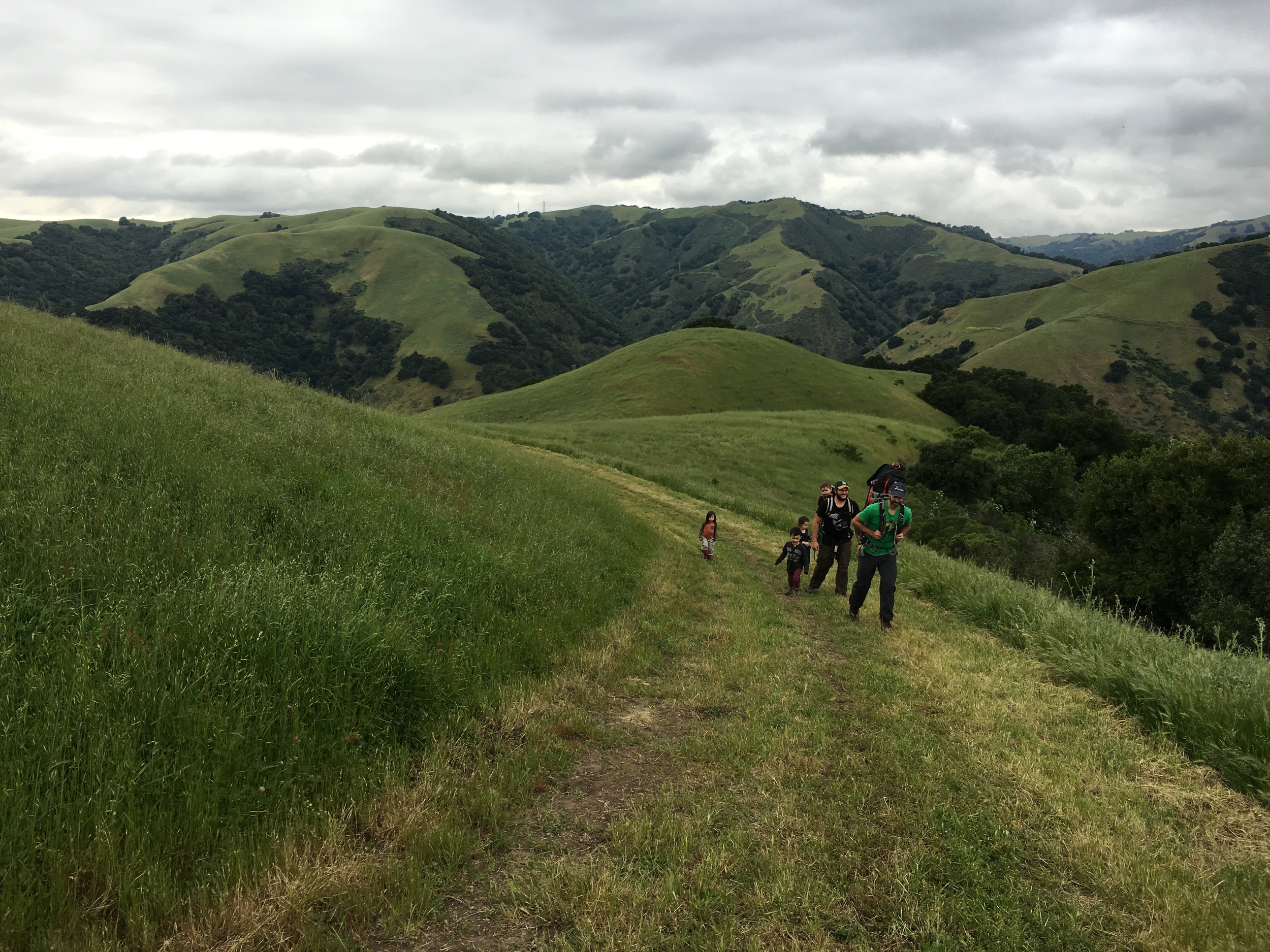
Fremont, Fremont, Fremont! As a longtime resident of Fremont, I was dying to get hiking in Vargas Plateau Regional Park, a new East Bay Regional Park District Park.

Chasqui Mom
Loving nature through hiking, backpacking & anything outdoors as a family
We truly had happy times at Black Diamond Mines Regional Preserve. Backpacking with children is ALWAYS an adventure, lots of fun and work! For our first backpacking trip of 2014, we chose a local overnight trip to Stewartville Backpack Camp at Black Diamond Mines in Antioch, CA.

This a family-friendly 3.2 mile hike-in camp in the East Bay hills. Trip Report will be coming soon! Until then enjoy my little video of our fun and successful backpacking adventure with our little ones!
Thank you for watching!!
Related Posts:
Snake Encounters on the Trail with Kids
Join in on the conversation by leaving a comment here! You can also join in on the conversations on Chasqui Mom's Facebook, Instagram and Twitter that is updated daily with outdoor activities and other wonderful posts and links from #OutdoorFamilies!
Point Reyes National Seashore is a National Park jewel in the San Francisco Bay Area. Point Reyes will always have a special place in my heart, because it was where we had our first family backpacking adventure. Not only is Point Reyes a great place for family backpacking, it also has many fantastic location for numerous day hikes.

Ever since my husband and I "discovered" Point Reyes we have always wanted to hike out to Tomales Point, but we just haven't found the opportunity to make it there. Even though Point Reyes is in the San Francisco Bay Area, it's still 2.5 hour drive to reach the trail head from the East Bay! It was definitely worth the drive, since we had an out-of-town guest coming to California for the first time. We wanted to show the beauty of the California coast, so off we went to Tomales Point.
Hiking the California Coast
When you think about hiking on the California coast, everyone thinks about warm sunshine, beautiful views of the Pacific ocean and cliffs. I would say that on all our coastal hiking outings: Año Nuevo SP, Rancho Corral de Tierra, Baker Beach, Pirates Cove and Backpacking Point Reyes have been for the most part, completely the opposite of sunny/warm and Tomales Point was no different!

Weather Conditions ~ The majority of the hike was foggy, it wasn't until 4 p.m. that the sun FINALLY broke through the fog. It was cold, misty, foggy and windy during most of the hike and then winds became stronger after the sun broke through the fog! I was almost knocked down a couple times near "Windy Gap" by the gusts! I normally bring multiple layers for myself and especially for the kids since they get cold sitting in the carriers.

Foggy trail near same location below

Fog-less Tomales Point
I usually do not like "Out and Back" trails because I want to see new scenery the entire hike but since it was foggy one way and sunny on the way out, it was like two completely different hikes! Everything looked different from the foggy morning hike. We were also able to see the tide roll into Tomales Bay, which none of us have ever seen before!

Bird Rock in the Pacific Ocean
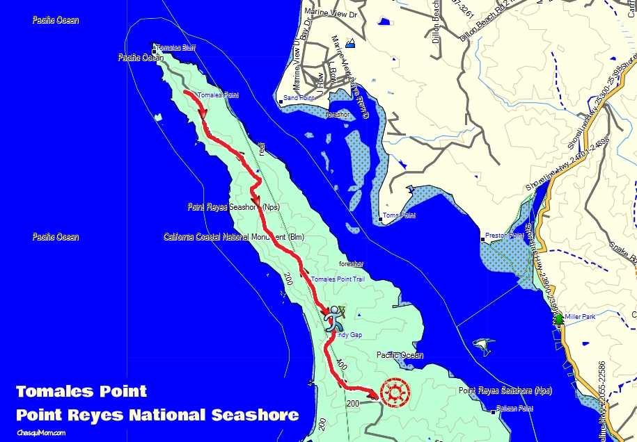
Trail Conditions ~ Tomales Point Trail is an out and back trail, 4.75 miles (one way) for a total 9.5 miles. We were aiming to hike to the bluffs but we were not committed since 9.5 miles is a really long hike with toddlers. We did not complete the entire trail, we opted out to not hike the last 0.5 miles to the bluffs (see trail report below). Everything I read about this hike said it was an easy "10 mile" hike but everything takes twice as long with kids. With that said, my toddlers LOVED this hike and the adults did too!
The trail itself was mostly single track with some wider trail sections. It was a combination of hiking on beach sand and compact dirt. A huge motivator to get my kids hiking and out of the carriers is SAND. There was a trail section where we were hiking uphill (with toddlers on our backs), in sand, "bushwhacking" our way through the tall wildflowers...I don't know about you but that was HARD. I made it about 20 ft and then my daughter yelled "Ooh sand!! I want to get out!!" and I happily let her out. My kids love to bring their shovels in case they find sand on hikes.
Getting There ~ Tomales Point Trail Head is at the end of Pierce Point Road a 40 minute drive from the Bear Valley Visitor Center, which I highly recommend visiting. Directions to Tomales Point Trailhead.
Abundant Wildlife
One of the main attractions of Tomales Point is the wildlife, in particular the Tule Elk. I was hoping to see a few Tule Elk but I was surprised that we hiked all day with the Tule Elk. Of course we always kept our distance since wildlife should never be disturb, but we took many moments to just stop and stare at these beautiful creatures.
National Park Service states that "In 2009, over 440 were counted at Tomales Point" and we definitely saw at least 50 elk during our hike.

Can you find the Elk scratching it's ear like a dog?
Seeing wildlife with kids is really amazing, so many teachable moments that I will need to write another post about it soon. My kids haven't really grasped the concept of specific type of animals, so when we told them those animals were "Tule Elk" they just gave us blank stares. When I told them they were kind of like deer they were a little confused because they didn't look like deer. It wasn't until we saw the bucks with antlers, that my toddlers were satisfied with telling me that we were hiking with "Reindeer".
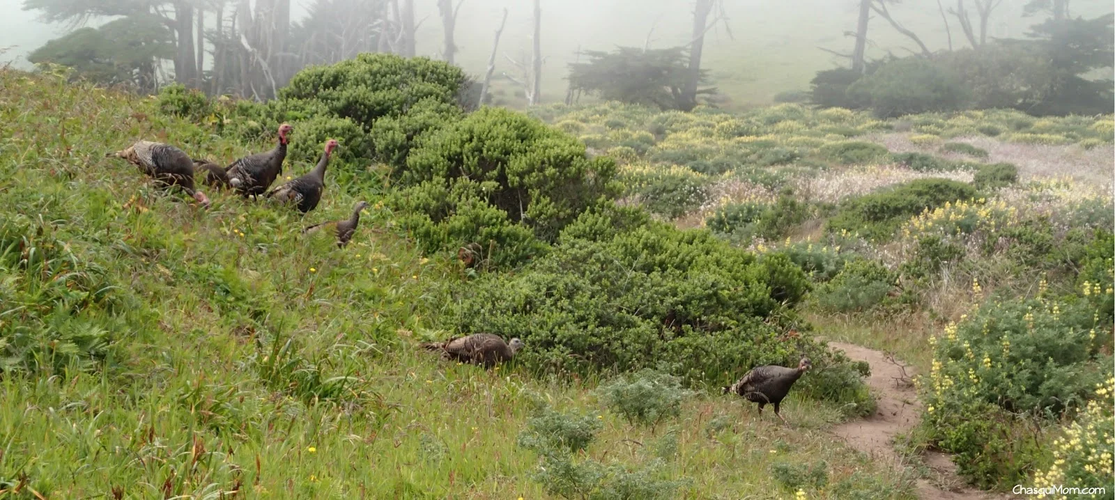
Why did the turkey cross the road?
We also found some wild turkeys crossing the trail. As we let them cross our path, I joked with our children that we were going to eat them and my son turned around and said "Mommy, we don't eat turkeys!". Sorry buddy, we do and they are delicious! Wild turkeys are not native to Point Reyes National Seashore, so maybe we could have eaten them...

Wildlife Proximity ~ We've had a few close wildlife encounters in the past, so we are very careful when wildlife is nearby. As we were hiking along the ridge, a herd of Tule Elk (bucks) ran across the trail 30 feet ahead of us. The low bushes hid the elk, so we could not see them until they were running across the trail (picture above). Thankfully we had our "herd" of children near by and my daughter (two years old) was up high in the carrier. My daughter was able to see the herd running and said, "Daddy, that is beautiful!".
Wildflowers Galore
I have never hiked where I was completely surrounded by wildflowers. My hiking ground is the San Francisco East Bay hills that dry up the second the rainy season stops, so all the hills surrounding me are currently golden brown with a few sparse wildflowers. The California coast stays a little more damp due to the fog, so even our precious California Golden Poppies were out in droves!

The one flower that stopped us in our tracks was the Cobwebby Thistle - Cirsium Occidentale (spiky pink "flower"). We found it near the last mile of the Tomales Point Trail, the closer we got to the end the more abundant they became. I could only identify the California Golden Poppy, and some type of purple lily but we were always surrounded by wildflowers. If you have allergies to pollen, I would suggest waiting until wildflower season is finished because we were covered in pollen!
My daughter was in HEAVEN...she absolutely loves flowers, one of her favorite things about the outdoors. It took us forever to walk through the field of flowers (about 4 ft high) because she had to stop and smell all the flowers. I had to "part the waters" with my hiking sticks so she could walk through and not get hit in the face.
Trail Report Details

I would not suggest this hike in its entirety for families new to hiking, hence the difficulty rating but if your are used to hiking with your kids this hike would be a great all day hike. A more family friendly hike at Tomales Point Trail would be hiking to Windy Gap (approx 1 mile - 2 miles roundtrip) and exploring the barns near the trail head. I absolutely loved this hike, from the wildflowers, wildlife to hiking the beautiful California coast, Tomales Point is a hike definitely worth the drive, effort and time.
Have you been to Point Reyes National Seashore before? If so what parts?
Join in on the conversation by leaving a comment here! You can also join in on the conversations on Chasqui Mom's Facebook, Instagram and Twitter that is updated daily with outdoor activities and other wonderful posts and links from #OutdoorFamilies!
Related Posts and Links:
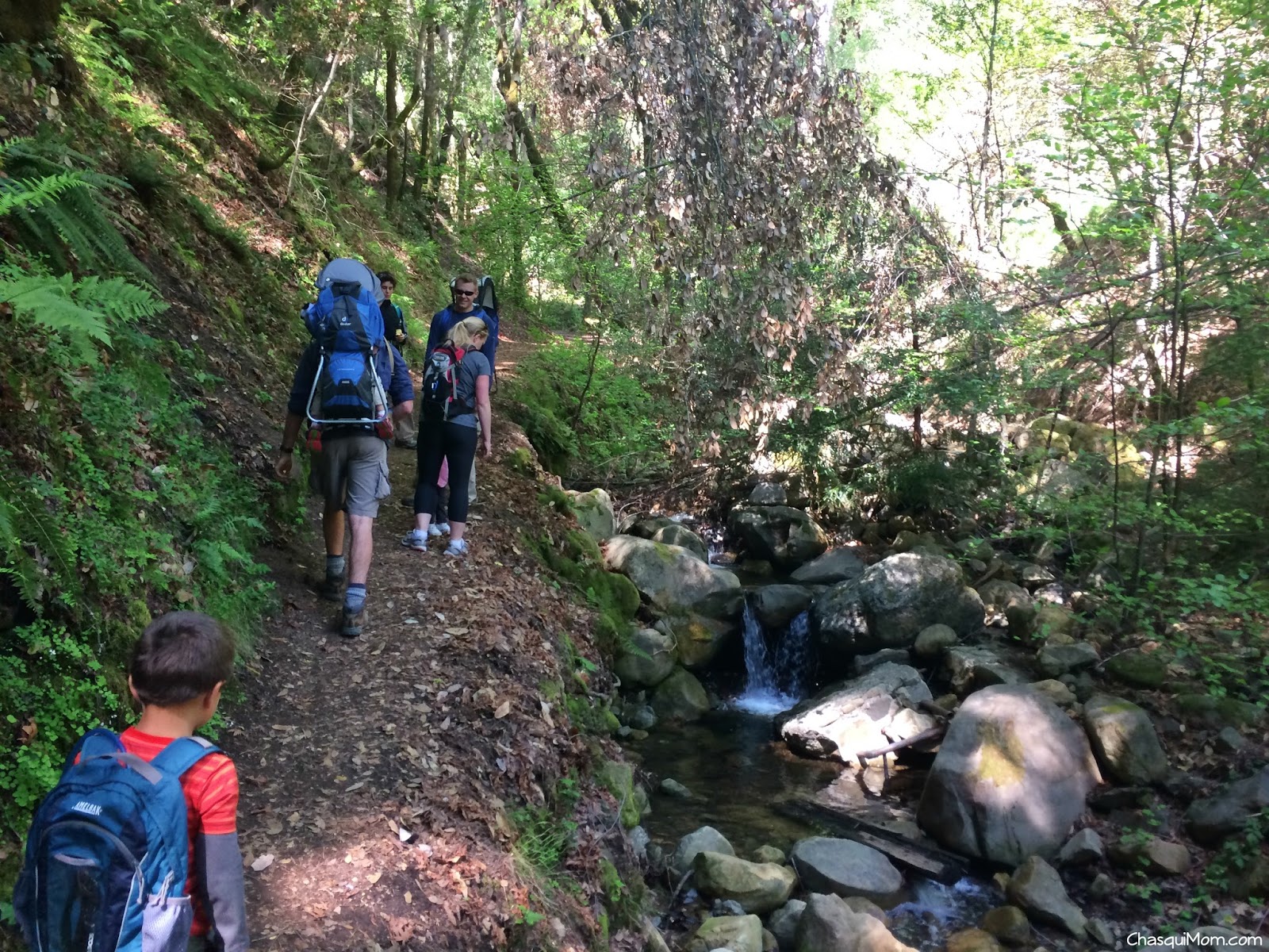
Uvas Canyon County Park is a very small but beautiful park in the South Bay. Located south of San Jose in Morgan Hill, this park contains about 6 miles of hiking, four waterfalls and creeks for everyone to enjoy.

Photo Courtesy of
.
On this occasion, I had a arranged a #HIRL (Hangout In Real Life) with a Google+ friend
and his family, and invited friends of mine. Three - 2 year olds, one - 4 year old and five parents!! I was the only solo parent hiking with two kids, since my husband was riding the Tierra Bella Century that day! What a better way to spend the day hiking to waterfalls and meeting up with new and old friends. It may have been the first
Toddler #HIRL history!
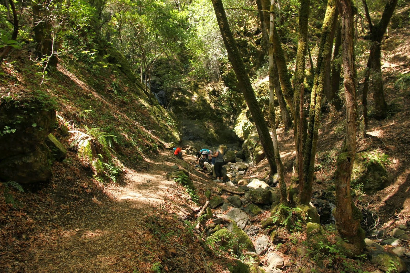
As hiking parents of little ones we knew that our mileage was not going to be long, so we aimed for the Waterfall Loop and if still felt energetic we were going to head to Triple Falls. Granted the latter never happened!
Waterfall Loop along Swanson Creek
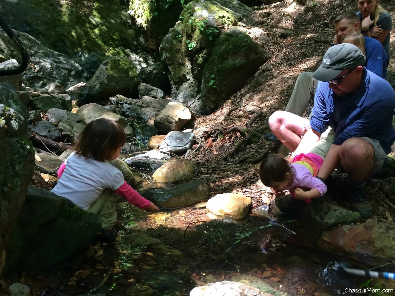
Most of the hike was an uphill towards the waterfalls but it was not a difficult uphill since my two year old daughter hiked most of the way up. Still for toddler-carrying parents any uphill is a sweaty trek! We hiked counter-clockwise on Waterfall Loop, one side follows along the creek closely and the other side is a plain fire road trail. The creek-side trail, had actual creek crossings and bridges to walk across. Two great features to keep kids hiking - water and bridges!

Creek Crossing!! ~ Photo Courtesy of

Bridges Make a Hike Fun ~ Photo Courtesy of
During a little carrier break, my daughter and I walked over to look at the flowers and she screamed, "Snake!!" and jumped backwards on the trail. I only saw branches until a heard something rustle by my feet and saw something slither!! Of course I screamed and jumped back to where my daughter was standing but as I took a closer look it was a lizard carrying another lizard by the neck, I thought maybe they were mating but the lizard was definitely biting the other lizards neck.
After our lizard encounter, we continued on the spur and in a few minutes we were at Basin Falls which brought excitement to everyone, especially the little ones. There were lots of smiles from all the kids and parents when we saw the falls. We tried to "relax" during our break at Basin Falls, but as always with kids, they are always trying to "not" fall into the water.

Chasqui Mom and niños!! Photo Courtesy of
Splashing at Basin Falls!!
Basin Falls Spur - Photo Courtesy of
There was lots of splashing with sticks, rock throwing, investigating the water basin at Basin Falls and earthworms that came out out from under the leaves. Lunch was eaten and after my daughter decided to not "accidentally" fall into the water, we packed up and headed back to Waterfall Loop (Fire road trail side).

Heading back! Photo Courtesy of
We took another spur to Black Rock Falls, which wasn't as impressive as Basin Falls but the rocks were black!

Most of the kids were done hiking by then so we hurried back to the parking lot. Thankfully the rest of the trail was downhill so everyone was able to hike fast to the cars.
Trip Report Details


There aren't too many waterfalls in the San Francisco Bay Area, but cheers to family hiking and waterfalls that we do have!!
Waterfalls are great for family hikes! What is your favorite waterfall hike?
Join in on the conversation by leaving a comment here! You can also join in on the conversations on
,
and
that is updated daily with outdoor activities and other wonderful posts and links from #OutdoorFamilies!
Related Posts and Links:
This is not about bagging a 14er, not even close! Tolman Peak does not reach 1,000 ft but that does not mean we didn't get great views of the San Francisco Bay Area!
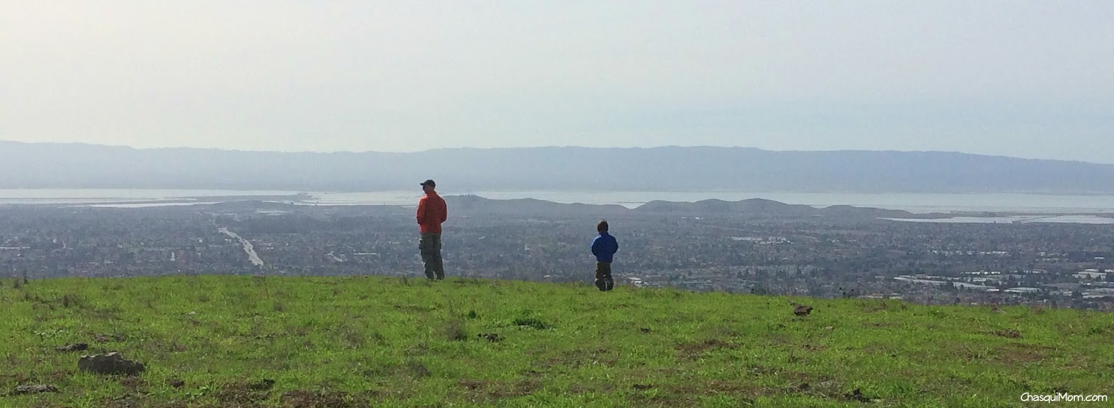
View of the San Francisco Bay Area from Tolman Peak
If you are not familiar with "Peak Bagging", that is an outdoor term for reaching the peak of a mountain like one of Colorado's famous mountains above 14,000 feet. Technically our little family "bagged" Tolman Peak, at only 947 ft, it is still peak bagging! Tolman Peak is more like a hill but from the top you can see the entire San Francisco Bay Area, from the South Bay to out past San Francisco.
Garin Dry Creek is surprisingly remote once a mile has gone by. I would consider Garin Dry Creek an "urban outdoors" park because its right up against two cities Union City and Hayward. Surrounded by California State East Bay, cemeteries and residential areas. Yet on almost every occasion we've been there we have encountered wildlife (alive and dead) and felt like we were miles away.
"Tolman Peak has a little kick to it!"
On this warm winter day, we wanted a relaxing hike to let the kids burn some energy so we decided to hike at Garin Dry Creek, Tolman Peak. We only need to hike to Gossip Rock and then we can say we have hiked on every trail at Garin Dry Creek! It was a busy day at the park that even the May Road Entrance parking lot was full. We actually had to park outside on the Mission Blvd, which added 0.55 miles to this 4.75 mile hike (from May Parking Lot).

Shady May Trail
May Trail is very shady and is not much like the rest of the park, which is exposed grassy hills. Our kids have issues with hiking fast up even the slightest uphill so even though Tolman Peak has some elevation gain the majority of the hike is perfect for my not-so-energetic two year old daughter. We continued onto High Ridge Loop Trail which is a fire road and could still hear all the traffic sounds from cars and the BART train.
Ladybugs were plentiful throughout the day which motivated the kids moving to find the next ladybug down the trail. Near the fork of High Ridge Loop and Tolman Peak Trail there was a waterhole for the grazing cattle and they all were laying in the shade. When I'm hiking alone with the kids, we normally hike to the waterhole and the kids throw rocks in the pond so the kids were a little astonished to see the cows in "their spot".
Our kids were in their
along the Tolman Peak Trail which followed a creek that actually had water flowing in it! Dry Creek was not dry and the sounds of croaking frogs made my kids happy. We reached a little bridge that was surrounded by large Pine and Eucalyptus trees, all of a sudden I realized that even though we were probably less than 2 miles away from the busy streets of Hayward I felt I like I was 100 miles away from civilization. No more traffic or train sounds, all the other park visitors were gone and we were alone with the sounds of the croaking frogs and my kids screaming! Sometimes there's no need to drive far away to get into the Great Outdoors.

After a little break near the bridge, we finally made it to the base of Tolman Peak and it was time to hike uphill. We didn't want the kids to get burned out nor spend hours on end going up hill so I carried my daughter in my Ergo and my husband picked up our boy unto his shoulders. Tolman Peak definitely has a little kick to it, let's just say my husband and I got a workout!

I love My Hiking Family!
Where is Tolman Peak?
Obviously Tolman Peak exists...I was just a little confused about where the actual peak was. According to the
East Bay Regional Park District
map, Tolman Peak was just south of the South Fork Trail near the bench, but I could not find the circular peak marker that you normally find at the peaks. According to our Garmin GPS the peak was north of the bench near some rock formations, either way we were at the top and we enjoyed our views of the Bay.
Even if it's a warm day down below in suburbia-land, going up on the East Bay Hills always allows for the direct chilly ocean wind cut right through us. I always think that we won't need our jackets but a few minutes on top of Tolman Peak led to wearing every piece of clothing in our packs! After we all bundled up we all hiked down on South Fork Trail, which was a single track trail and somewhat steep in sections.

We tried to hurry back to the car since I was cold and couldn't warm up! My daughter decided that she wanted to hike at her own pace so it took a little longer than we hoped but I'm always happy when she hikes because she doesn't hike long distances like her brother. We were hungry and only packed snacks since we planned on eating out afterwards, but we were all running low on energy and needed to finish. Promises of treats, finding more ladybugs moved everyone along and we finally finished our lovely family peak bagging at Tolman Peak.
Side Note:
The great thing about hiking with kids is that everything slows down and you get to enjoy the small beauties of nature. The San Francisco Bay Area never gets real "Winter" weather other than rain and with due to drought conditions in California our East Bay hills have been terribly dry. Even with the tiny bit of rain we have received recently the hills been showing signs of Spring.

Trip Report
: Garin Dry Creek Regional Park
Who: Family - Two Adults and two toddlers
Mileage: 5.3 miles (From the Mission Blvd)
Time: 4 hours - Toddlers partially carried
Elevation Change: Approx 1,000 ft
Family Friendly: Moderate


Trail Directions (Lollipop)
: From May Rd Entrance Parking Lot - May Trail 0.12 Miles - Slight right onto High Ridge Loop 0.32 miles - At the 2nd fork continue straight to Tolman Peak Trail 0.88 miles - At the Fork take a left (counter clockwise) continue on Tolman Peak Trail for another 0.82 miles - Right onto South Fork Trail for 1.29 miles and continue back Tolman Peak, High Ridge Loop and May Trail to parking lot.
I love my urban outdoor parks! What's your go to park whether urban or not?
Related Posts and Links:
Join in on the conversation by leaving a comment here! You can also join in on the conversations on
,
and
that is updated daily with outdoor activities and other wonderful posts and links from #OutdoorFamilies!