National Forest

A Tale of Two Mountains: Hiram Peak VS Ellis Peak [Guest Post by Nate Rische]

On our last attempted backpacking trip for this year, our good friend and fellow blogger Nate Rische of

In The Absence of Something Substantial

 accompanied us to the Lake Tahoe.  Unfortunately, I became a victim of altitude sickness and we were not able to backpack on the Tahoe Rim Trail.  On the other hand, Nate was able to hike up to Ellis Peak, enjoy the beautiful views of Lake Tahoe and mark off another peak he bagged!

I’m not Chasqui Mom. I’m not even a mom. And thankfully, because that would be awkward; I’m a guy. But while the chasqui were running up and down the Incan Empire,

my ancestors

were fierce warriors in Bohemia (the region, not the artists) known as the Chod. So you can call me Chodové Warrior. You might also remember me as

cheese-tester-guy

.

So much of Chasqui Mom is about hiking as a family, and it may seem odd for a single guy to guest post. You’re thinking about it all wrong; I may be single, but I love to spend time outdoors with my family.  Unfortunately my blood relations all live far away, so I don’t get as many opportunities to get out with them. That just means I have to get out with my

other

family. Wonderful people like the Chasqui Family.

Nate carrying my daughter on a backpacking trip - Chasqui Mom

Don’t laugh; try to take a couple of

toddler’s backpacking

, and you’ll appreciate the need to invite along a guy like me, a pack mule willing to weigh down his pack with your extra gear and throw kids on his shoulder when necessary.

I’m not a mountain climber. I mean, I’d sure like to be at some point, at least a little bit. It’s on my to-do list, and you know how that goes. Unless you already climb mountains, in which case you don’t because you’re a little bit better about those to-do lists than I am.

So when I get the opportunity, I like to get what I can.

A bit back, I went camping at Highland Lakes, way up in the Sierra Mountains in the Stanislaus National Forrest. In fact, I think my quote about the location was, “Wow, this is remote. When the Chinese invasion comes, this is where I’m coming.” While driving out there, we watched the thunderheads roil on the horizon. We arrived at the campsite with enough time to set up my tent before it started to hail. Good golly, it hailed. Then rained on and off through the afternoon, evening, night, and even into the next morning.

Those of us camping had desired to hike along the Pacific Crest trail, but illness from one of our campers had cancelled that plan. We had the day and nothing planned. When the rain cleared up in early afternoon, I looked up at Hiram Peak towering over us, and knew what I had to do.

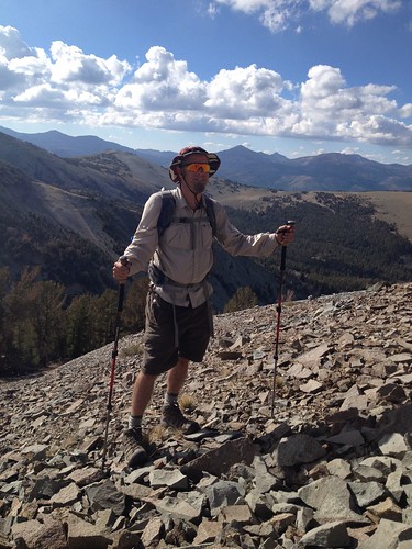
Hiram Peak - August 2012

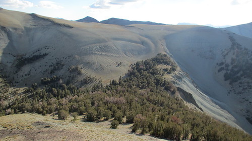
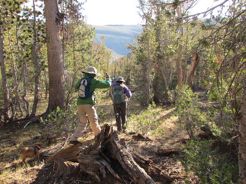
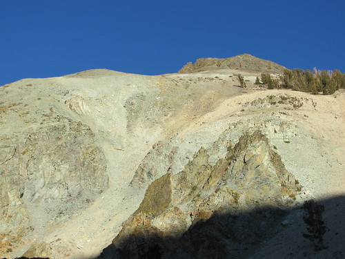
There was no trail, so I surveyed the mountain and made my initial ascent along the west side, approaching from the smaller of the two Highland Lakes. I had a choice to go around the south or north side for the second half of the climb. The south side looked easier, but the north side remained in view of the lakes and campground. I erred on the side of caution, and took the north route. I circled around a plateau along the north side, and started my ascent towards the peak on the east side of the mountain.

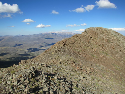
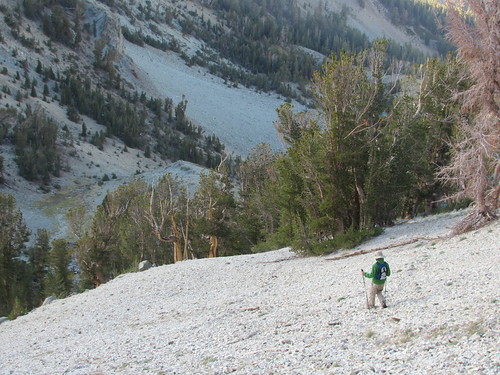
Once I hit circled around on the east, there were gorgeous views of groves and valleys stretching on the southeast side of the mountain, scenery that we couldn’t see from our camp ground. I circled around on the east/south-east, and as I climbed the shrubby undergrowth gave way to a very loose rocky terrain. The summit itself was all rocks, boulders, stones, and rubble, everything in between. There was no clear path, and as I zig-zagged up towards the summit it got steeper and steeper.

Heading up to Hiram Peak

About 150 vertical feet from the summit, I took stock of where I was and what I had left. The terrain ahead was rough, and I’d seen great views already. I still had to climb all the way back down, and I made a decision. I’d done enough, I was satisfied to turn around. Or so I thought. I went back down. I thought I was happy. It was good enough.

I was wrong. I had been so close. I could have made it, I should have finished. I didn’t. I’d taken the easy way out.

Regret.

Fast forward a bit. We were set to go backpacking on the Tahoe Rim Trail, when one of our group succumbed to altitude sickness. I’m very grateful that altitude sickness is not something with which I’ve had much trouble. Cancelling our plans to backpack, we instead decided to setup camp nearby, but the afternoon was still open, and the trailhead to Ellis Peak beckoned.

I made the initial climb up to the first ridge, and an outcropping of rocks stood away from the trail. I climbed to the top, and looked out over the Lake Tahoe valley. To my right, Ellis Peak loomed.

I followed the trail as it led up the ridgeline, turning into furious wind, threatening to blow us over. Seriously, gale-force winds blowing up from the lake along the north side of the peak. Thankfully, we crossed over to the south side for the final ascent, and the mountain shielded us from the wind thereafter.

On the north face, in the wind, it was frozen cold. In the wind shadow, it was comfortable, and the sun streamed through the pine forest.

The trail led first to Ellis Lake, which is sort of a misnomer, because a lake there is no more. Simply a very large, grassy divot tucked in a valley before the real ascent started.

According to the trail map, the peak was only ½ mile away, and several hundred vertical feet above.

I wasn't going to quit this time. Following the trail, it turned up. And up. After a good climb, we reached the “peak” of the trail. I looked over, the actual peak rose above us another 150 feet, but the trail went no higher.

I wasn't going to regret again.

I climbed those final 150 feet and looked over the peak. It was astounding; climbing up the south side of the peak it was perfectly still. But peaking over the edge and looking down the north side, the wind threatened to knock me over.

Ellis Peak View

The view was spectacular. As beautiful as any I’d ever seen before, with all of Lake Tahoe stretching out before me. I’d say it took my breath away, but that was probably just the wind.

Sometimes you think you’ve seen all you need to see, and that little bit of effort at the end isn’t worth it. You’re good enough. Maybe you’re thinking of the climb back down, or what you’re going to cook for dinner or whatever.

You’ll never regret staring out over the top of that mountain, even if it costs you a little more. Good enough isn’t, and you’ll always have unfinished business with that mountain.

At least until you do something about it. And maybe the view at the top isn’t any better than you’ve already seen. That isn’t the point; the whole idea isn’t about what you saw, but what you did. Or did not do.

My lasting memory of Hiram Peak is staring up at the top from below.  But from Ellis Peak, the whole world was at my feet.

Hiram Peak, I will see you again.

_________________________________________________________________________________

Have you ever had a "trail regret"? What did you do to overcome it?

Join in on the conversation by leaving a comment here! You can also join in on the conversations on 

Chasqui Mom's Facebook

 and 

Twitter

 that is updated daily with outdoor activities and other wonderful posts and links from #OutdoorFamilies!

Related Links and Posts:

  1. Book Review "The Last Days of the Incas" - Guest Post by Nate Rische
  2. In the Absence of Something Substantial by Nate Rische
  3. The Toughest Backpacking Cheese

Summer Road Trip 2013

Just getting back from our whirlwind family road trip to Colorado!  Have too much to write about but here's a little glimpse of our trip all around the west!


The Loch at Rocky Mountain National Park, Colorado


Visiting the Allosaurus at Dinosaur National Monument, Utah.


Elk at the Alpine Tundra at Rock Mountain National Park, Colorado


A quick stop at Arches National Park, Utah


A little camping at Castle Rock Campground, Fishlake National Forest, Utah


A jaunt on The Strip in Las Vegas, Nevada!


A desert stop on the Pacific Crest Trail, in California.

Three National Parks, one national forest campground, two hotels, a cabin and a SUV were our homes for the last week.  So many stories, lessons learned and best of all lots of fun!

Related Posts:
  1. Dinosaur National Monument, Oh My!!
  2. The Colorful Colorado River Trailhead, Rocky Mountain National Park

Outdoor Father Series: "Climbing Mount Emma" by Jeff Moser

In honor of Father's Day coming up on Sunday, June 16th, I will be featuring three outdoor father's favorite experiences with their children.  Second up! Jeff Moser has many family friendly stories, about hiking, backpacking, camping, road tripping, cycling, cave exploring, snowshoeing and much more.  Using Carson City, NV, as his base camp, most of his outings in Northern Nevada and California's eastern Sierras.  You can keep up with Jeff's progress at thepathlessbeaten.com or follow his Facebook Page The Path Less Beaten.


Posted on September 11, 2012

We've had the mountain climbing bug lately, and so another day hike was planned for last weekend. On September 9th, we headed for Mount Emma on the northeast corner of the Hoover Wilderness. We got a horribly late start that Sunday, not leaving the house until noon, and not reaching the the trailhead until 2pm. Normally, eating lunch on the peak is a good idea, so you don't get in trouble with afternoon thundershowers and wind. The late start set the tone for a nervous hike, but also lowered the expectations if we didn't make the summit.

Mount Emma
Getting Started
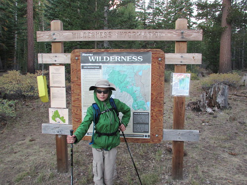
Just south of the turnoff to Sonora Pass (State Route 108), and just as Highway 395 bends to the east to head to Bridgeport, Little Walker road leaves the pavement and heads south up into the mountains. Just stay on the same road all the way, crossing the bridge, and avoiding the left turn to the Obsidian Campground. You pass a Burt Canyon Trailhead pullout, and continue to wind up the mountain to Stockade Flat. The road gets rocky at times, but is probably passable in a passenger car if you're careful. 6.7 miles from the pavement, you'll reach the trailhead at a Hoover Wilderness sign.


Mount Emma
Almost to the meadow
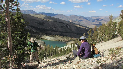
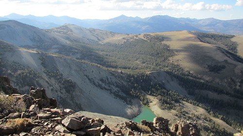
Over the course of a mile, the trail climbs from the trailhead through trees, meadows, and barren rock before reaching Emma Lake. Emma Lake is a small greenish lake below the summit of Mount Emma. The outlet creek was still flowing, so it must be being fed by springs. We saw a couple anglers on the upwind side of the lake, and we found a decent camping spot on the northwest side of the lake in the trees.

Mount Emma
Across the meadow
The wind was blowing pretty hard at Emma Lake, so we didn't rest too long. It was getting late, but we decided to go for the peak anyway. The trail ends at the lake, so the rest of the way to the peak would be off-trail. We needed to get to the saddle to the southwest of Mount Emma, and by looking at the canyon above the lake, it was easy to pick out the best route.

Mount Emma
Starting to get rocky below Mount Emma
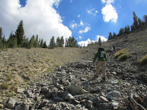
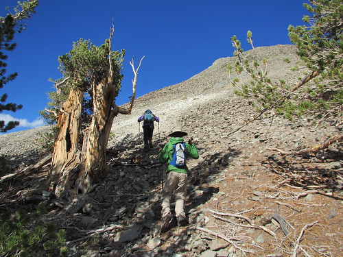
We started up a rocky drainage on the far side of the lake. It had looked hard from far away, but the rocks were firm and the footing stable. The steep climb wasn't so bad either. Sometimes it's nice to gain a lot of elevation quickly without a lot of walking. We all had our trekking poles too, which made the climb easier. Kristy led the climb, and found the best route up.

Mount Emma
Emma Lake
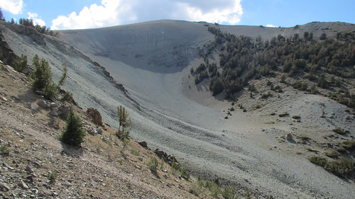
At the top of the first climb was a little meadow. It gave us a nice break and allowed us to pick out the next climb. The low point of the saddle was just ahead of us, not too far up a scree slope. We were starting to feel good about making it to the top now. Emma Lake was getting smaller below us.

Mount Emma
The Off-Trail section begins
I had looked at this area before coming out using Google Earth. It's funny how everything looks so smooth and gentle on the computer, when in reality, it's steep, covered in rocks, bushes, and trees. It's always much bigger and different than you imagine.

Mount Emma
Across a little meadow
We reached the top of the scree slope, and entered a little forested area that covered just the saddle between the peak and ridge to the west. Trapped under a downed branch at 10 thousand feet was a Mylar balloon. My son looked puzzled and wondered how it got there. Somewhere, someone let a helium balloon go at a graduation party. It's wild that it made it up this far! We stuffed it in my pack for proper disposal back home.

Mount Emma
Gaining altitude quick - Emma Lake below
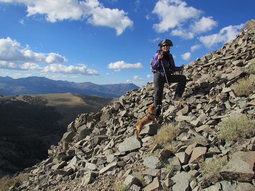
We could see the peak through the trees, and the GPS said it was only a quarter mile to the top! We'd be at the top in no time. Or so we thought. After leaving the protection of the trees, the wind really picked up. The easy walking ended as we entered the final talus slope to the top. It was hard for us to keep our balance in the wind, and our little dogs were having a hard time negotiating the rocks. Eventually the Chihuahua had to be carried.

Mount Emma
Open bowl to the west
My son climbed on ahead of us and stood up on what appeared to be the peak. He held his arms up in victory. We slowly made our way up to him, and climbed over the last rock to join him. The strong wind now turned into a blast of air as we topped out. And not just periodic gusts, but heavy sustained winds. It was hard to even stand straight up. We held off the celebration of making the summit, because we weren't quite there yet.

Mount Emma
Leaving the saddle for the final climb to the peak
The real peak wasn't much higher, and maybe only 40 yards away. Maybe this was high enough. Nope. We all agreed we needed to finish. The dogs were shaking. They were either freezing or freaked out from the wind. Probably both though. Kristy huddled the dogs in her jacket while the boy and I finished the summit. We quickly signed the peak register, took a quick look around, then went back down to where Kristy was huddled between some rocks. I took the dogs, then her and the boy went back up to the top for a look.

Mount Emma
Getting late, but still enough daylight
Sometimes getting to the peak can be a relaxing. There can be time for lunch, sight-seeing, and photos. This was not one of those days though. I took a few obligatory photos, but looking around wasn't really on my mind. It was 5 pm, and all I could think about was getting the family back down the mountain before dark.

Mount Emma
Toughest part of the climb yet. Steep talus in the wind.
The howling wind got me thinking that you really don't "conquer" a mountain. The mountain doesn't care if you're there or not. It's been there for thousands of years through countless winters and summers. You merely get to visit these special places for a short amount of time before you need to get going.

Mount Emma
There's the top!
The wind was starting to chill us fast. I zipped my pant legs on, and got into my wind jacket. Kristy's fingers were starting to go numb. We had some water and a quick snack, then tackled the talus slope. We couldn't wait to get back down to the trees! My son led the way down, getting ahead of us a bit.

Mount Emma
Summit of Mount Emma in crazy winds
We slowly made our way down, being extra careful with each step on the loose rock. With the wind still raging, my son suddenly stopped and dropped his trekking poles. I watched with concern, hoping he was ok. When you gotta go, you gotta go. Concern changed to "oh no...", as it became apparent he was going to try to take a leak into a 50mph wind. It was a quick lesson. He twisted and turned as if he were trying to water the whole mountainside. On the bright side, it was a bit of comic relief in an otherwise tense moment.

Mount Emma
Emma Lake below
It was a big relief when we finally made it back into the shelter of the trees on the ridge. We took some time to rest, warm up, and rehydrate. After getting down that section, the rest of the hike seemed like it would be a snap.
Mount Emma
Back down the saddle
Recharged and ready for some more hiking, we made our way over to the scree slope. Going down was fairly easy, thanks to our poles and a fairly firm surface. No boots sinking into the sand and filling with rocks. We were back down to the lake in no time at all.

Mount Emma
Into the tress and out of the wind
We went around the south side of Emma Lake this time, a shorter route, crossed the outlet creek, then got back on the trail. The sun was behind the mountains now, only shining far to the east on the Sweetwater mountains. We were glad to be back on a fast trail with only a mile left of hiking.

Mount Emma
Down the scree

Mount Emma
Looking back at Mount Emma
As we drove down out of the mountains, we had a feast with all the food we had brought with us, but never really had time to eat. Crackers, cheese, salami, jerky, and trail mix. It was dark by the time we made it back to the pavement.

Mount Emma
Back at Emma Lake with the sun going down

Mount Emma
Tired Chihuahua
Cutting the hike so close to nightfall was a good lesson. I had even decided to cut "headlamp" out of my ten essentials packing list. Next time I plan to prepare more in the coming days before the climb, so we can just get up in the morning and go. I had left too much to do that morning. It's a lot less stressful during the hike when you know you have plenty of time to make the summit, and get off the top before the worst weather of the day hits.

Mount Emma
Back at the trailhead
Although the view from the top of Mount Emma was not as spectacular as some of the mountains I've climbed, it was still a great hike. The scenery along the way was beautiful, and the off-trail hiking section added a fun challenge. Looking back up at the peak from the base of the rugged north side really makes you think, "Wow...I just climbed that!".

More information:

ELEVATION Trailhead: 8,580
Emma Lake: 9,320
Mount Emma: 10,525
Topo Map: Fales Hot Springs, CA

Outdoor Fathers Series: "The Enlightening Powers of Darkness" by Michael Byrd

In honor of Father's Day coming up on Sunday, June 16th, I will be featuring three outdoor father's favorite experiences with their children.  First up! Michael Byrd is a devoted husband, fun father of four kids, avid hiker, future novelist, excellent cook and amateur photographer, Michael feels lucky to live in the shadow of the Nantahala Mountains in western North Carolina. With literally hundreds of miles of hiking trails in his backyard, Michael is doing his best to explore each one of them. You can keep up with his progress at ATatdusk.com
Posted on December 17, 2012

It’s not every day I get invited on a night hike. And as much as that sounds like a simple statement, it’s actually a veiled request for more invitations – hint, hint.

I know. It’s not very subtle, but night hikes are fun. In fact, in my opinion, which is what you’re going to get since this is my blog, they’re the second most fun thing you can do at night.

What makes this night hike so special? Glad you asked. It was my oldest daughter’s idea.

Photo by Rob Gasbarro
She’s my outdoorsy kid. Well, all my kids will go outdoors and on hikes – when I ask, but my oldest daughter will ask me to go on hikes. It’s nice. She loves hiking and being in the woods. And I love seeing her excitement.

So, last week, she came to me and asked me to go along with her on the Outdoor 76 Night Hike. She read about it on Facebook. I didn’t have to think about it. Of course, I would go.

I’ll admit, though, I was a little surprised that she was interested in a “night” hike. This is the girl who won’t take the dog out after sunset even with all the outside lights on. Or walk into the dark garage. It’s a big step and I was absolutely not going to let slip by.

But I wondered what could have motivated her enough to hike in the dark?

You know, the more I thought about it, the more I realized there was more to this invitation than just a chance to hike at night. It’s possible she knew her brothers and sister would never consider doing a night hike and it would give her some individual, quality time with Daddy.

This isn’t unique to her. They all do it. I’m just grateful they think I’m still cool enough to hang out with.

Anyway, I asked her to gather all the details and we carved our plans in stone. This date was not going to be broken. So, Friday night, December 14th, we were hiking to the top of Silers Bald in the Nantahala Mountain Range – not to be confused with Silers Bald in the Smokies, although it is the same family.

Reservations were required, so my daughter made sure I was the first one to call. All that was left was hammering out the details. (You can see our Fourteen Essentials for a Night Hike here.)

We made a trip to Outdoor 76, our local, community oriented outfitter, so she could pick out her very own headlamp. It was an event. You would have thought she was picking out a prom dress – or, at least, how I imagine other 16 year old girls are about picking out prom dresses.

She inspected every detail and component. She tried them all on – in front of a mirror, looking at herself from every angle. She tested the lights and moving parts. She even read the packaging. And in her ever practical way, she picked the medium priced headlamp that provided the most options and output. See. Not your typical teenager.

While we were there, three of her friends, who were window shopping for clothes, saw her and came over to chat. My daughter’s not your typical girly-girl. Sure, she loves clothes, and dresses, and fashion, and being a girl, but it’s not her whole life. She also loves camping, getting dirty and following the trail less traveled.

Her friends had a hard time understanding why in the world she would want to hike…at night…in the dark…on a Friday…with a bunch of grown-ups. It didn't bother my daughter one bit.

Photo by Rob Gasbarro
She actually looked very pleased by their reaction. I could tell by her piercing blue eyes and her confident, yet gentle smile she was thinking to herself, “You silly little girls.”

Yes. The force is strong with this one.

The day finally came and it was the best hike ever. There were about 30 of us in all. Spirits were high. The temperature was great. The campfire was toasty warm. And zillions of stars were twinkling in the sky.
I’ll never forget the cool mountain air on my cheeks. I’ll never forget the view of the lights of Franklin, shining in the valley below. I’ll never forget the new friends and hiking buddies we met that night.

But there’s much more I’m taking away from that night. I knew my daughter was amazing, but the whole process of planning this trip, climbing to the top of Silers Bald, the way she was with people of all ages, the strength with which she carried herself and overcoming the dark, left an indelible image in my mind.

It was one of those rare experiences where you get a glimpse of who your child is going to be as an adult. And, I like it. She’s going to be even more amazing than I could have ever imagined.

See ya’ on the trail

Lower Highland Lakes Statistics

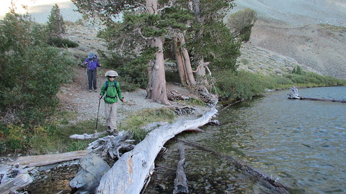
Here is the trail report for Lower Highland Lakes (distance, elevation change, etc).  Sadly what I thought was a two mile hike around the lake was actually a measly one mile hike.  I would say I'm disappointed in myself but I was terribly sick.  Now I feel like I have to go hiking soon so I can make it up to myself.

Lower Highland Lakes, 1.0 miles, Elevation Start: 8,500 ft - End 8,600 ft, Elevation Change 100 ft.

var _gaq = _gaq || []; _gaq.push(['_setAccount', 'UA-34676414-1']); _gaq.push(['_trackPageview']); (function() { var ga = document.createElement('script'); ga.type = 'text/javascript'; ga.async = true; ga.src = ('https:' == document.location.protocol ? 'https://ssl' : 'http://www') + '.google-analytics.com/ga.js'; var s = document.getElementsByTagName('script')[0]; s.parentNode.insertBefore(ga, s); })();